Category:Armenian-language SVG maps showing history
Media in category "Armenian-language SVG maps showing history"
The following 16 files are in this category, out of 16 total.
-
 100 Years War France 1435.svg 948 × 945; 141 KB
-
 Armenian Genocide Map-hy.svg 2,574 × 1,264; 465 KB
-
 Bagratuni Armenia 1000-hy.svg 2,717 × 1,595; 767 KB
-
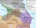
 Caucasus 1213 AD map hy.svg 1,155 × 898; 4.49 MB
-
 Caucasus 290 BC map (hy).svg 1,155 × 898; 4.42 MB
-
 Caucasus in 300 AD (Armenian - hy).png 1,127 × 833; 800 KB
-
 Constantinople-HY.svg 500 × 400; 19 KB
-
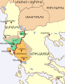 Epirus across Greece and Albania (hy).svg 330 × 420; 160 KB
-
 Magellan's voyage HY.svg 2,488 × 1,378; 4.11 MB
-
 Map Crusader states 1135-hy.svg 978 × 1,330; 122 KB
-
 Map of Ancient Rome 271 AD (hy).svg 2,050 × 1,213; 344 KB
-
 Map of Lydia ancient times-hy.svg 400 × 277; 47 KB
-
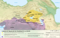
 Roman East 50-hy.svg 2,717 × 1,595; 853 KB
-
 Urartu 840 820-hy.svg 2,714 × 1,740; 821 KB
-
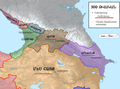
 Zakarid Armenia 1200 map-hy.svg 2,717 × 1,594; 672 KB
-
 Պարսիկների առաջին ներխուժումը Հունաստան.svg 992 × 793; 3.57 MB


.svg)
.png)

.svg)


.svg)


