Category:Artington
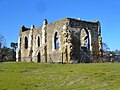
English: Artington is a village and civil parish in the borough of Guildford, in Surrey, England, lying on the edge of the built-up area of Guildford. It is about mile and a half south of Guildford town centre, and west of the River Wey, above the ford which gave Guildford its name and on the North Downs Way and A3100 road. A holy well lies by the ford, while the ruins of the 13th century chapel of St Catherine's lie on a hill above it. The 2001 census gave a population of 326 for the parish.
village in Surrey, England, UK  | |||||
| Upload media | |||||
| Instance of | |||||
|---|---|---|---|---|---|
| Location | Guildford, Surrey, South East England, England | ||||
| Area |
| ||||
 | |||||
Subcategories
This category has the following 6 subcategories, out of 6 total.
Media in category "Artington"
The following 200 files are in this category, out of 273 total.
(previous page) (next page)-
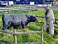 "Farm Talk" (2004) Jo Wood, Arlington, Guildford, Surrey.jpg 2,587 × 1,940; 2.02 MB
-

-
 A3100, The Old Portsmouth Road - geograph.org.uk - 3963617.jpg 2,048 × 1,536; 1.32 MB
-
 Access road, Littleton - geograph.org.uk - 3964003.jpg 2,048 × 1,536; 1,016 KB
-
 Approaching Guildford - geograph.org.uk - 3865744.jpg 2,048 × 1,536; 1.19 MB
-
 Approaching Littleton - geograph.org.uk - 3964017.jpg 1,981 × 1,485; 986 KB
-
 Artington park and ride - geograph.org.uk - 3865727.jpg 2,013 × 1,510; 1.05 MB
-
 Artington retail units - geograph.org.uk - 3963622.jpg 2,048 × 1,536; 899 KB
-
 Artington, view from St Catherine's Hill.jpg 6,000 × 1,670; 3.16 MB
-
 Ascending Sunnydown - geograph.org.uk - 856662.jpg 640 × 480; 111 KB
-
 Avenue of trees in Loseley Park - geograph.org.uk - 2415965.jpg 1,600 × 1,200; 600 KB
-
 B3000 ramps up to cross the railway - geograph.org.uk - 2687136.jpg 640 × 428; 105 KB
-
 Beechwood House - geograph.org.uk - 5800595.jpg 1,024 × 678; 809 KB
-
 Beware toads on Littleton Lane - geograph.org.uk - 3052796.jpg 640 × 480; 166 KB
-
 Braboeuf Manor - North Front - geograph.org.uk - 5258449.jpg 2,560 × 1,920; 2.27 MB
-
 Brickfields Farm - geograph.org.uk - 3987123.jpg 2,048 × 1,536; 1.57 MB
-
 Bridge across the River Wey - geograph.org.uk - 3557384.jpg 2,048 × 1,536; 1.5 MB
-
 Bridge at St Catherine's Lock - geograph.org.uk - 5536270.jpg 1,280 × 850; 655 KB
-
 Bridge over the River Wey Navigation - geograph.org.uk - 5464546.jpg 1,024 × 643; 199 KB
-

-
 By the main line - geograph.org.uk - 3953256.jpg 640 × 430; 81 KB
-
 Canada Geese - geograph.org.uk - 3018752.jpg 4,288 × 3,216; 3.31 MB
-
 Canal and Towpath - geograph.org.uk - 5464562.jpg 1,024 × 561; 178 KB
-
 Canal banks - geograph.org.uk - 3865602.jpg 2,048 × 1,536; 1.46 MB
-
 Canalside Cottage, Wey Navigation - geograph.org.uk - 2070467.jpg 640 × 430; 156 KB
-
 Caravans, Loseley park - geograph.org.uk - 4178634.jpg 2,048 × 1,536; 2.61 MB
-
 Catherine's Lock, Shalford Meadow - geograph.org.uk - 4810203.jpg 640 × 426; 53 KB
-

-
 Cattle near Guildford - geograph.org.uk - 2020115.jpg 800 × 600; 128 KB
-
 Chapel - Loseley Park - geograph.org.uk - 2416024.jpg 1,600 × 1,059; 603 KB
-
 Church across Shalford Meadow - geograph.org.uk - 5148270.jpg 640 × 426; 68 KB
-
 Conduit Farm - geograph.org.uk - 3962208.jpg 2,048 × 1,536; 1.52 MB
-
 Conduit Farm - geograph.org.uk - 856671.jpg 640 × 480; 127 KB
-
 Conduit Farm, near Guildford - geograph.org.uk - 2353026.jpg 2,794 × 1,871; 1.63 MB
-
 Conveniences at Artington Park ^ Ride - geograph.org.uk - 4025634.jpg 4,000 × 3,000; 2.85 MB
-
 Copse near Littleton - geograph.org.uk - 3965715.jpg 2,048 × 1,536; 1.31 MB
-
 Cottages near St Catherine's Chapel - geograph.org.uk - 4997164.jpg 3,840 × 2,160; 4.45 MB
-
 Crossways by Polsted - geograph.org.uk - 856290.jpg 480 × 640; 152 KB
-
 Disused rail line - geograph.org.uk - 3865869.jpg 2,048 × 1,536; 1.82 MB
-
 Disused railway bridge - geograph.org.uk - 3865866.jpg 2,048 × 1,536; 1.79 MB
-
 Downslink meets the main line - geograph.org.uk - 5450353.jpg 1,024 × 768; 302 KB
-

-

-
 Fallow strip. Loseley Park - geograph.org.uk - 4178824.jpg 1,932 × 1,449; 2.21 MB
-
 Farmland near Loseley Park - geograph.org.uk - 3965523.jpg 2,048 × 1,536; 1.25 MB
-
 Farmland, Loseley Park - geograph.org.uk - 3965510.jpg 2,048 × 1,536; 1.32 MB
-
 Farmland, Loseley Park - geograph.org.uk - 4178901.jpg 2,048 × 1,536; 3.18 MB
-
 Ferry Lane footbridge - geograph.org.uk - 3156281.jpg 640 × 425; 356 KB
-
 Field corner near Peasmarsh - geograph.org.uk - 3987118.jpg 2,048 × 1,536; 1.61 MB
-
 Field south of Loseley House - geograph.org.uk - 2416027.jpg 1,600 × 1,200; 453 KB
-
 Fields and buildings by New Pond Road, Binscombe - geograph.org.uk - 2575947.jpg 1,600 × 1,200; 567 KB
-
 Fields in the springtime - geograph.org.uk - 3987136.jpg 2,048 × 1,536; 1.5 MB
-
 Fields near Littleton - geograph.org.uk - 3963960.jpg 2,048 × 1,536; 1.56 MB
-
 Fields near Peasmarsh - geograph.org.uk - 3987127.jpg 2,048 × 1,536; 1.37 MB
-
 Fields near Peasmarsh - geograph.org.uk - 3987146.jpg 2,048 × 1,536; 1.43 MB
-
 Fields near the Warrens - geograph.org.uk - 3965556.jpg 2,048 × 1,536; 1.35 MB
-
 Fieldscape near Peasmarsh - geograph.org.uk - 3987506.jpg 2,048 × 1,536; 1.3 MB
-
 Flooded fields - geograph.org.uk - 3866011.jpg 2,048 × 1,536; 1.84 MB
-
 Footbridge across the River Wey - geograph.org.uk - 4855171.jpg 4,000 × 3,000; 3.63 MB
-
 Footpath across Shalford meadow - geograph.org.uk - 5148284.jpg 640 × 426; 86 KB
-
 Footpath across the fields - geograph.org.uk - 3965495.jpg 2,048 × 1,536; 1.27 MB
-
 Footpath by Mount Browne - geograph.org.uk - 3963951.jpg 2,048 × 1,536; 1.46 MB
-
 Footpath by Mount Browne police HQ - geograph.org.uk - 2298413.jpg 600 × 800; 159 KB
-
 Footpath by the mainline - geograph.org.uk - 3953254.jpg 640 × 430; 86 KB
-
 Footpath junction - geograph.org.uk - 3963954.jpg 2,048 × 1,536; 1.71 MB
-
 Footpath marker, The Ridges - geograph.org.uk - 3963641.jpg 1,903 × 1,428; 1,013 KB
-
 Footpath through Loseley Park - geograph.org.uk - 2298885.jpg 800 × 600; 170 KB
-
 Footpath to Loseley Park - geograph.org.uk - 2298390.jpg 800 × 600; 193 KB
-
 Footpath to Peasmarsh - geograph.org.uk - 3987508.jpg 2,048 × 1,536; 1.55 MB
-
 Footpath towards Artington - geograph.org.uk - 3963986.jpg 2,048 × 1,536; 1.45 MB
-
 Footpath west from St Catherine's lock - geograph.org.uk - 2070510.jpg 640 × 430; 144 KB
-
 Footpath, Artington - geograph.org.uk - 3865748.jpg 2,048 × 1,536; 1.96 MB
-
 Footpath, Shalford Meadow - geograph.org.uk - 5354017.jpg 640 × 326; 48 KB
-
 Fountain in Walled Garden - geograph.org.uk - 2416015.jpg 1,600 × 1,200; 485 KB
-
 Four and Twenty Blackbirds - geograph.org.uk - 2490189.jpg 1,920 × 2,560; 2.32 MB
-
 Free Range Children - geograph.org.uk - 2094076.jpg 2,272 × 1,704; 2.46 MB
-
 Freestanding oak, Loseley Park - geograph.org.uk - 4178826.jpg 2,048 × 1,536; 2.88 MB
-
 Geese in Loseley Park - geograph.org.uk - 2415986.jpg 1,600 × 1,200; 500 KB
-
 Godamling Navigation waymarker - geograph.org.uk - 4437970.jpg 3,648 × 2,736; 4.22 MB
-
 Grazing land - geograph.org.uk - 5210790.jpg 640 × 426; 46 KB
-
 Greensand path - geograph.org.uk - 3965725.jpg 2,048 × 1,536; 1.27 MB
-
 Grove Cottage - geograph.org.uk - 4178632.jpg 1,928 × 1,446; 2.24 MB
-
 Guildford , Houses ^ Gardens - geograph.org.uk - 2583645.jpg 3,264 × 2,448; 3.19 MB
-
 Guildford - Boundary Stone - geograph.org.uk - 5254984.jpg 1,920 × 2,560; 3.29 MB
-
 Guildford - Braboeuf Manor - geograph.org.uk - 5258446.jpg 2,560 × 1,920; 2.28 MB
-
 Guildford - Chantries - geograph.org.uk - 5258458.jpg 2,560 × 1,920; 2.56 MB
-
 Guildford - Disused Chalk Pit - geograph.org.uk - 5249838.jpg 2,560 × 1,920; 2.18 MB
-
 Guildford - From St Catherine's Hill - geograph.org.uk - 5249813.jpg 2,560 × 1,920; 3.17 MB
-
 Guildford - Guildown - geograph.org.uk - 5249826.jpg 2,560 × 1,920; 2.62 MB
-
 Guildford - St Catherine's Chapel - geograph.org.uk - 5249822.jpg 2,560 × 1,920; 2.95 MB
-
 Guildford Park ^ Ride - geograph.org.uk - 5210787.jpg 640 × 426; 52 KB
-
 Hawthorn and oak - geograph.org.uk - 3987130.jpg 2,048 × 1,536; 1.48 MB
-

-
 Hog's Back to Godalming - geograph.org.uk - 5147830.jpg 5,152 × 3,864; 7.14 MB
-
 Hog's Back to Leith Hill - geograph.org.uk - 5147754.jpg 5,152 × 3,864; 6.43 MB
-
 Hole in the hedge - geograph.org.uk - 3987504.jpg 2,048 × 1,536; 1.29 MB
-

-
 Houses on The Ridges, Artington - geograph.org.uk - 5147341.jpg 2,304 × 1,728; 842 KB
-
 Information board on St. Catherine's Hill, Guildford - geograph.org.uk - 2321260.jpg 2,999 × 2,224; 541 KB
-
 Joining the Portsmouth Direct Line - geograph.org.uk - 3377525.jpg 640 × 430; 85 KB
-
 Landslide on Greensand - geograph.org.uk - 2070597.jpg 640 × 430; 160 KB
-
 Littleton Lane - geograph.org.uk - 3964007.jpg 2,048 × 1,536; 1.38 MB
-
 Littleton Lane - geograph.org.uk - 3964013.jpg 2,048 × 1,536; 1.54 MB
-
 Littleton Lane, Littleton - geograph.org.uk - 5147344.jpg 2,304 × 1,728; 826 KB
-
 Lock keeper's cottage - geograph.org.uk - 4213035.jpg 2,013 × 1,510; 3.95 MB
-
 Lock keeper's house - geograph.org.uk - 3866029.jpg 2,048 × 1,536; 1.39 MB
-

-

-
 Loseley House - Ancient moat - geograph.org.uk - 5786068.jpg 1,000 × 1,333; 1.39 MB
-
 Loseley House - Cedar of Lebanon - geograph.org.uk - 5786050.jpg 1,130 × 1,000; 1.05 MB
-
 Loseley House - from its drive - geograph.org.uk - 5786028.jpg 1,436 × 1,000; 1.29 MB
-
 Loseley House - Northern façade - geograph.org.uk - 5786039.jpg 1,333 × 1,000; 1.11 MB
-
 Loseley House - Wisteria-covered wall - geograph.org.uk - 5786062.jpg 1,331 × 1,000; 1.45 MB
-
 Meander in the River Wey - geograph.org.uk - 2070578.jpg 640 × 430; 186 KB
-
 MG On Display - geograph.org.uk - 3018654.jpg 4,288 × 3,216; 3.47 MB
-
 Mount Browne - geograph.org.uk - 5799356.jpg 1,024 × 678; 774 KB
-
 Moving towards the lock - geograph.org.uk - 4213026.jpg 2,048 × 1,536; 3.06 MB
-
 Music in the Park - geograph.org.uk - 3018610.jpg 4,288 × 3,216; 3.68 MB
-
 Narrowboat on the River Wey - geograph.org.uk - 2070594.jpg 640 × 430; 189 KB
-
 National Trust Barge - River Wey - geograph.org.uk - 2070452.jpg 640 × 430; 176 KB
-

-

-
 Near St Catherine's Lock - geograph.org.uk - 3021937.jpg 640 × 425; 350 KB
-
 New Pond Road - geograph.org.uk - 5913208.jpg 2,078 × 1,343; 462 KB
-
 New Pond Road north of Binscombe - geograph.org.uk - 2298509.jpg 800 × 600; 132 KB
-
 North Downs Way below the Hog's Back - geograph.org.uk - 2203275.jpg 2,816 × 1,880; 2.71 MB
-
 North Downs Way crosses the River Wey - geograph.org.uk - 2070602.jpg 640 × 430; 166 KB
-
 North Downs Way heading east - geograph.org.uk - 3052781.jpg 640 × 480; 115 KB
-
 North Downs Way, Piccard's Farm - geograph.org.uk - 3844052.jpg 640 × 480; 77 KB
-
 Nursery near Shalford Junction - geograph.org.uk - 5210784.jpg 640 × 426; 64 KB
-
 Oaks, Mount Browne - geograph.org.uk - 3963969.jpg 2,048 × 1,536; 1.33 MB
-

-
 Old Portsmouth Road, Artington - geograph.org.uk - 3080459.jpg 1,600 × 1,200; 481 KB
-
 Old railway line by the River Wey - geograph.org.uk - 2067908.jpg 640 × 430; 201 KB
-
 Path to St Catherine's Lock - geograph.org.uk - 2272958.jpg 640 × 430; 57 KB
-
 Piccard's Farm - geograph.org.uk - 3844045.jpg 640 × 480; 59 KB
-
 Pill Box - geograph.org.uk - 5450397.jpg 640 × 406; 85 KB
-
 Pillbox by the River Wey - geograph.org.uk - 2067918.jpg 640 × 430; 186 KB
-
 Pillbox, River Wey - geograph.org.uk - 3866015.jpg 1,964 × 1,473; 1.28 MB
-
 Portsmouth Direct Line - geograph.org.uk - 3377519.jpg 640 × 430; 80 KB
-

-
 Portsmouth line railway from Ferry Lane bridge - geograph.org.uk - 2203220.jpg 2,816 × 1,880; 3.85 MB
-
 Pre-Worboys sign, St Katharine's Hill - geograph.org.uk - 3470516.jpg 1,600 × 1,200; 205 KB
-

-
 Putting the Wheel Before the Cart - geograph.org.uk - 3018684.jpg 4,288 × 3,216; 3.49 MB
-
 Quadrum Park - geograph.org.uk - 5210789.jpg 640 × 426; 51 KB
-
 Radio Masts, Hog's Back Ridge - geograph.org.uk - 3559043.jpg 2,048 × 1,536; 676 KB
-
 Railway Bridge - geograph.org.uk - 3865608.jpg 1,997 × 1,497; 1,018 KB
-
 Railway Bridge - geograph.org.uk - 5464585.jpg 1,024 × 618; 168 KB
-
 Railway crossing - geograph.org.uk - 3987113.jpg 2,048 × 1,536; 1.88 MB
-

-
 Railway footbridge - geograph.org.uk - 3865860.jpg 1,902 × 1,428; 1.37 MB
-
 Railway near Peasmarsh - geograph.org.uk - 3987110.jpg 2,048 × 1,536; 1.3 MB
-

-
 River Wey - geograph.org.uk - 2070590.jpg 640 × 430; 153 KB
-
 River Wey - Wey Navigation - geograph.org.uk - 2070429.jpg 640 × 430; 151 KB
-
 River Wey - Wey Navigation - geograph.org.uk - 2070554.jpg 640 × 430; 174 KB
-
 River Wey - Wey Navigation - geograph.org.uk - 2070559.jpg 640 × 430; 214 KB
-
 River Wey - Wey Navigation - geograph.org.uk - 2070563.jpg 640 × 430; 180 KB
-
 River Wey and Godalming Navigation - geograph.org.uk - 3907131.jpg 3,648 × 2,736; 4.93 MB
-
 River Wey at Ferry Lane bridge - geograph.org.uk - 3157914.jpg 640 × 428; 120 KB
-
 River Wey at Shalford - geograph.org.uk - 5744706.jpg 3,888 × 2,592; 3.16 MB
-
 River Wey confluence - geograph.org.uk - 4213014.jpg 1,945 × 1,459; 2.85 MB
-
 River Wey from Wey South Path - geograph.org.uk - 2070567.jpg 640 × 430; 186 KB
-
 River Wey looking north - geograph.org.uk - 2073894.jpg 640 × 430; 167 KB
-
 River Wey Navigation - geograph.org.uk - 3865594.jpg 2,048 × 1,536; 1.32 MB
-
 River Wey Navigation - geograph.org.uk - 3865599.jpg 2,048 × 1,536; 1.09 MB
-
 River Wey Navigation - geograph.org.uk - 4810195.jpg 640 × 426; 60 KB
-
 River Wey Navigation - geograph.org.uk - 5147902.jpg 640 × 426; 74 KB
-
 River Wey Navigation - geograph.org.uk - 5816042.jpg 1,024 × 681; 158 KB
-
 River Wey Navigation near Shalford - geograph.org.uk - 4213011.jpg 2,048 × 1,536; 3.09 MB
-
 River Wey Navigation towpath - geograph.org.uk - 4213029.jpg 2,048 × 1,536; 2.53 MB
-
 River Wey Navigation, near Shalford - geograph.org.uk - 5536262.jpg 1,280 × 1,024; 819 KB
-
 River Wey Navigation, near Shalford - geograph.org.uk - 5536278.jpg 1,280 × 850; 836 KB
-
 River Wey south of Guildford - geograph.org.uk - 2070571.jpg 640 × 430; 192 KB
-
 Sandy Lane - geograph.org.uk - 5799359.jpg 1,024 × 678; 976 KB
-
 Sandy Lane, Guildford - geograph.org.uk - 5147342.jpg 2,304 × 1,728; 806 KB
-
 Sandy track - geograph.org.uk - 2094067.jpg 2,272 × 1,704; 1.76 MB
-
 Sarsaparilla for Sale - geograph.org.uk - 3018697.jpg 4,288 × 3,216; 3.28 MB
-
 Shalford Junction - geograph.org.uk - 4810204.jpg 640 × 426; 60 KB
-
 Shalford Meadow - geograph.org.uk - 5147906.jpg 640 × 426; 99 KB
-
 Shalford Meadow - geograph.org.uk - 5147913.jpg 640 × 426; 75 KB
-
 Shalford Meadow - geograph.org.uk - 5147917.jpg 640 × 426; 78 KB
-
 Shalford Meadow - geograph.org.uk - 5148279.jpg 640 × 426; 68 KB
-
 Shalford Meadow - geograph.org.uk - 5148286.jpg 640 × 426; 89 KB
-
 Shalford Meadow - geograph.org.uk - 5354008.jpg 640 × 426; 56 KB
-
 Shalford Meadow - geograph.org.uk - 5354014.jpg 640 × 426; 58 KB
-
 Shalford Meadows - geograph.org.uk - 3377516.jpg 640 × 430; 76 KB
-
 Shalford Meadows - geograph.org.uk - 3953251.jpg 640 × 430; 81 KB
-
 Shalford Meadows - geograph.org.uk - 3953252.jpg 640 × 430; 75 KB
-
 Shalford Meadows - geograph.org.uk - 4810200.jpg 640 × 426; 56 KB
-
 Shalford Meadows - geograph.org.uk - 4810202.jpg 640 × 426; 61 KB
-
 Shalford Meadows - geograph.org.uk - 4810205.jpg 640 × 426; 52 KB
-
 Shalford Meadows - geograph.org.uk - 5816044.jpg 1,024 × 681; 180 KB
-
 Shalford Park - geograph.org.uk - 3907139.jpg 2,736 × 3,648; 4.8 MB
-
 Site of Peasmarsh Junction - geograph.org.uk - 5536285.jpg 1,280 × 850; 611 KB
-
 Sluice on River Wey - geograph.org.uk - 3021910.jpg 640 × 425; 472 KB
-

-
 Sports field, Binscombe - geograph.org.uk - 4178905.jpg 2,048 × 1,536; 2.94 MB
-
 St Catherine's Chapel - geograph.org.uk - 3557369.jpg 2,048 × 1,536; 879 KB
_Jo_Wood,_Arlington,_Guildford,_Surrey.jpg)
_seen_from_St._Catherine%27s_Hill,_Guildford_-_geograph.org.uk_-_2321314.jpg)


_Navigation_-_geograph.org.uk_-_2070516.jpg)


