Category:Aslacton
English: Aslacton is a village and civil parish in the English county of Norfolk. It is situated between Norwich and Diss, and is near Great Moulton.
village and civil parish in Norfolk, UK  | |||||
| Upload media | |||||
| Instance of | |||||
|---|---|---|---|---|---|
| Location | South Norfolk, Norfolk, East of England, England | ||||
| Area |
| ||||
| official website | |||||
 | |||||
Subcategories
This category has the following 2 subcategories, out of 2 total.
A
M
Media in category "Aslacton"
The following 200 files are in this category, out of 276 total.
(previous page) (next page)-
 A footpath no more - geograph.org.uk - 4058736.jpg 640 × 480; 192 KB
-
 A footpath no more - geograph.org.uk - 4058742.jpg 640 × 480; 251 KB
-
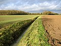
 A narrow path but not a public footpath - geograph.org.uk - 2231036.jpg 640 × 480; 189 KB
-
 A public footpath not - geograph.org.uk - 2230999.jpg 640 × 480; 131 KB
-
 A public footpath not - geograph.org.uk - 2231009.jpg 640 × 480; 118 KB
-
 Aggregate on hardstanding - geograph.org.uk - 4058743.jpg 640 × 480; 167 KB
-
 Air raid shelter on Site 2 - geograph.org.uk - 4485786.jpg 562 × 640; 565 KB
-

-
 An abandoned track, perhaps - geograph.org.uk - 2231034.jpg 640 × 480; 174 KB
-

-
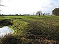
 Aslacton Ford - geograph.org.uk - 2922968.jpg 3,264 × 2,448; 4.11 MB
-
 Aslacton Mill.jpg 640 × 480; 138 KB
-
 Aslacton Primary School sign - geograph.org.uk - 5155429.jpg 3,072 × 2,304; 1.95 MB
-
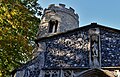
 Aslacton St Michael's church - geograph.org.uk - 2207427.jpg 700 × 525; 236 KB
-
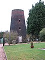 Aslacton tower mill - geograph.org.uk - 2230768.jpg 480 × 640; 118 KB
-
 Aslacton, Dogwood berries in the hedgerow, Steeple Lane - geograph.org.uk - 4698302.jpg 3,678 × 2,456; 4.18 MB
-
 Aslacton, Guelder rose berries in the hedgerow, Steeple Lane - geograph.org.uk - 4698310.jpg 2,452 × 1,640; 2.06 MB
-
 Aslacton, Hawthorn berries in the hedgerow, Steeple Lane - geograph.org.uk - 4698283.jpg 2,452 × 1,639; 2.47 MB
-
 Aslacton, Model Farm - geograph.org.uk - 4697288.jpg 3,678 × 2,455; 5.44 MB
-
 Aslacton, Power line, Steeple Lane - geograph.org.uk - 4698290.jpg 3,678 × 2,456; 4.69 MB
-
 Aslacton, St. Michael's Church - geograph.org.uk - 4697182.jpg 3,678 × 2,455; 4.99 MB
-
 Aslacton, St. Michael's Church - geograph.org.uk - 4698484.jpg 3,481 × 2,195; 3.8 MB
-
 Aslacton, St. Michael's Church tower - geograph.org.uk - 4698459.jpg 3,678 × 2,456; 6.98 MB
-

-
 Aslacton, St. Michael's Church, The altar - geograph.org.uk - 4698470.jpg 3,679 × 2,455; 5.69 MB
-
 Aslacton, St. Michael's Church, The altar - geograph.org.uk - 4698472.jpg 4,254 × 2,550; 5.94 MB
-
 Aslacton, St. Michael's Church, The altar - geograph.org.uk - 4698475.jpg 3,993 × 2,885; 7.1 MB
-
 Aslacton, St. Michael's Church, The c15th south porch - geograph.org.uk - 4697197.jpg 3,540 × 2,275; 5.42 MB
-
 Aslacton, St. Michael's Church, The c15th south porch - geograph.org.uk - 4698478.jpg 3,559 × 3,064; 7.14 MB
-

-
 Aslacton, St. Michael's Church, The font - geograph.org.uk - 4698461.jpg 3,627 × 2,373; 3.79 MB
-
 Aslacton, St. Michael's Church, The nave - geograph.org.uk - 4697204.jpg 5,478 × 3,614; 6.75 MB
-
 Aslacton, St. Michael's Church, The pulpit - geograph.org.uk - 4698465.jpg 4,853 × 3,301; 7.51 MB
-
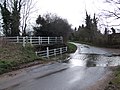
 Aslacton, The bridge at Bridge Farm - geograph.org.uk - 4698274.jpg 2,554 × 1,644; 3 MB
-
 Aslacton, The Street, Provender Mill - geograph.org.uk - 4698316.jpg 3,678 × 2,456; 4.59 MB
-
 Aslacton, Woodrow Farm, A large field of maize - geograph.org.uk - 4697284.jpg 4,274 × 2,142; 6.28 MB
-
 Aslacton, Woodrow Farm, A large field of maize - geograph.org.uk - 4698323.jpg 3,678 × 2,456; 6.75 MB
-
 B1134 Long Row, Gissing - geograph.org.uk - 5140231.jpg 3,072 × 2,304; 1.88 MB
-
 B1134 Long Row, Sneath Common - geograph.org.uk - 5140246.jpg 3,072 × 2,304; 1.8 MB
-
 B1134 Long Row, Sneath Common - geograph.org.uk - 5140265.jpg 3,072 × 2,304; 1.87 MB
-
 Black Mill Lane Postbox ^ Station Road - geograph.org.uk - 5156770.jpg 3,072 × 2,304; 1.88 MB
-
-
 Bus Stop - geograph.org.uk - 4248277.jpg 1,024 × 768; 255 KB
-
 Caravans by Tibenham airfield - geograph.org.uk - 2230894.jpg 640 × 455; 107 KB
-
 Caravans by Tibenham airfield - geograph.org.uk - 2230895.jpg 640 × 593; 143 KB
-

-
 Cereal crop near Tibenham - geograph.org.uk - 3920671.jpg 640 × 480; 129 KB
-
 Cereal crop on the old Tibenham airfield - geograph.org.uk - 3920673.jpg 640 × 480; 154 KB
-

-
 Church Road sign - geograph.org.uk - 5154628.jpg 2,966 × 2,224; 5.02 MB
-
 Church Road ^ footpath - geograph.org.uk - 5154960.jpg 3,072 × 2,304; 1.74 MB
-
 Church Road, Aslacton - geograph.org.uk - 5154630.jpg 3,072 × 2,304; 1.75 MB
-
 Church Road, Aslacton - geograph.org.uk - 5154985.jpg 3,072 × 2,304; 1.79 MB
-
 Church Road, Aslacton - geograph.org.uk - 5156297.jpg 3,072 × 2,304; 1.92 MB
-
 Church Road, Aslacton - geograph.org.uk - 5156304.jpg 3,072 × 2,304; 1.84 MB
-
 Church Road, Aslacton - geograph.org.uk - 6004014.jpg 3,456 × 2,592; 2.27 MB
-
 Church Street, Aslacton - geograph.org.uk - 5154981.jpg 3,072 × 2,304; 1.78 MB
-
 Claas Lexion 550 - geograph.org.uk - 4248247.jpg 1,024 × 768; 174 KB
-
 Cottage in Moulton Road - geograph.org.uk - 1572346.jpg 640 × 496; 108 KB
-

-
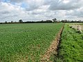
 Cultivated fields by Channonz Hall - geograph.org.uk - 2231020.jpg 640 × 480; 174 KB
-

-
 Disused track to Channonz Hall - geograph.org.uk - 2231039.jpg 640 × 466; 184 KB
-
 Driveway to Sneath Barn on Sneath Common - geograph.org.uk - 2230783.jpg 640 × 480; 147 KB
-
 Entering Great Moulton on Moulton Road - geograph.org.uk - 5156681.jpg 3,072 × 2,304; 1.84 MB
-

-
 Farm Buildings, Low Common - geograph.org.uk - 350506.jpg 640 × 480; 68 KB
-
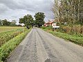
 Farmland off the B1134 Long Row - geograph.org.uk - 5140268.jpg 3,072 × 2,304; 1.74 MB
-
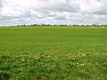
 Fields by Aslacton - geograph.org.uk - 3920696.jpg 640 × 480; 188 KB
-
 Fields by Tibenham - geograph.org.uk - 3920676.jpg 640 × 480; 130 KB
-
 Fields by Tibenham airfield - geograph.org.uk - 3920687.jpg 640 × 480; 189 KB
-
 Fields north of the B1134 road - geograph.org.uk - 2230986.jpg 640 × 480; 115 KB
-
 Fields north of the B1134 road - geograph.org.uk - 2231032.jpg 640 × 480; 124 KB
-

-
 Footbridge at the Ford on Steeple Lane - geograph.org.uk - 5153712.jpg 3,072 × 2,304; 1.84 MB
-

-
 Footpath to Pottergate Street - geograph.org.uk - 5154963.jpg 3,072 × 2,304; 1.93 MB
-
-
 Ford at Pottergate Street - geograph.org.uk - 2922943.jpg 3,872 × 2,592; 2.32 MB
-
 Ford on Steeple Lane - geograph.org.uk - 5153709.jpg 3,072 × 2,304; 1.99 MB
-

-
 Gated entrance to Dale Farm, Great Moulton - geograph.org.uk - 6003985.jpg 3,456 × 2,592; 3.93 MB
-

-

-
-

-
-
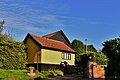
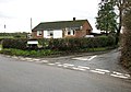
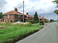 Houses - geograph.org.uk - 4247615.jpg 1,024 × 768; 216 KB
-

-
 Livestock sheds at Beech Farm - geograph.org.uk - 4056805.jpg 640 × 480; 214 KB
-
 Looking down to Pottergate Street - geograph.org.uk - 350517.jpg 640 × 480; 55 KB
-
 Looks like an old abandoned track - geograph.org.uk - 2231035.jpg 640 × 480; 172 KB
-
 Low Common - geograph.org.uk - 365452.jpg 640 × 424; 179 KB
-
 Low Common Road ^ Ford - geograph.org.uk - 5153723.jpg 3,072 × 2,304; 1.88 MB
-
 Low Common Road, Aslacton - geograph.org.uk - 5153684.jpg 3,072 × 2,304; 1.85 MB
-
 Low Common Road, Aslacton - geograph.org.uk - 5153703.jpg 3,072 × 2,304; 1.86 MB
-
 Low Common, Tas Valley Way, Haystack at Valley Farm - geograph.org.uk - 4698265.jpg 4,211 × 2,765; 7.64 MB
-

-
 Mill Lane sign - geograph.org.uk - 5156405.jpg 3,072 × 2,304; 1.89 MB
-
 Mill Lane sign - geograph.org.uk - 5156561.jpg 2,953 × 2,215; 2.9 MB
-
 Mill Lane, Aslacton - geograph.org.uk - 5156396.jpg 3,072 × 2,304; 1.95 MB
-
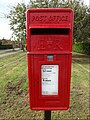
 Moulton Road Postbox - geograph.org.uk - 5140719.jpg 3,072 × 2,304; 1.82 MB
-
 Moulton Road Postbox - geograph.org.uk - 5140722.jpg 3,072 × 2,304; 2.06 MB
-
 Moulton Road Postbox - geograph.org.uk - 5140729.jpg 2,228 × 2,962; 5.62 MB
-
 Moulton Road Postbox - geograph.org.uk - 5140730.jpg 2,265 × 3,011; 4.67 MB
-
 Moulton Road Postbox - geograph.org.uk - 5142352.jpg 2,304 × 3,072; 5.1 MB
-
 Moulton Road ^ Moulton Road Postbox - geograph.org.uk - 5140714.jpg 3,072 × 2,304; 1.75 MB
-
 Moulton Road, Great Moulton - geograph.org.uk - 5156691.jpg 3,072 × 2,304; 2.08 MB
-
 Moulton Road, Great Moulton - geograph.org.uk - 5156788.jpg 3,072 × 2,304; 1.62 MB
-
 Moulton Road. Tivetshall, St Margaret - geograph.org.uk - 5169998.jpg 2,848 × 2,136; 1.51 MB
-
 Muir Lane, Aslacton - geograph.org.uk - 5154424.jpg 3,072 × 2,304; 1.89 MB
-
 Muir Lane, Aslacton - geograph.org.uk - 5154429.jpg 3,072 × 2,304; 1.65 MB
-
 Muir Lane, Aslacton - geograph.org.uk - 5154493.jpg 3,072 × 2,304; 4.02 MB
-
 Muir Lane, Aslacton - geograph.org.uk - 5154778.jpg 3,072 × 2,304; 1.8 MB
-
 Nissen huts and glider accommodation hangars - geograph.org.uk - 6003971.jpg 3,343 × 2,480; 1.59 MB
-
 Norfolk Gliding Club sign - geograph.org.uk - 5152388.jpg 3,072 × 2,304; 1.93 MB
-
 Old concreted camp road on Site 2 - geograph.org.uk - 4485792.jpg 640 × 480; 404 KB
-
 Old concreted track - geograph.org.uk - 4056780.jpg 640 × 480; 225 KB
-

-
-
 Overgrown air raid shelters on Site 2 - geograph.org.uk - 4485790.jpg 640 × 597; 514 KB
-
 Pearl Farm Postbox - geograph.org.uk - 5155325.jpg 3,072 × 2,304; 1.95 MB
-
 Pearl Farm Postbox - geograph.org.uk - 5155331.jpg 3,072 × 2,304; 1.92 MB
-
 Pearl Farm Postbox - geograph.org.uk - 5155335.jpg 2,291 × 3,046; 6.39 MB
-
 Pearl Farm Postbox - geograph.org.uk - 5155337.jpg 2,253 × 2,995; 4.07 MB
-
 Pearl Farm Postbox - geograph.org.uk - 5155432.jpg 2,304 × 3,072; 4.5 MB
-
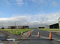
 Picnic table on Tibenham airfield - geograph.org.uk - 6003967.jpg 3,380 × 2,501; 1.85 MB
-
 Plantation Road sign - geograph.org.uk - 5140241.jpg 3,031 × 2,273; 5 MB
-
 Plantation Road sign - geograph.org.uk - 5152346.jpg 3,072 × 2,304; 1.99 MB
-
 Plantation Road sign - geograph.org.uk - 5152509.jpg 3,072 × 2,304; 1.97 MB
-
 Plantation Road sign - geograph.org.uk - 5156560.jpg 3,072 × 2,304; 1.84 MB
-
 Plantation Road, Aslacton - geograph.org.uk - 5156439.jpg 3,072 × 2,264; 4.68 MB
-
 Plantation Road, Aslacton - geograph.org.uk - 5156485.jpg 3,072 × 2,280; 3.74 MB
-
 Plantation Road, Aslacton - geograph.org.uk - 5156528.jpg 2,967 × 2,167; 3.15 MB
-
 Plantation Road, Aslacton - geograph.org.uk - 5156548.jpg 2,858 × 2,067; 1.71 MB
-
 Plantation Road, Sneath Common - geograph.org.uk - 5140236.jpg 3,067 × 2,304; 2.76 MB
-
 Plantation Road, Sneath Common - geograph.org.uk - 5140247.jpg 3,072 × 2,304; 1.78 MB
-
 Plantation Road, Sneath Common - geograph.org.uk - 5152338.jpg 3,072 × 2,304; 1.85 MB
-
 Plantation Road, Sneath Common - geograph.org.uk - 5152400.jpg 3,072 × 2,304; 1.85 MB
-
 Plantation Road, Sneath Common - geograph.org.uk - 5152498.jpg 3,072 × 2,304; 1.83 MB
-
 Plantation Road, Sneath Common - geograph.org.uk - 5152510.jpg 3,072 × 2,304; 1.76 MB
-
 Ploughed field - geograph.org.uk - 4248260.jpg 1,024 × 768; 258 KB
-
 Pond in field by Channonz Hall - geograph.org.uk - 2231025.jpg 640 × 480; 160 KB
-

-
 Pottergate Street sign - geograph.org.uk - 5156324.jpg 3,072 × 2,304; 1.95 MB
-
 Pottergate Street, Aslacton - geograph.org.uk - 5156316.jpg 3,072 × 2,304; 1.85 MB
-
 Public footpath to Plantation Road - geograph.org.uk - 4056781.jpg 640 × 480; 174 KB
-
 Public footpath to Woodrow Lane - geograph.org.uk - 4056788.jpg 640 × 480; 223 KB
-
 Puddle in field by Channonz Hall - geograph.org.uk - 2231005.jpg 640 × 480; 152 KB
-
 RAF Tibenham - Communal site 1 - geograph.org.uk - 4056733.jpg 640 × 480; 179 KB
-
 RAF Tibenham - Communal site 1 - geograph.org.uk - 4056735.jpg 640 × 480; 182 KB
-
 RAF Tibenham - Communal site 1 - geograph.org.uk - 4056739.jpg 640 × 480; 287 KB
-
 RAF Tibenham - Communal site 1 - geograph.org.uk - 4056748.jpg 640 × 480; 272 KB
-
 RAF Tibenham - Communal site 1 - geograph.org.uk - 4056751.jpg 640 × 480; 333 KB
-
 RAF Tibenham - Communal site 1 - geograph.org.uk - 4056755.jpg 640 × 480; 278 KB
-
 RAF Tibenham - Communal site 1 - geograph.org.uk - 4056758.jpg 640 × 472; 219 KB
-
 RAF Tibenham - Communal site 1 - geograph.org.uk - 4056761.jpg 640 × 480; 240 KB
-
 RAF Tibenham - Communal site 1 - geograph.org.uk - 4056769.jpg 640 × 480; 292 KB
-
 RAF Tibenham - Communal site 1 - geograph.org.uk - 4056775.jpg 640 × 480; 272 KB
-
 RAF Tibenham - Sick quarters - geograph.org.uk - 4058722.jpg 640 × 480; 163 KB
-
 RAF Tibenham - Sick quarters - geograph.org.uk - 4058725.jpg 640 × 480; 196 KB
-
 RAF Tibenham - Sick quarters - geograph.org.uk - 4058728.jpg 640 × 480; 164 KB
-
 RAF Tibenham - Sick quarters - geograph.org.uk - 4058730.jpg 640 × 480; 170 KB
-
 RAF Tibenham - Site 2 - geograph.org.uk - 4056796.jpg 640 × 480; 207 KB
-
 RAF Tibenham - Site 2 - geograph.org.uk - 4056799.jpg 640 × 480; 208 KB
-
 RAF Tibenham - Site 2 - geograph.org.uk - 4056801.jpg 640 × 480; 190 KB
-
 RAF Tibenham - Site 6 - geograph.org.uk - 4058675.jpg 640 × 480; 126 KB
-
 RAF Tibenham - Site 6 - geograph.org.uk - 4058677.jpg 571 × 640; 175 KB
-
 RAF Tibenham - Site 6 - geograph.org.uk - 4058680.jpg 480 × 640; 132 KB
-
 RAF Tibenham - Site 6 - geograph.org.uk - 4058683.jpg 640 × 480; 150 KB
-
 RAF Tibenham - Site 6 - geograph.org.uk - 4058685.jpg 640 × 566; 211 KB
-
 RAF Tibenham - Site 6 - geograph.org.uk - 4058686.jpg 640 × 480; 174 KB
-
 River at the Ford - geograph.org.uk - 5153717.jpg 2,304 × 3,072; 4.94 MB
-
 Road Junction - geograph.org.uk - 4248266.jpg 1,024 × 768; 239 KB
-
 Road off Church Road - geograph.org.uk - 5154993.jpg 3,072 × 2,304; 1.73 MB
-

-
 Road Sign - geograph.org.uk - 4248271.jpg 1,024 × 768; 345 KB
-
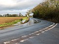
 Road to Forncett St Peter - geograph.org.uk - 851731.jpg 640 × 480; 81 KB
-
 Roadsign on Steeple Lane - geograph.org.uk - 5153707.jpg 2,304 × 3,072; 5.24 MB
-
 Roadsign on Woodrow Lane - geograph.org.uk - 5154585.jpg 2,304 × 2,830; 6.6 MB
-
 Roadsigns on Plantation Road - geograph.org.uk - 5140243.jpg 2,253 × 2,995; 3.29 MB
-
 Roadsigns on the B1134 Long Row - geograph.org.uk - 5140226.jpg 2,928 × 2,196; 4.12 MB
-
 Roadsigns on the B1134 Long Row - geograph.org.uk - 5140230.jpg 3,072 × 2,304; 1.9 MB
-
 Roadsigns on the B1134 Long Row - geograph.org.uk - 5140255.jpg 2,970 × 2,228; 5.62 MB
-
 Rural bus stop on Muir Lane, Great Moulton - geograph.org.uk - 6004022.jpg 3,456 × 2,592; 1.95 MB
-
 Sheds at Fernleigh Farm - geograph.org.uk - 1572603.jpg 600 × 591; 125 KB
-
 Sheds at Fernleigh Farm - geograph.org.uk - 1572604.jpg 640 × 480; 103 KB
-
 Sheep grazing at Beech Farm - geograph.org.uk - 4056808.jpg 640 × 480; 199 KB
-
 Sign on Tivetshall St.Margaret Maltings - geograph.org.uk - 5140363.jpg 3,072 × 2,304; 1.84 MB
-
 Signpost on Church Road - geograph.org.uk - 5154503.jpg 2,046 × 2,860; 4.72 MB
-
 Signpost on Low Common Road - geograph.org.uk - 5153697.jpg 2,253 × 2,995; 5.85 MB
-
 Signpost on Pottergate Street - geograph.org.uk - 5156329.jpg 2,291 × 3,046; 5.1 MB
-
 Signpost on The Street - geograph.org.uk - 5156360.jpg 2,253 × 2,995; 5.8 MB
-
 Signpost on Tibenham Road - geograph.org.uk - 5152356.jpg 2,228 × 2,962; 4.52 MB
-
 Signpost ^ Plantation Road sign - geograph.org.uk - 5152507.jpg 3,072 × 2,304; 1.82 MB
-
 Signpost ^ Plantation Road sign - geograph.org.uk - 5152508.jpg 2,265 × 3,011; 4.39 MB
-
 Signpost ^ Plantation Road sign - geograph.org.uk - 5153624.jpg 2,216 × 2,947; 4.98 MB
-

-
 Small pond beside non-existing footpath - geograph.org.uk - 2231027.jpg 480 × 640; 151 KB
-
 Small pond by Channonz Hall - geograph.org.uk - 2231044.jpg 640 × 480; 181 KB


_-_geograph.org.uk_-_2230886.jpg)


_-_geograph.org.uk_-_2230903.jpg)


_-_geograph.org.uk_-_2230816.jpg)
_-_geograph.org.uk_-_2230817.jpg)
_-_geograph.org.uk_-_2230824.jpg)
_-_geograph.org.uk_-_2230813.jpg)
_-_geograph.org.uk_-_2230828.jpg)


