Category:Athgarvan
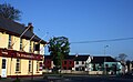
English: Athgarvan ( southwest of Newbridge in County Kildare, Ireland. It is on the R416 regional road and lies just west of the River Liffey which forms the eastern boundary of the village, while The Curragh forms its western boundary.
village in Ireland  | |||||
| Upload media | |||||
| Instance of | |||||
|---|---|---|---|---|---|
| Location | County Kildare, Leinster, Ireland | ||||
| Elevation above sea level |
| ||||
 | |||||
Media in category "Athgarvan"
The following 3 files are in this category, out of 3 total.
-
 Athgarvan, County Kildare - geograph.org.uk - 1816369.jpg 3,799 × 2,350; 2.78 MB
-
 Graveyard - geograph.org.uk - 3852822.jpg 2,162 × 2,162; 1.09 MB
-
 IMG Athgarvan823.jpg 3,883 × 2,406; 2.19 MB

