Category:Atsana
| Object location | | View all coordinates using: OpenStreetMap |
|---|
| Upload media | |||||
| Instance of | |||||
|---|---|---|---|---|---|
| Location | Lanchkhuti Municipality, Guria, Georgia | ||||
| Population |
| ||||
| Elevation above sea level |
| ||||
 | |||||
Media in category "Atsana"
The following 10 files are in this category, out of 10 total.
-
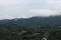
 Atsana view.jpg 3,872 × 2,592; 4.2 MB
-
 Atsana, view from Oqona.jpg 5,184 × 3,456; 4.99 MB
-
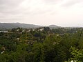
 Atsana, village center.jpg 5,184 × 3,456; 4.58 MB
-
 Atsana.JPG 3,264 × 2,448; 2.52 MB
-
 Atsaura, Sakvikhia.jpg 5,184 × 3,456; 7.67 MB
-
 Atsaura.jpg 5,184 × 3,456; 9.52 MB
-
 Oda House in Guria.jpg 3,872 × 2,592; 4.33 MB
-
 Sakvikhia 2.jpg 3,872 × 2,592; 4.64 MB
-
 Sakvikhia.jpg 3,872 × 2,592; 4.35 MB
-
 აცანა.jpg 4,032 × 3,024; 4.34 MB


