Category:Attenhofen
municipality of Germany    | |||||
| Upload media | |||||
| Instance of |
| ||||
|---|---|---|---|---|---|
| Part of |
| ||||
| Location | Kelheim, Lower Bavaria, Bavaria, Germany | ||||
| Head of government |
| ||||
| Population |
| ||||
| Area |
| ||||
| Elevation above sea level |
| ||||
| Different from | |||||
| official website | |||||
 | |||||
Subcategories
This category has the following 4 subcategories, out of 4 total.
Media in category "Attenhofen"
The following 6 files are in this category, out of 6 total.
-
 Wappen Attenhofen.png 300 × 350; 147 KB
-
 Wappen von Attenhofen.svg 710 × 758; 72 KB
-
 Attenhofen - Lage im Landkreis.png 148 × 185; 25 KB
-
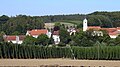
 Attenhofen 01.jpg 2,936 × 1,652; 1.63 MB
-
 Attenhofen 02.jpg 2,592 × 1,458; 2.18 MB
-
 Attenhofen in KEH.svg 576 × 664; 591 KB


