Category:August 2005 in London
Ceremonial counties of England: Bedfordshire · Berkshire · Buckinghamshire · Cambridgeshire · Cheshire · Cornwall · Cumbria · Derbyshire · Devon · Dorset · Durham · East Riding of Yorkshire · East Sussex · Essex · Gloucestershire · Greater London · Greater Manchester · Hampshire · Herefordshire · Hertfordshire · Isle of Wight · Kent · Lancashire · Leicestershire · Lincolnshire · Merseyside · Norfolk · North Yorkshire · Northamptonshire · Northumberland · Nottinghamshire · Oxfordshire · Rutland · Shropshire · Somerset · South Yorkshire · Staffordshire · Suffolk · Surrey · Tyne and Wear · Warwickshire · West Midlands · West Sussex · West Yorkshire · Wiltshire · Worcestershire
City-counties: Bristol ·
Former historic counties:
Other former counties:
City-counties: Bristol ·
Former historic counties:
Other former counties:
Deutsch: Bilder, die im August 2005 in London aufgenommen worden sind. Bitte beachten Sie, dass dies weder das Datum des Uploads noch das Datum des Scannens eines Fotos ist.
English: Images/pictures taken in London during August 2005. Note this is not the date of the upload, nor the date a photo was scanned.
Español: Fotografías o imágenes tomadas en London durante agosto 2005. No es la fecha de subida ni escaneo, sino la fecha en que las fotografías o imágenes se crearon.
Esperanto: Bildoj faritaj en London en aŭgusto 2005. Tio ne estas la dato, kiam la bildoj estis alŝutitaj aŭ skanitaj.
Français : Photographies ou images prises en London durant août 2005. Ce n'est pas la date du téléchargement ou du scan.
Galego: Fotografías ou imaxes tomadas en London durante agosto 2005. Non é a data de subida nin escaneamento, senón a data na que se crearon as fotografías ou imaxes.
Italiano: Fotografie o immagini scattate a London nel agosto 2005. Nota bene: la data non si riferisce né a quella di upload né a quella in cui la foto è stata digitalizzata.
Norsk bokmål: Bilder tatt i London i løpet av august 2005. Merk at dette ikke er datoen for opplasting, eller når et bilde har blitt skannet.
Norsk nynorsk: Bilete teke i London i løpet av august 2005. Merk at dette ikkje er datoen for opplasting, eller når eit bilete har vorte skanna.
Русский: Изображения, сделанные в London в течение август 2005 (не дата загрузки изображения).
Українська: Зображення, зроблені в London протягом серпень 2005. Зауважте, що це не дата завантаження чи дата сканування фотографії.
| August 2004 | ← | August 2005 | → | August 2006 | |||||||
| Jan | Feb | Mar | Apr | May | Jun | Jul | Aug | Sep | Oct | Nov | Dec |
| 97 | 79 | 114 | 121 | 163 | 168 | 270 | 338 | 262 | 252 | 177 | 159 |
|---|---|---|---|---|---|---|---|---|---|---|---|
Subcategories
This category has the following 8 subcategories, out of 8 total.
N
- Notting Hill Carnival 2005 (111 F)
Media in category "August 2005 in London"
The following 200 files are in this category, out of 330 total.
(previous page) (next page)-
 "The London" - geograph.org.uk - 36866.jpg 640 × 482; 87 KB
-
 08-14-05 Royal Victoria Dock.jpg 2,235 × 1,161; 1.36 MB
-
 10 Downing Street (38690758).jpg 1,512 × 2,016; 742 KB
-
 2005 newsagent London 36300230.jpg 1,224 × 1,632; 603 KB
-
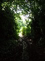
 Footpath across Malden Golf Course. - geograph.org.uk - 32365.jpg 640 × 480; 139 KB
-
 Addington Village bus and tram station.jpg 640 × 432; 120 KB
-
 Sandilands tram stop looking west.jpg 640 × 474; 159 KB
-
 London Chiswick Bath Road Halt site geograph-3257423-by-Ben-Brooksbank.jpg 2,350 × 1,382; 3.82 MB
-
 Hampstead Heath The Pergola.jpg 2,032 × 1,524; 1.2 MB
-
 South Lodge at Addington Palace, CRo - geograph.org.uk - 55149.jpg 640 × 516; 84 KB
-
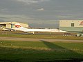
 London Biggin Hill Airport 1.jpg 640 × 481; 74 KB
-
 London Biggin Hill Airport 2.jpg 640 × 430; 75 KB
-
 Loughborough Junction railway station 1.jpg 1,280 × 960; 261 KB
-
 Squeeze in There (36641791).jpg 750 × 681; 60 KB
-
 2005-08-26 - London - Embankment - Pigeon Spikes (4888256260).jpg 2,592 × 1,944; 3.2 MB
-
 2005-08-26 - London - Eurostar Waterloo International - Departures - Arri (4888260868).jpg 2,549 × 1,910; 3.85 MB
-
 2005-08-26 - London - National Gallery - Sitting Alone - Way Out - Miscel (4887650345).jpg 2,561 × 1,778; 2.29 MB
-
 2005-08-26 - London - South Bank - Skatepark (4887656745).jpg 2,592 × 1,944; 3.68 MB
-
 2005-08-26 - London - South Bank - Skatepark (4888259068).jpg 2,340 × 1,773; 2.6 MB
-
 2005-08-26 - London - Staircase (4888248206).jpg 2,542 × 1,772; 2.58 MB
-
 2005-08-26 - London - Trying to Climb on Nelsons Column - Trafalgar Squ (4888250530).jpg 2,592 × 1,944; 3.52 MB
-
 2005-08-28 - London - Honor Oak Park Rails (4887660253).jpg 1,941 × 1,131; 1.25 MB
-
 2005-08-28 - London - OXO Tower at Night (4888286534).jpg 1,864 × 2,531; 326 KB
-
 2005-08-28 - London - Paddington Station - Black and White (4888286344).jpg 2,592 × 1,944; 1.2 MB
-
 2005-08-28 - United Kingdom - England - London - Notting Hill - Red Brick 4887683035.jpg 2,585 × 1,788; 2.97 MB
-

-
 Brimsdown railway station in 2005.jpg 640 × 480; 60 KB
-
 Rotherhithe Riverside.jpg 1,338 × 866; 226 KB
-
 2005-08-30 - London - Bollywood (4887686747).jpg 2,219 × 1,550; 2.94 MB
-
 2005-08-30 - London - Charing Cross - Security Cameras (4887689483).jpg 1,944 × 2,592; 3.77 MB
-
 2005-08-30 - London - Golden Jubilee Bridge (4887691171).jpg 2,410 × 1,944; 3.28 MB
-

-
 A3 Apartments - geograph.org.uk - 134840.jpg 640 × 480; 119 KB
-
 A3 at Hook looking east. - geograph.org.uk - 39477.jpg 640 × 480; 106 KB
-
 A3 at the Hook underpass - geograph.org.uk - 39474.jpg 640 × 480; 87 KB
-
 Abbey Road Studios (2005-08-01 13.10.44 by Fred Hsu).jpg 3,456 × 2,304; 2.3 MB
-
 Abbs Cross Lane, Hornchurch, Essex - geograph.org.uk - 41844.jpg 480 × 640; 85 KB
-
 Addiscombe Road, Croydon - geograph.org.uk - 33224.jpg 463 × 640; 133 KB
-
 Air strip, Rushett Farm - geograph.org.uk - 33875.jpg 640 × 480; 79 KB
-

-
 Ambulance - Flickr - gwire.jpg 1,632 × 1,224; 340 KB
-
 Anerley Town Hall - geograph.org.uk - 39277.jpg 477 × 640; 104 KB
-
 Ballards Farm Road, South Croydon - geograph.org.uk - 38110.jpg 640 × 450; 111 KB
-
 Bandstand at the Horniman Museum SE23 - geograph.org.uk - 41368.jpg 640 × 476; 92 KB
-
 Barbican-tube-from-road-bri.jpg 600 × 419; 81 KB
-

-
 Christ Church, Beckenham - geograph.org.uk - 35351.jpg 491 × 356; 214 KB
-
-
 Beeches of Farthing Downs - geograph.org.uk - 868178.jpg 640 × 444; 97 KB
-
 Birch Tree Avenue, Coney Hall BR4 - geograph.org.uk - 41256.jpg 640 × 424; 100 KB
-
 Blackfriars Bridge at night - geograph.org.uk - 811514.jpg 640 × 480; 78 KB
-
 BlackfriarsBridgeP1020583.jpg 800 × 600; 142 KB
-
 Bloomsbury Square 1.jpg 2,048 × 1,536; 1.61 MB
-
 Boots the chemist london.png 768 × 1,024; 1.14 MB
-
 Bridle Road, CR0 - geograph.org.uk - 55138.jpg 640 × 481; 174 KB
-
 Brigstock Road, Thornton Heath CR7 - geograph.org.uk - 47405.jpg 640 × 492; 79 KB
-
 Broadband Available Here^ - geograph.org.uk - 38765.jpg 640 × 482; 129 KB
-
 Broadcoombe, Selsdon - geograph.org.uk - 38316.jpg 640 × 426; 53 KB
-

-
 Bromley Common URC - geograph.org.uk - 49488.jpg 640 × 485; 70 KB
-
 St Luke's, Bromley Common BR2 - geograph.org.uk - 47193.jpg 492 × 640; 71 KB
-
 St Swithun's RC church BR2 - geograph.org.uk - 47203.jpg 640 × 494; 73 KB
-

-
 Brookside "East Side" - geograph.org.uk - 46452.jpg 640 × 428; 73 KB
-
 Buckinham Palace aurrean, goardia aldaketa ikustearen zain - panoramio.jpg 1,200 × 1,600; 517 KB
-
 Building 1000.jpg 1,600 × 1,200; 328 KB
-
 Canary Wharf - panoramio - neopeo.jpg 1,632 × 1,224; 538 KB
-
 Canary Wharf Station.jpg 682 × 1,024; 405 KB
-
 Carshalton Ponds, High Street (A232) - geograph.org.uk - 47026.jpg 640 × 480; 91 KB
-
 Chase Farm Hospital Enfield - geograph.org.uk - 35456.jpg 640 × 480; 33 KB
-
 Cheam Baptist Church - geograph.org.uk - 106458.jpg 640 × 480; 268 KB
-
 Cheam Period Cottages - geograph.org.uk - 106464.jpg 519 × 413; 85 KB
-
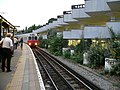
 Chessington North station - geograph.org.uk - 42265.jpg 640 × 480; 145 KB
-
 Chessington South Station - geograph.org.uk - 45374.jpg 640 × 480; 138 KB
-
 Chessington South Station - geograph.org.uk - 45380.jpg 640 × 480; 86 KB
-

-
 Chingford Rugby Club - geograph.org.uk - 35913.jpg 640 × 480; 15 KB
-
 Chrisp Street Market, Poplar - geograph.org.uk - 37220.jpg 640 × 480; 79 KB
-

-

-

-

-
 Clock Tower, Stockwell. - geograph.org.uk - 34999.jpg 640 × 480; 96 KB
-
 Concorde Alpha Bravo at London Heathrow.jpg 1,600 × 1,200; 351 KB
-
 Coney Hall BR4 - geograph.org.uk - 44171.jpg 640 × 481; 89 KB
-
 Container Stack - geograph.org.uk - 36898.jpg 640 × 482; 75 KB
-
 Crescent West, Hadley Wood, Barnet - geograph.org.uk - 45039.jpg 640 × 480; 114 KB
-
 Crown Ash Hill TN16 - geograph.org.uk - 44683.jpg 481 × 640; 107 KB
-

-
 Cutty Sark at Dawn - geograph.org.uk - 1575951.jpg 640 × 480; 74 KB
-
 D-stock at Gunnersbury.jpg 1,280 × 960; 626 KB
-
 Dagenham Civic Offices - geograph.org.uk - 38509.jpg 640 × 482; 88 KB
-
 Do Not Pass Go^ (HMP Pentonville) - geograph.org.uk - 36686.jpg 482 × 640; 49 KB
-
 Docklands Crane.jpg 500 × 667; 268 KB
-
 Downside Crescent, Hampstead - geograph.org.uk - 40300.jpg 640 × 528; 252 KB
-
 Earl's Court District Line platforms.jpg 1,280 × 960; 574 KB
-
 Earl's Court Station, SW5 - geograph.org.uk - 828965.jpg 640 × 480; 93 KB
-
 Earls Court Exhibition buildings - geograph.org.uk - 35124.jpg 640 × 479; 218 KB
-
 Eastcote station - geograph.org.uk - 945379.jpg 640 × 480; 68 KB
-
 Elephant and Castle Shopping Centre - geograph.org.uk - 35353.jpg 640 × 480; 79 KB
-
 Elfrida Crescent SE6 - geograph.org.uk - 47900.jpg 640 × 481; 72 KB
-
 Endwell Road at Brockley Cross SE4 - geograph.org.uk - 45854.jpg 640 × 481; 69 KB
-
 Enfield Island Village - geograph.org.uk - 35900.jpg 640 × 480; 19 KB
-
 Enid Blyton lived here - geograph.org.uk - 134822.jpg 640 × 480; 220 KB
-

-
 Eros at Night, Piccadilly Circus - geograph.org.uk - 34842.jpg 640 × 480; 321 KB
-
 Fishing Lakes, Warwick Lane, Rainham - geograph.org.uk - 39259.jpg 640 × 480; 158 KB
-
 Fitness Exchange, Beckenham - geograph.org.uk - 33216.jpg 640 × 408; 68 KB
-
 Flag of Luxembourg.jpg 1,200 × 1,600; 819 KB
-
 Flower Beds and trees - geograph.org.uk - 106481.jpg 640 × 480; 469 KB
-
 Footbridge over Lower Richmond Road (A316) - geograph.org.uk - 46381.jpg 640 × 480; 122 KB
-
 Forbidden Planet London 1.jpg 2,048 × 1,536; 1.54 MB
-
 Fountain in Manor Park, Sutton. - geograph.org.uk - 33425.jpg 612 × 480; 626 KB
-
 Free Britain from the Curse.jpg 350 × 263; 17 KB
-
 Gallions Hotel, Beckton.jpg 1,600 × 1,200; 343 KB
-

-

-
 Gate to the Park - geograph.org.uk - 49013.jpg 482 × 640; 73 KB
-
 GDH at SE10 - geograph.org.uk - 41847.jpg 640 × 480; 79 KB
-
 "Legoland" - Dunmow House, Barking - geograph.org.uk - 36605.jpg 432 × 640; 80 KB
-
 Gracechurch street.jpg 754 × 1,013; 223 KB
-
 Grange Holborn Hotel.jpg 2,048 × 1,536; 1.6 MB
-
-
 Greenview Avenue, Monks Orchard - geograph.org.uk - 39420.jpg 640 × 481; 94 KB
-
 Greenwich - panoramio.jpg 1,200 × 1,600; 459 KB
-
 Hadley Wood Railway Station.jpg 640 × 391; 77 KB
-
 Hammersmith & Chiswick station site geograph-3596502-by-Ben-Brooksbank.jpg 2,393 × 1,450; 2.89 MB
-
 Hampstead Ponds, bathing pond - geograph.org.uk - 40321.jpg 640 × 480; 128 KB
-

-
 Harwood Hall, Corbets Tey, Upminster - geograph.org.uk - 39256.jpg 640 × 480; 108 KB
-
 Havering Road, Collier Row, Romford, Essex - geograph.org.uk - 34893.jpg 640 × 480; 135 KB
-
 Havering-atte-Bower, Essex - geograph.org.uk - 46103.jpg 640 × 480; 141 KB
-
 Haverstock Hill - geograph.org.uk - 40293.jpg 640 × 479; 204 KB
-
 Hawes Down Junior School, West Wickham BR4 - geograph.org.uk - 41393.jpg 640 × 481; 114 KB
-
 Hawk Wood - geograph.org.uk - 33948.jpg 640 × 480; 166 KB
-
 Hazel Bank - geograph.org.uk - 630546.jpg 640 × 480; 128 KB
-
 Heath Street, Hampstead - geograph.org.uk - 40279.jpg 640 × 480; 123 KB
-
 Heathfield - geograph.org.uk - 37965.jpg 640 × 512; 72 KB
-
 Heathfield - old vegetable garden - geograph.org.uk - 37969.jpg 640 × 512; 75 KB
-
 Heavy Reading - geograph.org.uk - 44921.jpg 640 × 480; 148 KB
-
 Hogsmill River, north from footbridge. - geograph.org.uk - 32676.jpg 480 × 640; 167 KB
-

-
 Homebase with pond, Bromley Road SE6 - geograph.org.uk - 47895.jpg 640 × 481; 91 KB
-
 Honor Oak Crematorium SE23 - geograph.org.uk - 45058.jpg 640 × 474; 84 KB
-
 Hook Chessington - geograph.org.uk - 42240.jpg 640 × 480; 166 KB
-
 Hook underpass - geograph.org.uk - 134835.jpg 640 × 480; 138 KB
-
 Hook village - geograph.org.uk - 42282.jpg 640 × 480; 154 KB
-
 Hook village shops - geograph.org.uk - 42283.jpg 640 × 480; 136 KB
-
 Hornchurch Police Station - geograph.org.uk - 41781.jpg 640 × 480; 90 KB
-
 Horse and Barge Pub in South Harefield - geograph.org.uk - 38552.jpg 640 × 480; 24 KB
-
 Horton Country Park - geograph.org.uk - 35094.jpg 640 × 354; 76 KB
-
 Houses in Dyne Road - geograph.org.uk - 38605.jpg 640 × 480; 108 KB
-
 Houses in Lancaster Grove, Swiss Cottage - geograph.org.uk - 38615.jpg 640 × 480; 254 KB
-
 Incinerator at Chase Farm Hospital - geograph.org.uk - 50029.jpg 480 × 640; 58 KB
-

-
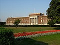
 J Sainsbury HQ 1.jpg 2,048 × 1,536; 1.16 MB
-
 J Sainsbury HQ 2.jpg 2,048 × 1,536; 1.13 MB
-
 J Sainsbury HQ 3.jpg 2,048 × 1,536; 1.14 MB
-
 J Sainsbury HQ 4.jpg 2,048 × 1,536; 1.13 MB
-

-
 Jewish Cemetery Rainham - geograph.org.uk - 38567.jpg 640 × 482; 83 KB
-
 St Martin's Church, Kensal Rise - geograph.org.uk - 40500.jpg 480 × 640; 107 KB
-

-
 Kenwood Drive BR3 - geograph.org.uk - 44688.jpg 640 × 461; 85 KB
-
 Keston Court Farm, Keston BR2 - geograph.org.uk - 43183.jpg 640 × 450; 76 KB
-
 Keston Court Stables, BR2 - geograph.org.uk - 41248.jpg 640 × 420; 67 KB
-
 Kimpton Park Industrial Estate - geograph.org.uk - 32935.jpg 640 × 480; 123 KB
-
 King George V Playing Field - geograph.org.uk - 630547.jpg 640 × 465; 91 KB
-

-
 Langley Park Golf Club - geograph.org.uk - 34667.jpg 640 × 444; 193 KB
-
 Langley Park Golf Club BR3 - geograph.org.uk - 47237.jpg 640 × 443; 90 KB
-

-
 LHR Terminal 3 waiting area.jpg 3,072 × 1,108; 1.1 MB
-
 Lifetime Accessories - geograph.org.uk - 42245.jpg 640 × 480; 176 KB
-
 Littleheath Road CR2 - geograph.org.uk - 45987.jpg 640 × 481; 88 KB
-
 London (2).JPG 640 × 480; 54 KB
-
 London (3).JPG 640 × 480; 35 KB
-
 London (4).JPG 640 × 480; 49 KB
-
 London - Sherlock Holmes.JPG 640 × 480; 60 KB
-
 London - The Royal Society of Arts.jpg 2,391 × 1,904; 1.14 MB
-
 London 2005.jpg 1,366 × 2,048; 334 KB
-
 London Bridge - geograph.org.uk - 683638.jpg 640 × 512; 75 KB
-
 London bridge alcove.jpg 640 × 773; 217 KB
-
 London Cutty Sark-etik ikusita - panoramio.jpg 1,200 × 1,600; 450 KB
-
 London Eye circling Big Ben - geograph.org.uk - 114655.jpg 475 × 640; 114 KB
-
 London MBridgeUnder By DanBUK.jpg 1,280 × 1,024; 480 KB
-
 London Paddington Station 4887684667.jpg 2,088 × 1,392; 2.22 MB
-
 London Road Cemetery BR1 - geograph.org.uk - 44169.jpg 640 × 477; 100 KB
-
 LondonAmbu.jpg 1,024 × 768; 159 KB
-
 Long Lane Woods, Croydon - geograph.org.uk - 34343.jpg 640 × 481; 203 KB
-
 Looking East from entrance to Oakhill Park - geograph.org.uk - 45915.jpg 640 × 480; 123 KB
-

-
 Lych Gate and Church at Clay Hill - geograph.org.uk - 35225.jpg 480 × 640; 74 KB
-
 Malan Square South Hornchurch - geograph.org.uk - 38984.jpg 640 × 482; 111 KB
-
 Malden Manor Station.jpg 640 × 480; 75 KB
-
 Marble Arch station, W1 - geograph.org.uk - 831396.jpg 640 × 480; 73 KB
-
 Market Square, Kingston - geograph.org.uk - 587481.jpg 480 × 640; 96 KB
-
 Mast, Imperial Way, South Croydon. - geograph.org.uk - 33431.jpg 480 × 640; 75 KB
-
 Mercury Gardens, Romford - geograph.org.uk - 46862.jpg 640 × 480; 90 KB
-


.jpg)


.jpg)
.jpg)
.jpg)
.jpg)
.jpg)
.jpg)
.jpg)
.jpg)
.jpg)
.jpg)
.jpg)


.jpg)
.jpg)
.jpg)


.jpg)


_-_geograph.org.uk_-_47026.jpg)


_-_geograph.org.uk_-_32661.jpg)


_-_geograph.org.uk_-_36686.jpg)


_-_geograph.org.uk_-_46381.jpg)


_passing_under_Malden_Road_(A2043)_at_Malden_Junction._-_geograph.org.uk_-_32366.jpg)


.JPG)
.JPG)
.JPG)


