Category:August 2006 in Ireland
Countries of Europe: Austria · Azerbaijan‡ · Belarus · Belgium · Bosnia and Herzegovina · Bulgaria · Croatia · Czech Republic · Denmark · Estonia · Finland · France‡ · Georgia‡ · Germany · Greece · Hungary · Iceland · Republic of Ireland · Italy · Kazakhstan‡ · Latvia · Lithuania · Luxembourg · Moldova · Monaco · Montenegro · Netherlands‡ · Norway · Poland · Portugal‡ · Romania · Russia‡ · Serbia · Slovakia · Slovenia · Spain‡ · Sweden · Switzerland · Turkey‡ · Ukraine · United Kingdom · Vatican City
Specific status: Gibraltar · Jersey
‡: partly located in Europe
Specific status: Gibraltar · Jersey
‡: partly located in Europe
| ← | → | ||||||||||||
| ← | Jan | Feb | Mar | Apr | May | Jun | Jul | Aug | Sep | Oct | Nov | Dec | → |
|---|---|---|---|---|---|---|---|---|---|---|---|---|---|
| 17 | 9 | 21 | 37 | 78 | 6 | 165 | 169 | 3 | 355 | 29 | 27 | ||

Deutsch: August 2006 in Irland
English: August 2006 in Ireland
Media in category "August 2006 in Ireland"
The following 168 files are in this category, out of 168 total.
-
 Famine sculpture in front of the International Financial Services Centre Dublin 2006.jpg 1,760 × 1,168; 360 KB
-
-
 Glendalough Lower Lake.jpg 2,476 × 1,797; 718 KB
-
 Glendalough.jpg 2,560 × 1,920; 746 KB
-
 Old road at Ballymacscanlan, Co Louth - geograph.org.uk - 224538.jpg 640 × 426; 154 KB
-
 Tower and graveyard, Glendalough - geograph.org.uk - 228352.jpg 480 × 640; 98 KB
-
 5000 Year Old Wood - geograph.org.uk - 245895.jpg 640 × 503; 116 KB
-
 An Loch Geal - geograph.org.uk - 219703.jpg 600 × 450; 87 KB
-
 An Sas (Sauce Creek) - geograph.org.uk - 219157.jpg 600 × 450; 83 KB
-
 Baile an Fheirtearaigh church - geograph.org.uk - 220215.jpg 600 × 450; 47 KB
-
-
 Ballinphunta - geograph.org.uk - 242961.jpg 640 × 306; 34 KB
-
 Ballyglennon Presbyterian Church - geograph.org.uk - 213222.jpg 640 × 479; 49 KB
-
 Ballymacscanlan Bay, Co Louth - geograph.org.uk - 224561.jpg 640 × 426; 131 KB
-
 Ballyseedy monument.jpg 2,304 × 1,728; 948 KB
-
 Beach North of Greenore Point - geograph.org.uk - 246736.jpg 640 × 255; 37 KB
-
 Beach South-west of Greenore Point - geograph.org.uk - 246743.jpg 640 × 401; 45 KB
-
 Benaderreen - geograph.org.uk - 241452.jpg 640 × 388; 52 KB
-
 Betty's Seat, near Tobernalt Bay - geograph.org.uk - 241291.jpg 427 × 640; 80 KB
-
 Boats on Glencar Lough - geograph.org.uk - 243492.jpg 640 × 427; 103 KB
-
 Border Collie herding sheep.jpg 1,024 × 684; 931 KB
-
 Brandon Pier - geograph.org.uk - 219724.jpg 600 × 450; 60 KB
-
 Bray harbour - geograph.org.uk - 228738.jpg 640 × 480; 72 KB
-
 Bray station - geograph.org.uk - 228315.jpg 640 × 480; 91 KB
-
 Bridge at Glenkeen - geograph.org.uk - 237689.jpg 640 × 480; 93 KB
-
 Bridge by the beach - geograph.org.uk - 219590.jpg 600 × 450; 66 KB
-
 Carrigagulla 03.jpg 1,561 × 1,022; 483 KB
-
 Carved Stone, Clonfinlough - geograph.org.uk - 245804.jpg 640 × 427; 101 KB
-
 Castelo de Athlone Irlanda.jpg 1,280 × 960; 246 KB
-
 Castlegregory Bank Holiday Weekend 06 063.jpg 2,272 × 1,704; 926 KB
-
 Castlekeeran Churchyard - geograph.org.uk - 239445.jpg 427 × 640; 69 KB
-
 Central Bank of Ireland.jpg 1,760 × 1,168; 300 KB
-
 Central Square, Ballickmoyler - geograph.org.uk - 682706.jpg 448 × 336; 60 KB
-
 Chambered Cairn - geograph.org.uk - 241275.jpg 640 × 427; 47 KB
-

-
 Church on Downpatrick Head - geograph.org.uk - 242756.jpg 640 × 427; 81 KB
-
 Clapper Bridge at Killeen - geograph.org.uk - 237454.jpg 640 × 480; 100 KB
-
 CollinsBarracksDublinCC.jpg 2,048 × 1,536; 376 KB
-
 Concrete jetty - geograph.org.uk - 220136.jpg 600 × 450; 113 KB
-
 Cork.Ireland. august 2006.jpg 1,510 × 1,130; 312 KB
-
 Crannog on Ballygawley Lough - geograph.org.uk - 241304.jpg 640 × 433; 55 KB
-
 Crazy Golf, Rosslare - geograph.org.uk - 246452.jpg 640 × 422; 82 KB
-
 Cross, Inis Meáin (Inishmaan), Aran Islands, Ireland (6779966323).jpg 1,024 × 1,024; 164 KB
-

-
 Deserted Farmhouse - geograph.org.uk - 246473.jpg 640 × 427; 57 KB
-
 Downpatrick Head - geograph.org.uk - 369263.jpg 640 × 427; 228 KB
-
 Dublin Connolly railway station 2006.jpg 1,760 × 1,168; 383 KB
-
 Dun Briste, Downpatrick Head - geograph.org.uk - 369248.jpg 640 × 422; 253 KB
-
 Dysert ODea Castle.jpg 960 × 1,280; 269 KB
-
 Eirjet Airbus A320-214 EI-DKF Dublin Airport.jpg 3,872 × 2,592; 1.36 MB
-
 Elegant church on Main Street, Arklow - geograph.org.uk - 228741.jpg 480 × 640; 55 KB
-
 Emo Court.jpg 3,008 × 2,000; 2.74 MB
-
 Entering Ballickmoyler from Carlow - geograph.org.uk - 684612.jpg 640 × 480; 76 KB
-
 Entering Ballickmoyler from Maganey - geograph.org.uk - 684620.jpg 640 × 480; 59 KB
-
 Entering Ballickmoyler from the West - geograph.org.uk - 682695.jpg 448 × 336; 34 KB
-
 Farmhouse at Lower Toomore - geograph.org.uk - 1537361.jpg 640 × 480; 106 KB
-
 Farmland south of Ballickmoyler - geograph.org.uk - 684603.jpg 640 × 480; 56 KB
-
-
 General Post Office Dublin 20060803.jpg 1,444 × 1,014; 867 KB
-
 Georgian doors in Fitzwilliam Square - geograph.org.uk - 228788.jpg 640 × 480; 94 KB
-
 Glantane East Wedge Tomb.jpg 1,476 × 916; 198 KB
-
 Glencar Lough - geograph.org.uk - 243480.jpg 640 × 427; 57 KB
-
 Glencar Waterfall - geograph.org.uk - 243467.jpg 640 × 427; 114 KB
-
 GPO Easter Rising Plaque.jpg 847 × 1,155; 294 KB
-
 Greater Newtown Head in Tramore.jpg 1,242 × 919; 215 KB
-
 Harbour, Ballygerry - geograph.org.uk - 231981.jpg 640 × 427; 59 KB
-
 Harmony Glen at Feakle Festival 2006.jpg 1,080 × 720; 1,012 KB
-
 Henry Street.jpg 1,024 × 768; 207 KB
-
 Hochkreuz-Kilfenora.jpg 1,536 × 2,048; 1.39 MB
-
 Holy water St Teresa's church Clarendon Street Dublin 2006.jpg 1,168 × 1,760; 330 KB
-
 Holywell near Tobernalt Bay - geograph.org.uk - 241295.jpg 640 × 495; 139 KB
-
 Hook Head lighthouse.jpg 900 × 1,200; 390 KB
-
-

-
 J17 on M7, terminus of the N77 roads in Ireland.jpg 2,592 × 1,944; 1.36 MB
-
 Johnstownbridge WB74.jpg 673 × 1,687; 144 KB
-
 Kilekenny Black Abbey Window.JPG 1,536 × 2,048; 1.31 MB
-
 Kilkenny Rothe House.JPG 2,048 × 1,536; 1,007 KB
-
 KilmoreMarina.JPG 2,016 × 1,512; 744 KB
-
 Kintogher - geograph.org.uk - 241193.jpg 640 × 427; 57 KB
-
 Landing stage, Clonmacnoise - geograph.org.uk - 626540.jpg 640 × 480; 78 KB
-
 Lifford Greyhound Stadium - geograph.org.uk - 213326.jpg 640 × 283; 27 KB
-
 Limerick-Square-Newcastle-West.jpg 640 × 480; 123 KB
-
 Lower Toomore - geograph.org.uk - 1537374.jpg 640 × 480; 89 KB
-
 Maeve's Grave - geograph.org.uk - 254449.jpg 640 × 427; 103 KB
-

-
 Main Street , Wexford - geograph.org.uk - 316246.jpg 440 × 628; 108 KB
-
 Main Street Belturbet.jpg 640 × 480; 107 KB
-
 Main Street Wexford - geograph.org.uk - 316261.jpg 583 × 624; 120 KB
-
 Main Street, Wexford - geograph.org.uk - 316252.jpg 628 × 567; 146 KB
-
 Marshy Ground close to Drumcliff Bay - geograph.org.uk - 241158.jpg 640 × 415; 47 KB
-
 Ministry for Foreign Affairs (Ireland).jpg 1,760 × 1,168; 468 KB
-
 Mizen Head Visitors Centre - geograph.org.uk - 310013.jpg 640 × 480; 87 KB
-
 N5 road in County Roscommon, Ireland.jpg 2,592 × 1,944; 1.72 MB
-
 Names in Stone, Knocknarea - geograph.org.uk - 254458.jpg 640 × 427; 123 KB
-
-
 New buildings in Smerwick - geograph.org.uk - 219524.jpg 600 × 301; 40 KB
-
 Newport railway viaduct.jpg 1,024 × 460; 234 KB
-
 North Bank of Sligo Harbour - geograph.org.uk - 242877.jpg 640 × 357; 44 KB
-
 O'Kelly's Pub, Ballickmoyler - geograph.org.uk - 682714.jpg 448 × 336; 23 KB
-
 Ogham stone, Castlekeeran Church - geograph.org.uk - 232266.jpg 427 × 640; 74 KB
-
 Oifig an Phoist (An Rinn, Baile Átha Cliath).jpg 1,760 × 1,168; 482 KB
-
 Old house in Ballickmoyler - geograph.org.uk - 684583.jpg 640 × 480; 107 KB
-
 Old railway bridge at Bush, Co Louth - geograph.org.uk - 224572.jpg 640 × 426; 179 KB
-
 Old railway bridge near Greenore - geograph.org.uk - 217518.jpg 640 × 426; 160 KB
-
 Old railway station at Bush, Co Louth - geograph.org.uk - 224568.jpg 640 × 426; 125 KB
-
 Omeath, Carlingford Lough - geograph.org.uk - 220463.jpg 640 × 426; 166 KB
-
 Order of St Patrick 2006.jpg 1,760 × 1,172; 580 KB
-
 Organ St. Patrick Cathedral Dublin..jpg 1,098 × 822; 225 KB
-
 Our Lady's Well, Buncarrick - geograph.org.uk - 231990.jpg 640 × 427; 71 KB
-
 Owennafeana river - geograph.org.uk - 219611.jpg 450 × 600; 104 KB
-
 Parkland around Blarney Castle - geograph.org.uk - 225120.jpg 640 × 480; 129 KB
-
 Path down from Maeve's Grave - geograph.org.uk - 241233.jpg 427 × 640; 101 KB
-
-
 Plaqueinbantry.jpg 2,048 × 1,536; 789 KB
-
 Porte Kinsale.JPG 1,200 × 1,600; 150 KB
-
 Portlaoise Abbeyleix Road Roadsign.JPG 2,592 × 1,944; 1.63 MB
-
 Rathcormack Church - geograph.org.uk - 241210.jpg 640 × 427; 46 KB
-
 Road at Treansallagh - geograph.org.uk - 213269.jpg 640 × 314; 31 KB
-
 Road to Bunlough Point - geograph.org.uk - 238051.jpg 640 × 480; 71 KB
-
 Road to Sruhir Strand - geograph.org.uk - 238052.jpg 640 × 480; 88 KB
-
 Rocks at Greenore Point - geograph.org.uk - 246729.jpg 640 × 391; 40 KB
-
 Rosslare Point - geograph.org.uk - 246665.jpg 640 × 403; 52 KB
-
 Rosslare Station - geograph.org.uk - 246669.jpg 640 × 385; 56 KB
-
 Rough Coastal Grassland - geograph.org.uk - 242201.jpg 640 × 386; 69 KB
-
 Round Barrow, Downpatrick Head - geograph.org.uk - 369309.jpg 640 × 427; 241 KB
-
-
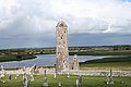
 Round Tower, Killala - geograph.org.uk - 242769.jpg 424 × 640; 38 KB
-

-
 Saint Ann's Church inside.jpg 2,048 × 1,536; 314 KB
-
 Saint Ann's Church vitrail.jpg 2,048 × 1,536; 771 KB
-
 Saint Ann's Church.jpg 2,048 × 1,536; 541 KB
-
 Sheet music St Patrick Cathedral DUBLIN..jpg 1,098 × 822; 149 KB
-
 Shingle Bank, Burrow - geograph.org.uk - 246460.jpg 640 × 396; 61 KB
-
 Signpost at Sally Gap - geograph.org.uk - 228293.jpg 480 × 640; 67 KB
-
 Slipway, Sligo Harbour - geograph.org.uk - 242907.jpg 640 × 427; 64 KB
-
 South Shore of Drumcliff Bay - geograph.org.uk - 241162.jpg 640 × 408; 66 KB
-
 Sruhir Strand - geograph.org.uk - 238069.jpg 640 × 480; 64 KB
-
 St Helen's Church - geograph.org.uk - 246702.jpg 640 × 427; 74 KB
-
 St Helen's Harbour - geograph.org.uk - 246715.jpg 640 × 409; 70 KB
-
 St. Ciaran's Well - geograph.org.uk - 232230.jpg 640 × 427; 76 KB
-
 Swilly Bridge - geograph.org.uk - 213299.jpg 640 × 479; 100 KB
-
 Swilly Burn - geograph.org.uk - 213303.jpg 640 × 479; 59 KB
-
-
 The Bay North of St Helen's Harbour - geograph.org.uk - 246719.jpg 640 × 413; 41 KB
-
 The beach in Smerwick harbour - geograph.org.uk - 220143.jpg 600 × 450; 47 KB
-
 The Boardwalk, Wexford - geograph.org.uk - 316217.jpg 628 × 470; 117 KB
-
 The Carlingford Lough ferry - geograph.org.uk - 224550.jpg 640 × 426; 139 KB
-

-
 The Great Saltee.JPG 2,016 × 1,512; 740 KB
-
 The Milltown river - geograph.org.uk - 220244.jpg 600 × 450; 105 KB
-
 The Navvy Bank, Dundalk - geograph.org.uk - 224523.jpg 640 × 426; 131 KB
-
 The Old Forge Inn, Wicklow - geograph.org.uk - 229964.jpg 640 × 480; 85 KB
-
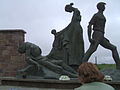
 The Patriots of 1798 - geograph.org.uk - 254686.jpg 640 × 433; 69 KB
-
 Tobernall Bay - geograph.org.uk - 241282.jpg 640 × 391; 31 KB
-
 Torc upper lake killarney.jpg 1,600 × 1,200; 480 KB
-
 Treansallagh Townland - geograph.org.uk - 213247.jpg 640 × 479; 61 KB
-
 Treansallagh Townland - geograph.org.uk - 213250.jpg 640 × 479; 73 KB
-
 Treansallagh Townland - geograph.org.uk - 213251.jpg 640 × 479; 50 KB
-
 Treansallagh Townland - geograph.org.uk - 213266.jpg 640 × 479; 61 KB
-
 Treaty stone of Limerick.jpg 2,816 × 2,112; 770 KB
-
 View from Carrowkeel.jpg 1,024 × 768; 91 KB
-
 Watch House, Downpatrick Head - geograph.org.uk - 369297.jpg 640 × 427; 243 KB
-
 Wave Erosion, Downpatrick Head - geograph.org.uk - 369272.jpg 640 × 427; 263 KB
-
 Waves - geograph.org.uk - 219597.jpg 600 × 450; 48 KB
-
 West End of Glencar Lough - geograph.org.uk - 243488.jpg 640 × 427; 62 KB
-
 Wet and Windy Beach at Rosslare - geograph.org.uk - 246447.jpg 640 × 427; 33 KB
-
 Wetland Habitat in the Blackwater Bog - geograph.org.uk - 245840.jpg 640 × 427; 58 KB

_-_geograph.org.uk_-_219607.jpg)


_-_geograph.org.uk_-_219157.jpg)


,_Aran_Islands,_Ireland_(6779966323).jpg)


_-_geograph.org.uk_-_219715.jpg)


.jpg)


.jpg)


