Category:August 2006 in Scotland
Deutsch: Bilder, die im August 2006 in Scotland aufgenommen worden sind. Bitte beachten Sie, dass dies weder das Datum des Uploads noch das Datum des Scannens eines Fotos ist.
English: Images/pictures taken in Scotland during August 2006. Note this is not the date of the upload, nor the date a photo was scanned.
Español: Fotografías o imágenes tomadas en Scotland durante agosto 2006. No es la fecha de subida ni escaneo, sino la fecha en que las fotografías o imágenes se crearon.
Esperanto: Bildoj faritaj en Scotland en aŭgusto 2006. Tio ne estas la dato, kiam la bildoj estis alŝutitaj aŭ skanitaj.
Français : Photographies ou images prises en Scotland durant août 2006. Ce n'est pas la date du téléchargement ou du scan.
Galego: Fotografías ou imaxes tomadas en Scotland durante agosto 2006. Non é a data de subida nin escaneamento, senón a data na que se crearon as fotografías ou imaxes.
Italiano: Fotografie o immagini scattate a Scotland nel agosto 2006. Nota bene: la data non si riferisce né a quella di upload né a quella in cui la foto è stata digitalizzata.
Norsk bokmål: Bilder tatt i Scotland i løpet av august 2006. Merk at dette ikke er datoen for opplasting, eller når et bilde har blitt skannet.
Norsk nynorsk: Bilete teke i Scotland i løpet av august 2006. Merk at dette ikkje er datoen for opplasting, eller når eit bilete har vorte skanna.
Русский: Изображения, сделанные в Scotland в течение август 2006 (не дата загрузки изображения).
Українська: Зображення, зроблені в Scotland протягом серпень 2006. Зауважте, що це не дата завантаження чи дата сканування фотографії.
| August 2005 | ← | August 2006 | → | August 2007 | |||||||
| Jan | Feb | Mar | Apr | May | Jun | Jul | Aug | Sep | Oct | Nov | Dec |
| 4 | 39 | 85 | 70 | 48 | 63 | 67 | 143 | 86 | 62 | 50 | 11 |
|---|---|---|---|---|---|---|---|---|---|---|---|
Subcategories
This category has the following 4 subcategories, out of 4 total.
P
Media in category "August 2006 in Scotland"
The following 139 files are in this category, out of 139 total.
-
 "Top o' the Town", Stirling - geograph.org.uk - 225138.jpg 640 × 480; 103 KB
-
 'I've found a starfish' - geograph.org.uk - 248544.jpg 640 × 480; 82 KB
-
 Kilmarnock Arms Hotel in Cruden Bay - geograph.org.uk - 1440702.jpg 640 × 480; 215 KB
-
 Red House Hotel, Cruden Bay - geograph.org.uk - 217024.jpg 640 × 480; 67 KB
-
 A burn passing beneath the Eskdale road - geograph.org.uk - 258451.jpg 480 × 640; 159 KB
-
 A706 - geograph.org.uk - 230461.jpg 640 × 480; 69 KB
-
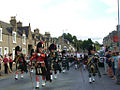 Aberlour parade in 2006.jpg 1,024 × 768; 406 KB
-
 Airbus A320-200 Monarch Airlines GLA.jpg 1,024 × 720; 208 KB
-
 Airbus A330-200 Monarch Airlines GLA.jpg 1,024 × 732; 217 KB
-
 Airdrie Academy - geograph.org.uk - 222492.jpg 640 × 456; 89 KB
-
 Arran Drive, Airdrie - geograph.org.uk - 222485.jpg 640 × 480; 143 KB
-
 Balaldie Farm sign on the B9165. - geograph.org.uk - 226098.jpg 640 × 426; 58 KB
-
 Baldrick runs the turnip counter - geograph.org.uk - 216731.jpg 640 × 480; 91 KB
-
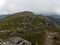 Beinn Dubhchraig - geograph.org.uk - 219295.jpg 640 × 478; 113 KB
-
 Ben Lomond from North Ridge - geograph.org.uk - 598141.jpg 640 × 480; 67 KB
-
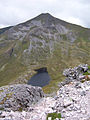
 Ben Lui - geograph.org.uk - 219046.jpg 640 × 478; 78 KB
-
 Ben Lui - geograph.org.uk - 219166.jpg 640 × 478; 128 KB
-
 Ben Oss - geograph.org.uk - 219268.jpg 640 × 478; 118 KB
-
 Berwickshire line - geograph.org.uk - 216359.jpg 640 × 480; 89 KB
-
 Binnein Mor.jpg 480 × 640; 134 KB
-
 Black Jack - geograph.org.uk - 215927.jpg 640 × 428; 272 KB
-
 Boeing 757-200 First Choice Airways GLA.jpg 1,024 × 697; 206 KB
-
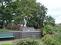 Boxers Memorial, Newmains Cross - geograph.org.uk - 217117.jpg 640 × 480; 148 KB
-
 Bridge Day 5 - Foundation Pouring!.jpg 1,023 × 680; 517 KB
-
 Burns 2.jpg 1,200 × 1,800; 214 KB
-
 Castle haar 0608 2.jpg 1,709 × 1,038; 824 KB
-
 Castle haar 0608.jpg 1,721 × 968; 783 KB
-
 Cattle feeder on N slopes of Hare Law - geograph.org.uk - 220348.jpg 640 × 480; 120 KB
-
 City of Truro, Strathspey Railway - geograph.org.uk - 234128.jpg 640 × 384; 94 KB
-
 Coast road south of Imachar - geograph.org.uk - 214330.jpg 640 × 480; 74 KB
-
 Coastline near Carrick - geograph.org.uk - 296225.jpg 640 × 303; 35 KB
-
 Cottage used as sheepfold - geograph.org.uk - 1033059.jpg 640 × 429; 89 KB
-
 Dallican Water - geograph.org.uk - 428812.jpg 640 × 492; 89 KB
-
 Dickmont's Den - geograph.org.uk - 354000.jpg 640 × 480; 89 KB
-

-
 Drumderg - geograph.org.uk - 227231.jpg 640 × 480; 75 KB
-
 Dunblanehydro angela mudge.jpg 640 × 480; 139 KB
-
 Dunnottar Angle.jpg 461 × 614; 313 KB
-
 Dunnottar scotland 545 step.jpg 2,128 × 2,832; 1.46 MB
-
 Dunnottar-Angle2.jpg 461 × 614; 307 KB
-
 East Coast Line at Flemington - geograph.org.uk - 220368.jpg 640 × 480; 88 KB
-
 Easter Whyntie - geograph.org.uk - 224154.jpg 640 × 406; 270 KB
-
 Easyjet boeing 737 GLA.jpg 1,016 × 551; 295 KB
-
 Entrance to Lynegar Farm - geograph.org.uk - 244023.jpg 640 × 480; 105 KB
-
 Every white dot is a gannet^ - geograph.org.uk - 229381.jpg 640 × 427; 89 KB
-
 Fallaw - geograph.org.uk - 215548.jpg 640 × 427; 261 KB
-
 Farm Machinery - geograph.org.uk - 225831.jpg 640 × 427; 264 KB
-
 Fields near Sandwick - geograph.org.uk - 245684.jpg 640 × 427; 72 KB
-
 Fields near Stove - geograph.org.uk - 233356.jpg 640 × 427; 58 KB
-
 Fungi - geograph.org.uk - 220503.jpg 640 × 480; 123 KB
-
 Green Arch - geograph.org.uk - 220536.jpg 480 × 640; 162 KB
-
 Hartwood railway station 1.jpg 640 × 480; 110 KB
-
 Hawick Public Library - geograph.org.uk - 934939.jpg 416 × 638; 129 KB
-
 Horse rider on Kames Bay, Millport - geograph.org.uk - 268589.jpg 640 × 212; 23 KB
-
 Inveredrie - geograph.org.uk - 230108.jpg 640 × 480; 49 KB
-
 Jive aces ian clarkson.jpg 500 × 333; 141 KB
-
 Kale field - geograph.org.uk - 224219.jpg 640 × 480; 101 KB
-
 Kildrummy.JPG 2,576 × 1,952; 941 KB
-
 Kinneddar - geograph.org.uk - 226381.jpg 640 × 345; 205 KB
-
 Laverockloch Farm - geograph.org.uk - 225775.jpg 640 × 427; 255 KB
-
 Leeks, Aberlady Mains - geograph.org.uk - 245364.jpg 640 × 480; 100 KB
-
 Loganair saab.jpg 1,024 × 730; 213 KB
-

-
 Macallan Barrels.jpg 2,816 × 2,112; 2.04 MB
-
 Manish Strand, Ensay - geograph.org.uk - 230417.jpg 640 × 427; 54 KB
-
 Mayne - geograph.org.uk - 225790.jpg 640 × 284; 151 KB
-
 Mayne - geograph.org.uk - 225793.jpg 640 × 386; 233 KB
-
 Mayne - geograph.org.uk - 225794.jpg 640 × 427; 281 KB
-
 Mayne - geograph.org.uk - 225816.jpg 640 × 427; 290 KB
-
 Meadows - geograph.org.uk - 222420.jpg 640 × 410; 237 KB
-
 Mirror ball performer (2006).JPG 2,592 × 1,952; 1.53 MB
-
 Muchallscastledrystone.jpg 2,620 × 1,392; 1.68 MB
-
 Muir of Linksfield - geograph.org.uk - 225835.jpg 640 × 255; 48 KB
-
 Muir of Linksfield - geograph.org.uk - 225843.jpg 640 × 352; 210 KB
-
 Multi storey flats in Kincardine - geograph.org.uk - 229369.jpg 640 × 480; 88 KB
-
 Nestends, Eyemouth - geograph.org.uk - 219632.jpg 640 × 461; 74 KB
-
 North Calder Water at Calderpark Haugh - geograph.org.uk - 1589222.jpg 640 × 483; 162 KB
-
 Old railway station - geograph.org.uk - 215372.jpg 640 × 424; 119 KB
-
 Old railway, Glen Farg - geograph.org.uk - 219095.jpg 640 × 480; 159 KB
-
 Orchardbank - geograph.org.uk - 222236.jpg 640 × 427; 254 KB
-
 Palmer's Cross - geograph.org.uk - 225818.jpg 640 × 347; 187 KB
-
 Perth railway bridge - geograph.org.uk - 215631.jpg 640 × 481; 122 KB
-
 Pottiehill - geograph.org.uk - 219080.jpg 640 × 480; 109 KB
-
 Railway Line - geograph.org.uk - 215634.jpg 640 × 427; 237 KB
-
 Railway near Greenfoot in 2006.jpg 640 × 468; 105 KB
-
 Rangers F.C. Tifo.jpg 320 × 240; 62 KB
-
 Rhynagarrie Farm, Morayshire. - geograph.org.uk - 213512.jpg 640 × 427; 96 KB
-
 Rock Pool - geograph.org.uk - 224028.jpg 405 × 640; 286 KB
-
 Rossie farm - geograph.org.uk - 226736.jpg 640 × 482; 91 KB
-
 Round Largo Bay to Ruddon's Point - geograph.org.uk - 350860.jpg 640 × 480; 75 KB
-
 Royal Mile, Edinburgh, 15 August 2006.jpg 960 × 1,280; 276 KB
-
 Ruaival, from Mullach Sgar, St Kilda - geograph.org.uk - 229623.jpg 640 × 427; 46 KB
-
 Scotairways G-BWIR Dundee airport.jpg 1,024 × 638; 308 KB
-
 Scottish Lighthouse Museum, Fraserburgh - geograph.org.uk - 215203.jpg 640 × 480; 123 KB
-
 Seacliff Beach - geograph.org.uk - 228902.jpg 640 × 480; 107 KB
-
 Second Knowes - geograph.org.uk - 215957.jpg 640 × 334; 176 KB
-
 Sheepfold below Round Craigs - geograph.org.uk - 227389.jpg 640 × 480; 87 KB
-
 Sheepfold, Crichness - geograph.org.uk - 227428.jpg 640 × 480; 139 KB
-
 Shelter Belt - geograph.org.uk - 222437.jpg 640 × 369; 180 KB
-
 Shore at Dougarie Point - geograph.org.uk - 214337.jpg 640 × 470; 90 KB
-
 Shunndabhaig, Ensay - geograph.org.uk - 230431.jpg 640 × 427; 86 KB
-
 Sprouts^ - geograph.org.uk - 245362.jpg 640 × 480; 136 KB
-
 Spynie - geograph.org.uk - 225826.jpg 640 × 427; 236 KB
-
 Stac a'Langa, St Kilda - geograph.org.uk - 229610.jpg 640 × 427; 72 KB
-
 Stac an Armin.jpg 640 × 427; 54 KB
-
 Starlings - geograph.org.uk - 224133.jpg 640 × 427; 245 KB
-
 Summer Storm - geograph.org.uk - 215946.jpg 640 × 395; 215 KB
-
 The Knowes - geograph.org.uk - 215955.jpg 640 × 375; 218 KB
-
 The Yard, Boat of Garten - geograph.org.uk - 228133.jpg 640 × 384; 76 KB
-
 Thomas Cook Airlines 757.jpg 1,024 × 764; 217 KB
-
 Thwaites 4 tonne Alldrive dumper.jpg 685 × 465; 268 KB
-
 Ticketscotland.jpg 2,848 × 2,134; 1.2 MB
-
 Tobees - geograph.org.uk - 222451.jpg 640 × 386; 202 KB
-
 Tobhan, Ensay - geograph.org.uk - 230619.jpg 636 × 421; 56 KB
-

-

-

-

-
 Travelling Fish - geograph.org.uk - 214645.jpg 640 × 480; 115 KB
-
 Udderbelly Venue at the Edinburgh Festival Fringe 2006 (217049041).jpg 3,456 × 2,304; 4.26 MB
-

-
 Wardmill - geograph.org.uk - 222417.jpg 640 × 387; 203 KB
-
 Waterton - geograph.org.uk - 226348.jpg 505 × 640; 247 KB
-
 West Coast Main Line - geograph.org.uk - 230573.jpg 640 × 480; 59 KB
-
 West coast of Ensay - geograph.org.uk - 230424.jpg 640 × 427; 78 KB
-
 West coast of Ensay - geograph.org.uk - 230429.jpg 640 × 427; 76 KB
-
 West coast of Ensay - geograph.org.uk - 230430.jpg 640 × 427; 81 KB
-
 West Coast Postal Train - geograph.org.uk - 517547.jpg 640 × 480; 114 KB
-
 West Mains - geograph.org.uk - 226371.jpg 640 × 339; 173 KB
-
 West Mains of Finavon - geograph.org.uk - 222518.jpg 640 × 397; 208 KB
-
 West Mains of Finavon - geograph.org.uk - 222522.jpg 640 × 427; 279 KB
-
 Whitewell - geograph.org.uk - 222244.jpg 640 × 300; 166 KB
-
 Wire-Glasgow.JPG 2,592 × 1,952; 1.96 MB
-
 Ballat Cross Roads - geograph.org.uk - 214463.jpg 640 × 480; 152 KB
-
 Cattle, Harelaw - geograph.org.uk - 230460.jpg 635 × 452; 46 KB
-
 Fisherrow beach - geograph.org.uk - 220695.jpg 640 × 453; 54 KB
-
 Girnick - geograph.org.uk - 218660.jpg 480 × 640; 152 KB
-

-
 Wellington Farm - road end signpost - geograph.org.uk - 220124.jpg 640 × 480; 52 KB


.JPG)


_-_geograph.org.uk_-_228173.jpg)


.jpg)


