Category:August 2007 in Nottinghamshire
Deutsch: Bilder, die im August 2007 in Nottinghamshire aufgenommen worden sind. Bitte beachten Sie, dass dies weder das Datum des Uploads noch das Datum des Scannens eines Fotos ist.
English: Images/pictures taken in Nottinghamshire during August 2007. Note this is not the date of the upload, nor the date a photo was scanned.
Español: Fotografías o imágenes tomadas en Nottinghamshire durante agosto 2007. No es la fecha de subida ni escaneo, sino la fecha en que las fotografías o imágenes se crearon.
Esperanto: Bildoj faritaj en Nottinghamshire en aŭgusto 2007. Tio ne estas la dato, kiam la bildoj estis alŝutitaj aŭ skanitaj.
Français : Photographies ou images prises en Nottinghamshire durant août 2007. Ce n'est pas la date du téléchargement ou du scan.
Galego: Fotografías ou imaxes tomadas en Nottinghamshire durante agosto 2007. Non é a data de subida nin escaneamento, senón a data na que se crearon as fotografías ou imaxes.
Italiano: Fotografie o immagini scattate a Nottinghamshire nel agosto 2007. Nota bene: la data non si riferisce né a quella di upload né a quella in cui la foto è stata digitalizzata.
Norsk bokmål: Bilder tatt i Nottinghamshire i løpet av august 2007. Merk at dette ikke er datoen for opplasting, eller når et bilde har blitt skannet.
Norsk nynorsk: Bilete teke i Nottinghamshire i løpet av august 2007. Merk at dette ikkje er datoen for opplasting, eller når eit bilete har vorte skanna.
Русский: Изображения, сделанные в Nottinghamshire в течение август 2007 (не дата загрузки изображения).
Українська: Зображення, зроблені в Nottinghamshire протягом серпень 2007. Зауважте, що це не дата завантаження чи дата сканування фотографії.
| August 2006 | ← | August 2007 | → | August 2008 | |||||||
| Jan | Feb | Mar | Apr | May | Jun | Jul | Aug | Sep | Oct | Nov | Dec |
| 23 | 18 | 22 | 19 | 22 | 29 | 23 | 27 | 21 | 27 | 37 | 33 |
|---|---|---|---|---|---|---|---|---|---|---|---|
Subcategories
This category has the following 2 subcategories, out of 2 total.
Media in category "August 2007 in Nottinghamshire"
The following 25 files are in this category, out of 25 total.
-
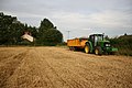
 After the harvest - geograph.org.uk - 567549.jpg 640 × 427; 87 KB
-
 Harby Mill - geograph.org.uk - 567550.jpg 640 × 427; 81 KB
-
 Harvest in Black House Field - geograph.org.uk - 514801.jpg 640 × 427; 72 KB
-
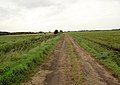
 Farm track near Misson - geograph.org.uk - 516964.jpg 640 × 425; 89 KB
-
 Highwood Farm - geograph.org.uk - 516966.jpg 640 × 415; 72 KB
-
 Ripening corn near Highwood Farm - geograph.org.uk - 516968.jpg 640 × 427; 124 KB
-
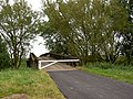
 Bailey bridge across River Idle. - geograph.org.uk - 528987.jpg 640 × 378; 109 KB
-
 Bailey bridge with gate. - geograph.org.uk - 529012.jpg 640 × 480; 177 KB
-
 Lane to levels farm. - geograph.org.uk - 529199.jpg 640 × 453; 110 KB
-
 Open farmland. - geograph.org.uk - 529190.jpg 640 × 394; 106 KB
-
 Above the sluice gate. - geograph.org.uk - 528980.jpg 640 × 480; 109 KB
-
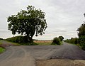 Another decision^ - geograph.org.uk - 528968.jpg 640 × 497; 99 KB
-
 Barley and pumping. - geograph.org.uk - 529211.jpg 640 × 453; 176 KB
-
 Burnt out car on bridleway. - geograph.org.uk - 528978.jpg 640 × 480; 190 KB
-
 Cottam pylons - geograph.org.uk - 531667.jpg 640 × 427; 63 KB
-
 Entrance to rifle range. - geograph.org.uk - 514716.jpg 640 × 470; 183 KB
-
 Friendly Cows - geograph.org.uk - 540031.jpg 640 × 480; 134 KB
-
 Guess what is at the end of River Lane^ - geograph.org.uk - 528958.jpg 640 × 381; 107 KB
-

-
 Newark on Trent - B6326 Level Crossing - geograph.org.uk - 528999.jpg 640 × 480; 100 KB
-
 Road bridge over River Meden - geograph.org.uk - 521376.jpg 640 × 474; 97 KB
-
 Saracens Head - geograph.org.uk - 535558.jpg 640 × 480; 122 KB
-
 The end of the road. - geograph.org.uk - 529044.jpg 640 × 441; 99 KB
-
 Titchfield Park, Mansfield - geograph.org.uk - 535910.jpg 480 × 640; 78 KB
-
 Tween Pond - geograph.org.uk - 568902.jpg 427 × 640; 62 KB


