Category:August 2007 in the City of Wakefield
Media in category "August 2007 in the City of Wakefield"
The following 60 files are in this category, out of 60 total.
-

-

-
-

-

-

-
 Annie Street - geograph.org.uk - 534587.jpg 640 × 404; 33 KB
-
 Barclays Bank - Bank Street - geograph.org.uk - 532507.jpg 640 × 506; 57 KB
-
 Beech House - Leeds Road, Outwood - geograph.org.uk - 534596.jpg 640 × 388; 48 KB
-

-
 Bingham Engineering Factory. - geograph.org.uk - 531054.jpg 640 × 480; 86 KB
-
 Blacker Hall Farm shop. - geograph.org.uk - 518676.jpg 640 × 439; 124 KB
-

-

-

-
 Bridle Path, East Hardwick - geograph.org.uk - 535630.jpg 640 × 480; 110 KB
-
 Castleford Railway Signal Box - geograph.org.uk - 518794.jpg 640 × 480; 82 KB
-
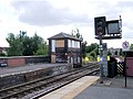
 Castleford Railway Station - geograph.org.uk - 518790.jpg 640 × 480; 75 KB
-
 Castleford Railway Station - geograph.org.uk - 518791.jpg 640 × 480; 77 KB
-
 Causeway Garth, Thorpe Audlin - geograph.org.uk - 527963.jpg 640 × 480; 107 KB
-
 Cedar Court Hotel. - geograph.org.uk - 517469.jpg 636 × 476; 84 KB
-
 Cedar Court Offices. - geograph.org.uk - 518673.jpg 640 × 396; 92 KB
-
 Coach Road - Outwood - geograph.org.uk - 534598.jpg 640 × 387; 37 KB
-
 Common Lane, Thorpe Audlin - geograph.org.uk - 527968.jpg 640 × 480; 150 KB
-
 Composed by the City bard^ - geograph.org.uk - 518684.jpg 640 × 531; 95 KB
-
 Cutsyke rooftops - geograph.org.uk - 538957.jpg 639 × 433; 107 KB
-
 Field Boundary - geograph.org.uk - 527993.jpg 640 × 480; 150 KB
-

-
 Fishing in the pond - geograph.org.uk - 531748.jpg 640 × 480; 94 KB
-
 Footbridge and stile - geograph.org.uk - 532561.jpg 640 × 480; 153 KB
-
 Footbridge over the River Went. - geograph.org.uk - 531037.jpg 640 × 480; 150 KB
-

-

-

-
-
 Footpath under the Railway Viaduct. - geograph.org.uk - 532542.jpg 640 × 480; 119 KB
-
 Frickley Athletic Football ground. - geograph.org.uk - 539244.jpg 640 × 480; 54 KB
-

-
 HSBC Bank - Bank Street - geograph.org.uk - 532499.jpg 640 × 584; 57 KB
-
 Hundhill Farm - geograph.org.uk - 533981.jpg 640 × 480; 90 KB
-
 Kirklands Hotel - Leeds Road, Outwood - geograph.org.uk - 534592.jpg 640 × 444; 55 KB
-
 Lonesome tree off Sheepwalk Lane. - geograph.org.uk - 534124.jpg 640 × 480; 82 KB
-
-

-

-
 Moor House - geograph.org.uk - 532579.jpg 640 × 480; 120 KB
-

-
 Mornington Farm - geograph.org.uk - 534189.jpg 640 × 480; 90 KB
-
 Moto services Woolley Edge. - geograph.org.uk - 513785.jpg 640 × 480; 96 KB
-
 Outwood Library - Leeds Road - geograph.org.uk - 534585.jpg 640 × 336; 50 KB
-

-
 Public footpath, Sheepwalk Lane. - geograph.org.uk - 534134.jpg 640 × 480; 116 KB
-
 South Elmsall Fire Station - geograph.org.uk - 539262.jpg 640 × 480; 51 KB
-
 Streethouse working men's club.jpg 640 × 492; 65 KB
-
 Tesco Supermarket, Pontefract - geograph.org.uk - 527118.jpg 640 × 480; 148 KB
-

-
-

-
 Upton communications mast. - geograph.org.uk - 534131.jpg 480 × 640; 106 KB
-


