Category:Avereest
| Object location | | View all coordinates using: OpenStreetMap |
|---|
former municipality in Overijssel, the Netherlands   | |||||
| Upload media | |||||
| Instance of |
| ||||
|---|---|---|---|---|---|
| Location |
| ||||
| Population |
| ||||
| Area |
| ||||
 | |||||
Subcategories
This category has the following 3 subcategories, out of 3 total.
Media in category "Avereest"
The following 9 files are in this category, out of 9 total.
-
 Avereest wapen.svg 433 × 424; 161 KB
-
 Coat of arms of Avereest.png 185 × 223; 4 KB
-
 Vlag avereest.PNG 326 × 217; 2 KB
-
 Flag of Avereest, Netherlands.svg 900 × 600; 522 bytes
-
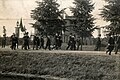
 Gevangenis,Rijksopvoedingsgesticht, SFA001006179.jpg 2,847 × 2,091; 1.15 MB
-
 Gevangenis,Rijksopvoedingsgesticht, SFA001021292.jpg 3,071 × 2,274; 1.47 MB
-
 Gevangenis,Rijksopvoedingsgesticht, SFA022819861.jpg 3,685 × 2,453; 1.86 MB
-
 Kaart Avereest 1868.PNG 1,540 × 1,346; 324 KB
-
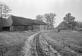 Overzicht - Avereest - 20026504 - RCE.jpg 1,200 × 805; 215 KB


