Category:Bäcks kyrka
| Object location | | View all coordinates using: OpenStreetMap |
|---|
church building in Töreboda Municipality, Västra Götaland County, Sweden  | |||||
| Upload media | |||||
| Instance of | |||||
|---|---|---|---|---|---|
| Location | Töreboda Municipality, Västra Götaland County, Sweden | ||||
| Diocese | |||||
| Has use |
| ||||
| Occupant | |||||
| Heritage designation |
| ||||
 | |||||
Svenska: Bäcks kyrka tillhör Fredsberg-Bäcks församling, Vadsbo kontrakt, Skara stift / Diocese of Skara.
|
This is a category about an ecclesiastical monument in Sweden, number 21300000003158 (sub-number: 21400000443605) in the RAÄ buildings database.
|
Media in category "Bäcks kyrka"
The following 34 files are in this category, out of 34 total.
-
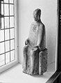
 Bäck-Dalslandsgruppen-ca1200-täljsten.jpg 349 × 463; 42 KB
-
 Bäcks kyrka - KMB - 16000200153172.jpg 710 × 600; 73 KB
-
 Bäcks kyrka - KMB - 16000200153173.jpg 450 × 600; 59 KB
-
 Bäcks kyrka - KMB - 16000200153176.jpg 672 × 600; 61 KB
-
 Bäcks kyrka - KMB - 16000200153177.jpg 1,379 × 600; 126 KB
-
 Bäcks kyrka - KMB - 16000200153179.jpg 440 × 600; 43 KB
-
 Bäcks kyrka - KMB - 16000200153180.jpg 429 × 600; 47 KB
-
 Bäcks kyrka - KMB - 16000200153181.jpg 441 × 600; 64 KB
-
 Bäcks kyrka - KMB - 16000200153182.jpg 432 × 600; 51 KB
-
 Bäcks kyrka - KMB - 16000200153183.jpg 455 × 600; 34 KB
-
 Bäcks kyrka - KMB - 16000200153184.jpg 454 × 600; 44 KB
-
 Bäcks kyrka - KMB - 16000200153185.jpg 444 × 600; 26 KB
-
 Bäcks kyrka - KMB - 16000200153186.jpg 236 × 600; 26 KB
-
 Bäcks kyrka - KMB - 16000200153187.jpg 437 × 600; 31 KB
-
 Bäcks kyrka - KMB - 16000200153188.jpg 443 × 600; 31 KB
-
 Bäcks kyrka - KMB - 16000200153189.jpg 434 × 600; 30 KB
-
 Bäcks kyrka - KMB - 16000200153190.jpg 465 × 600; 56 KB
-
 Bäcks kyrka - KMB - 16000200153191.jpg 416 × 600; 41 KB
-
 Bäcks kyrka - KMB - 16000200153192.jpg 437 × 600; 41 KB
-
 Bäcks kyrka - KMB - 16000200153193.jpg 444 × 600; 41 KB
-
 Bäcks kyrka - KMB - 16000200153194.jpg 443 × 600; 38 KB
-
 Bäcks kyrka - KMB - 16000200153195.jpg 434 × 600; 30 KB
-
 Bäcks kyrka - KMB - 16000200153196.jpg 442 × 600; 33 KB
-
 Bäcks kyrka - KMB - 16000200153197.jpg 442 × 600; 27 KB
-
 Bäcks kyrka - KMB - 16000200153198.jpg 436 × 600; 39 KB
-
 Bäcks kyrka - KMB - 16000200153199.jpg 884 × 600; 98 KB
-
 Bäcks kyrka - KMB - 16000200153202.jpg 1,400 × 534; 109 KB
-
 Bäcks kyrka - KMB - 16000200153203.jpg 828 × 600; 54 KB
-
 Bäcks kyrka - KMB - 16000200153204.jpg 873 × 600; 96 KB
-
 Bäcks kyrka - KMB - 16000200153205.jpg 427 × 600; 37 KB
-
 Bäcks kyrka - KMB - 16000200153206.jpg 443 × 600; 63 KB
-
 Bäcks kyrka - Peringskiöld.jpg 1,168 × 857; 565 KB
-
 Bäcks kyrka old1.jpg 453 × 600; 45 KB
-
 Bäcks kyrka old2.jpg 433 × 600; 67 KB


