Category:Bäuerlicher Vielzweckbau (Hauptstrasse 13, Villigen)
| Object location | | View all coordinates using: OpenStreetMap |
|---|
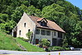
rural building in Villigen in the canton of Aargau, Switzerland  | |||||
| Upload media | |||||
| Instance of |
| ||||
|---|---|---|---|---|---|
| Part of | |||||
| Location | Villigen, Brugg District, Aargau, Switzerland | ||||
| Street address |
| ||||
| Heritage designation |
| ||||
| Inception |
| ||||
 | |||||
Media in category "Bäuerlicher Vielzweckbau (Hauptstrasse 13, Villigen)"
The following 3 files are in this category, out of 3 total.
-
 Hauptstr 13 Villigen.jpg 2,816 × 2,112; 2.81 MB
-
 Hauptstrasse 13 Villigen.jpg 2,816 × 2,112; 2.67 MB
-
 Villigen 036.jpg 3,888 × 2,592; 6.58 MB

