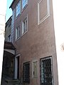
Category:Bürgerhaus, former Stadtschmiede, Pfarrstiege 2, Steyr
| This category shows the protected monument with the number 40485 in Austria. (Commons, de, Wikidata) |
| Object location | | View all coordinates using: OpenStreetMap |
|---|
building in Steyr, Austria .JPG) | |||||
| Upload media | |||||
| Instance of |
| ||||
|---|---|---|---|---|---|
| Location | Steyr, Upper Austria, Austria | ||||
| Street address |
| ||||
| Heritage designation | |||||
 | |||||
Media in category "Bürgerhaus, former Stadtschmiede, Pfarrstiege 2, Steyr"
The following 5 files are in this category, out of 5 total.
-
 Steyr Pfarrstiege 2 (01).JPG 1,920 × 2,560; 933 KB
-
 Steyr Pfarrstiege 2 (3).JPG 3,000 × 4,000; 4.3 MB
-
 Steyr Pfarrstiege 2 (4).JPG 3,000 × 4,000; 3.94 MB
-
 Steyr Pfarrstiege 2 (5).JPG 4,000 × 3,000; 4.97 MB
-
 Steyrer Pfarrstiege 2.jpg 3,828 × 2,553; 6.18 MB
.JPG)
.JPG)
.JPG)
