Category:Bürgerturm (Lindenfels)
| Object location | | View all coordinates using: OpenStreetMap |
|---|
Tower in Lindenfels  | |||||
| Upload media | |||||
| Instance of | |||||
|---|---|---|---|---|---|
| Made from material | |||||
| Location | Lindenfels, Landkreis Bergstraße, Darmstadt Government Region, Hesse, Germany | ||||
| Heritage designation | |||||
| Height |
| ||||
 | |||||
This is the category of the Hessian Kulturdenkmal (cultural monument) with the ID 55538 (Wikidata)
|
Subcategories
This category has only the following subcategory.
V
Media in category "Bürgerturm (Lindenfels)"
The following 5 files are in this category, out of 5 total.
-
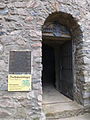 Bürgerturm Eingang.JPG 3,240 × 4,320; 5.2 MB
-
 Bürgerturm Lindenfels-Tafeln.jpg 3,240 × 4,320; 4.72 MB
-
 Bürgerturm Lindenfels.JPG 3,066 × 4,088; 6.16 MB
-
 Bürgerturm Treppe.JPG 4,320 × 3,240; 5.65 MB
-
 Historisches Lindenfels.jpg 3,009 × 4,013; 3.9 MB


