Category:B1078 road (England)

road in England | |||||
| Upload media | |||||
| Instance of |
| ||||
|---|---|---|---|---|---|
| Location | England | ||||
| Transport network |
| ||||
| |||||
Media in category "B1078 road (England)"
The following 44 files are in this category, out of 44 total.
-
 'Barking Fox' inn - geograph.org.uk - 280285.jpg 640 × 480; 74 KB
-
 Across the B1078 at Barking - geograph.org.uk - 1732400.jpg 768 × 1,024; 511 KB
-
 B1077 at the Junction with B1078 - geograph.org.uk - 1141206.jpg 3,072 × 2,304; 1.28 MB
-
 B1078 and the turn for Great Bricett - geograph.org.uk - 1070792.jpg 640 × 454; 96 KB
-

-
 B1078 Border Cot Lane, Wickham Market - geograph.org.uk - 1034898.jpg 3,072 × 2,304; 1.32 MB
-
 B1078 Border Cot Lane,Wickham Market - geograph.org.uk - 1034892.jpg 3,072 × 2,304; 1.36 MB
-
 B1078 Ipswich Road, Clopton - geograph.org.uk - 1126965.jpg 3,072 × 2,304; 1.35 MB
-
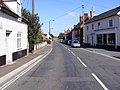 B1078 Lower Street, Wickham Market - geograph.org.uk - 1501429.jpg 3,072 × 2,304; 1.42 MB
-
 B1078 towards Barking - geograph.org.uk - 1732365.jpg 1,024 × 728; 442 KB
-
 B1078 towards Needham Market - geograph.org.uk - 1732369.jpg 1,024 × 736; 466 KB
-
 Clopton village sign - geograph.org.uk - 316847.jpg 640 × 456; 81 KB
-
 Coddenham Country Club - geograph.org.uk - 1377966.jpg 640 × 480; 67 KB
-
 Cottages by B1078, Coddenham Road - geograph.org.uk - 790022.jpg 640 × 397; 82 KB
-
 Cottages by corner in B1078 - geograph.org.uk - 789993.jpg 640 × 552; 115 KB
-
 Field by the B1078 - geograph.org.uk - 1070802.jpg 640 × 442; 95 KB
-
 Fields by the B1078 - geograph.org.uk - 1732355.jpg 1,024 × 655; 438 KB
-
 Garage - geograph.org.uk - 1490676.jpg 640 × 480; 95 KB
-
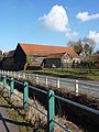
 Houses beside B1078, Barking - geograph.org.uk - 653698.jpg 640 × 430; 64 KB
-

-

-
 Over Potsford Brook, into Wickham Market - geograph.org.uk - 1409205.jpg 640 × 426; 192 KB
-
 Ringshall car sales - geograph.org.uk - 968240.jpg 640 × 421; 72 KB
-
 Road Bend - geograph.org.uk - 1748653.jpg 1,600 × 1,200; 386 KB
-
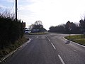
 Road junction at Ashbocking - geograph.org.uk - 315698.jpg 640 × 480; 70 KB
-
 Sign Wickham Market Station - geograph.org.uk - 235849.jpg 1,600 × 1,200; 412 KB
-
 The B1078 - geograph.org.uk - 1490684.jpg 640 × 480; 83 KB
-
 The B1078 - geograph.org.uk - 1490687.jpg 480 × 640; 98 KB
-
 The B1078 near Campsey Hame - geograph.org.uk - 256323.jpg 1,600 × 1,200; 408 KB
-
 Village hall, Barking - geograph.org.uk - 1738053.jpg 1,024 × 714; 521 KB
-
 Wickham Market Station.jpg 1,600 × 1,200; 390 KB
-
 A house at Park Corner - geograph.org.uk - 330875.jpg 640 × 430; 56 KB
-
 Avian Influenza ( Bird Flu ) Sign - geograph.org.uk - 338388.jpg 640 × 480; 143 KB
-
 Avian Influenza ( Bird Flu ) Sign - geograph.org.uk - 338394.jpg 640 × 480; 129 KB
-

-
 B1078 Main Road, Lower Hatcheston - geograph.org.uk - 1501437.jpg 3,072 × 2,304; 1.54 MB
-
 B1078 through Barking Tye - geograph.org.uk - 653675.jpg 640 × 417; 92 KB
-

-

-
 Country road, just off the B1078 - geograph.org.uk - 339503.jpg 640 × 480; 96 KB
-
 Road junction, Needham Market - geograph.org.uk - 546809.jpg 640 × 416; 59 KB
-

-
 The B1078 near Long Grove - geograph.org.uk - 256315.jpg 1,600 × 1,200; 579 KB
-


_Sign_-_geograph.org.uk_-_338388.jpg)
_Sign_-_geograph.org.uk_-_338394.jpg)


