Category:B1205 road (England)

road in England | |||||
| Upload media | |||||
| Instance of |
| ||||
|---|---|---|---|---|---|
| Location | England | ||||
| Transport network |
| ||||
| |||||
Media in category "B1205 road (England)"
The following 16 files are in this category, out of 16 total.
-
 B1205 near Northorpe Level Crossing - geograph.org.uk - 1410431.jpg 640 × 425; 81 KB
-
 B1205 near Northorpe Level Crossing - geograph.org.uk - 1410442.jpg 640 × 425; 72 KB
-
 Brandy Wharf Scene - geograph.org.uk - 1107006.jpg 640 × 480; 63 KB
-
 Grayingham Lodge Farm - geograph.org.uk - 326737.jpg 640 × 480; 118 KB
-
 Moortown Crossroads - geograph.org.uk - 140639.jpg 640 × 426; 114 KB
-
 Traffic Lights, Brandy Wharf Bridge - geograph.org.uk - 1413374.jpg 640 × 480; 90 KB
-
 Waddingham - geograph.org.uk - 124755.jpg 640 × 426; 140 KB
-
 B1205 junction with the A15 - geograph.org.uk - 142584.jpg 640 × 426; 84 KB
-
 B1205 Near Northorpe Level Crossing - geograph.org.uk - 142893.jpg 640 × 426; 90 KB
-
 Brandy Wharf Bridge - geograph.org.uk - 68061.jpg 640 × 480; 113 KB
-
 College Farm, South Kelsey Carrs - geograph.org.uk - 323781.jpg 640 × 427; 64 KB
-
 Kirton Road - geograph.org.uk - 326721.jpg 640 × 480; 76 KB
-
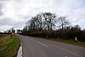
 Near Waddingham Grange - geograph.org.uk - 124730.jpg 640 × 426; 73 KB
-
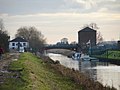
 The Bridge at Brandy Wharf - geograph.org.uk - 315106.jpg 640 × 420; 114 KB
-
 The Cider Centre, Brandy Wharf - geograph.org.uk - 315117.jpg 640 × 380; 132 KB
-
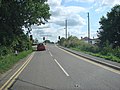
 The Road to Waddingham - geograph.org.uk - 124714.jpg 640 × 426; 87 KB


