Category:B4228 road (England)

road in England | |||||
| Upload media | |||||
| Instance of |
| ||||
|---|---|---|---|---|---|
| Location | England | ||||
| Transport network |
| ||||
| |||||
Subcategories
This category has the following 3 subcategories, out of 3 total.
M
- Milepost at Hewelsfield (2 F)
- Milepost at Tutshill (4 F)
Media in category "B4228 road (England)"
The following 16 files are in this category, out of 16 total.
-
 Miss Grace's Lane - geograph.org.uk - 202805.jpg 640 × 427; 325 KB
-
 Old Milestone by the B4228, Woodcroft (geograph 6018903).jpg 683 × 1,024; 230 KB
-
 Road to St Briavels from Oakhill Wood - geograph.org.uk - 202875.jpg 640 × 480; 280 KB
-
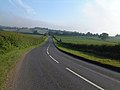
 The B4228 at Dennel Hill - geograph.org.uk - 812957.jpg 640 × 426; 88 KB
-
 The Live and Let Live Inn - geograph.org.uk - 524955.jpg 640 × 480; 69 KB
-
 Tidenham War Memorial Hall - geograph.org.uk - 524958.jpg 640 × 480; 103 KB
-
 Tutshill Village sign on B4228 - geograph.org.uk - 555092.jpg 640 × 482; 87 KB
-
 Wintour's Leap and the B4228 - geograph.org.uk - 206166.jpg 640 × 480; 353 KB
-
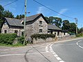
 Woodcroft Gloucestershire.jpg 2,000 × 1,500; 936 KB
-

-
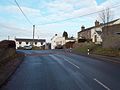
 Crossroads at Crossways - geograph.org.uk - 1431917.jpg 640 × 480; 219 KB
-
 Entrance to Madgett's Farm on the B4228 - geograph.org.uk - 507759.jpg 640 × 480; 122 KB
-
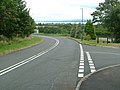 Junction of B4228 and Bigstone Meadow - geograph.org.uk - 555094.jpg 640 × 482; 95 KB
-

-

-


.jpg)


