Category:B6179 road (England)
road in England | |||||
| Upload media | |||||
| Instance of |
| ||||
|---|---|---|---|---|---|
| Location | England | ||||
| Transport network |
| ||||
| |||||

Subcategories
This category has the following 2 subcategories, out of 2 total.
B
- Butterley Hill (1 F)
D
- Derby Road, Ripley (2 F)
Media in category "B6179 road (England)"
The following 16 files are in this category, out of 16 total.
-

-
 Bus stop at Butterley on the B6179 - geograph.org.uk - 1373297.jpg 640 × 426; 87 KB
-
 Butterley Hill (B6179) - geograph.org.uk - 1022121.jpg 640 × 480; 91 KB
-
 Butterley Hill (B6179) - Sharp Bend - geograph.org.uk - 1022127.jpg 640 × 480; 90 KB
-
 Coach Road junction with the B6179 - geograph.org.uk - 1022508.jpg 640 × 480; 93 KB
-
 Denby Pottery on B6179 - geograph.org.uk - 1004507.jpg 640 × 480; 68 KB
-
 Derby Garden Centre 1 - geograph.org.uk - 1574915.jpg 640 × 480; 260 KB
-
 Floral display at Swanwick - geograph.org.uk - 1480167.jpg 640 × 480; 248 KB
-
 Old Milepost by the B6179 in Ripley (geograph 5623718).jpg 986 × 1,382; 176 KB
-
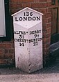
 Old Milepost by the B6179, Derby Road, in Lower Kilburn (geograph 5623721).jpg 986 × 1,554; 190 KB
-
 Old Milepost by the B6179, south of Ripley (geograph 5623719).jpg 986 × 1,543; 242 KB
-

-
 154 Miles to London - geograph.org.uk - 823559.jpg 640 × 481; 137 KB
-
 B6179 Derby Road at Marehay - geograph.org.uk - 1473957.jpg 640 × 480; 64 KB
-
 B6179 Derby Road at Marehay - geograph.org.uk - 1474468.jpg 640 × 480; 74 KB
-
 Lower Kilburn - geograph.org.uk - 591310.jpg 640 × 482; 107 KB


_-_geograph.org.uk_-_1022121.jpg)
_-_Sharp_Bend_-_geograph.org.uk_-_1022127.jpg)


.jpg)
.jpg)
.jpg)


