Category:B758 road (Scotland)
road in Scotland | |||||
| Upload media | |||||
| Instance of |
| ||||
|---|---|---|---|---|---|
| Location | South Lanarkshire, Scotland | ||||
| Transport network |
| ||||
| Has part(s) |
| ||||
| |||||
Subcategories
This category has only the following subcategory.
H
- Haughhead Bridge, Uddingston (12 F)
Media in category "B758 road (Scotland)"
The following 15 files are in this category, out of 15 total.
-
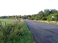 B758 towards Blantyre (geograph 6966709).jpg 800 × 600; 124 KB
-
 Blantyre Farm Road (A758) (geograph 6966714).jpg 1,024 × 768; 239 KB
-
 Blantyre Farm Road (A758) (geograph 6966719).jpg 800 × 600; 107 KB
-
 Haughhead Bridge - geograph.org.uk - 1775175.jpg 640 × 480; 88 KB
-
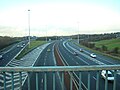
 Junction 4 (M73), M74 (geograph 2777386).jpg 640 × 371; 49 KB
-
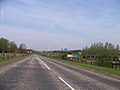
 M74 North of Uddingston - geograph.org.uk - 1775127.jpg 640 × 480; 64 KB
-
 Maryville Interchange - geograph.org.uk - 1775162.jpg 640 × 480; 56 KB
-
 Maryville Interchange - M73, M74 - geograph.org.uk - 106423.jpg 640 × 480; 97 KB
-
 NCR 75 entrance (geograph 7197213).jpg 4,896 × 3,686; 7.44 MB
-
 Railway bridge with traffic lights (geograph 7196547).jpg 1,024 × 768; 317 KB
-
 Recently cleared wooded area (geograph 7197210).jpg 4,896 × 3,686; 7.41 MB
-

-
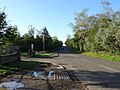
 The B758 west of Kylepark - geograph.org.uk - 1291558.jpg 640 × 481; 53 KB
-
 The West End Bar, Blantyre (geograph 6966724).jpg 800 × 517; 97 KB
-
 Track into woodland (geograph 6966712).jpg 800 × 566; 184 KB
.jpg)
_(geograph_6966714).jpg)
_(geograph_6966719).jpg)

,_M74_(geograph_2777386).jpg)


.jpg)
.jpg)


.jpg)
.jpg)
.jpg)