Category:Bad Homburg, Landgrafendenkmal, Tannenwaldallee
| Object location | | View all coordinates using: OpenStreetMap |
|---|
This is the category of the Hessian Kulturdenkmal (cultural monument) with the ID 8402 (Wikidata)
|
| Upload media | |||||
| Instance of | |||||
|---|---|---|---|---|---|
| Location | Bad Homburg vor der Höhe, Hochtaunuskreis, Darmstadt Government Region, Hesse, Germany | ||||
| Heritage designation | |||||
 | |||||
Media in category "Bad Homburg, Landgrafendenkmal, Tannenwaldallee"
The following 13 files are in this category, out of 13 total.
-
 Bad Homburg, Landgrafendenkmal, Tannenwaldallee, Detail (2).JPG 3,264 × 4,928; 7.06 MB
-
 Bad Homburg, Landgrafendenkmal, Tannenwaldallee, Detail.JPG 3,264 × 4,928; 5.79 MB
-
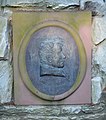 Bad Homburg, Landgrafendenkmal, Tannenwaldallee, Landgraf Ferdinand.JPG 3,152 × 3,568; 5.48 MB
-
 Bad Homburg, Landgrafendenkmal, Tannenwaldallee, Landgraf Friedrich II.JPG 3,048 × 3,464; 4.8 MB
-
 Bad Homburg, Landgrafendenkmal, Tannenwaldallee, Rückseite.JPG 3,240 × 4,184; 8.06 MB
-
 Bad Homburg, Landgrafendenkmal, Tannenwaldallee, Wappen.JPG 1,560 × 1,456; 1.17 MB
-
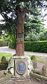
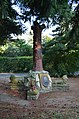 Bad Homburg, Landgrafendenkmal, Tannenwaldallee.JPG 3,264 × 4,928; 8.58 MB
-
 Landgrafendenkmal im Adelheidswertpark 01.jpg 2,988 × 5,312; 7.6 MB
-
 Landgrafendenkmal im Adelheidswertpark 02.jpg 2,988 × 3,984; 5.79 MB
-
 Landgrafendenkmal im Adelheidswertpark 03.jpg 2,988 × 5,312; 7.03 MB
-
 Landgrafendenkmal im Adelheidswertpark 04.jpg 2,988 × 5,312; 7.91 MB
-
 Landgrafendenkmal im Adelheidswertpark 05.jpg 2,988 × 5,312; 6.29 MB
-
 Landgrafendenkmal im Adelheidswertpark 06.jpg 2,988 × 3,984; 4.01 MB
.JPG)


