Category:Badlesmere, Kent
English: Category:Villages in Kent
village and civil parish in Kent, United Kingdom  | |||||
| Upload media | |||||
| Instance of | |||||
|---|---|---|---|---|---|
| Location | Swale, Kent, South East England, England | ||||
| Population |
| ||||
| Elevation above sea level |
| ||||
 | |||||
Subcategories
This category has the following 4 subcategories, out of 4 total.
Media in category "Badlesmere, Kent"
The following 83 files are in this category, out of 83 total.
-
 A251 Ashford Road - geograph.org.uk - 5674317.jpg 640 × 480; 146 KB
-
 A251 towards Faversham - geograph.org.uk - 5674307.jpg 640 × 428; 116 KB
-
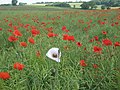 Albino Poppy - geograph.org.uk - 1369913.jpg 640 × 480; 120 KB
-
-
 Badlesmere - geograph.org.uk - 396837.jpg 640 × 480; 110 KB
-
 Badlesmere Court, Field sown with a spring crop - geograph.org.uk - 4831336.jpg 3,678 × 2,456; 4.56 MB
-
 Badlesmere Green - geograph.org.uk - 1369857.jpg 640 × 480; 119 KB
-

-
 Badlesmere, St. Leonard's Church - geograph.org.uk - 4829653.jpg 4,653 × 2,960; 7.49 MB
-
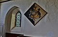
 Badlesmere, St. Leonard's Church, Hatchment 1 (detail) - geograph.org.uk - 4831352.jpg 2,825 × 3,407; 4.71 MB
-
 Badlesmere, St. Leonard's Church, Hatchment 1 - geograph.org.uk - 4831343.jpg 5,060 × 3,250; 7.35 MB
-

-
 Badlesmere, St. Leonard's Church, One of two west windows - geograph.org.uk - 4831377.jpg 2,348 × 4,250; 4.67 MB
-

-
 Badlesmere, St. Leonard's Church, Royal Coat of Arms - geograph.org.uk - 4833535.jpg 3,673 × 3,119; 5.09 MB
-
 Badlesmere, St. Leonard's Church, Small stained glass window - geograph.org.uk - 4833526.jpg 1,638 × 2,456; 2.36 MB
-
 Badlesmere, St. Leonard's Church, South porch - geograph.org.uk - 4833543.jpg 3,678 × 2,455; 5.79 MB
-
 Badlesmere, St. Leonard's Church, Tall Georgian box pews - geograph.org.uk - 4829667.jpg 5,520 × 3,680; 7.4 MB
-

-
 Badlesmere, St. Leonard's Church, The altar - geograph.org.uk - 4833523.jpg 5,183 × 3,390; 7.7 MB
-
 Badlesmere, St. Leonard's Church, The font - geograph.org.uk - 4833533.jpg 3,678 × 2,624; 3.3 MB
-

-

-

-

-

-
 Badlestone Court Farm - geograph.org.uk - 2438374.jpg 640 × 196; 37 KB
-
 Badlestone Court Farm - geograph.org.uk - 2438376.jpg 640 × 480; 93 KB
-
-
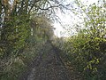
 Bridleway leading to Badlesmere - geograph.org.uk - 1369855.jpg 640 × 480; 122 KB
-
-
 Bridleway through Badlesmere Park Wood - geograph.org.uk - 1051240.jpg 640 × 467; 122 KB
-
 Cattle sheltering under a tree - geograph.org.uk - 4563250.jpg 4,000 × 3,000; 4.28 MB
-
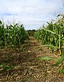
 Crop field - geograph.org.uk - 2438585.jpg 640 × 480; 116 KB
-
 Dayton Road - geograph.org.uk - 2438371.jpg 640 × 480; 78 KB
-
 Dayton Road - geograph.org.uk - 2438377.jpg 640 × 480; 101 KB
-
 Dayton Road - geograph.org.uk - 2438378.jpg 640 × 480; 92 KB
-
 Dinner time at Badlesmere Court Farm - geograph.org.uk - 1051206.jpg 640 × 471; 75 KB
-
 Farmland near Badlesmere - geograph.org.uk - 6268667.jpg 640 × 480; 82 KB
-
 Fisher Street Road, Badlesmere - geograph.org.uk - 1051223.jpg 640 × 480; 147 KB
-
 Fisher Street Road, Badlesmere. - geograph.org.uk - 6268678.jpg 640 × 480; 82 KB
-
 Forge Cottage, Badlesmere - geograph.org.uk - 396851.jpg 640 × 481; 111 KB
-
 Harvesting - geograph.org.uk - 5862724.jpg 1,024 × 684; 288 KB
-
 House on Ashford Road - geograph.org.uk - 2078128.jpg 640 × 480; 65 KB
-
 Lane by Badlesmere Church - geograph.org.uk - 1940799.jpg 1,280 × 960; 623 KB
-
 Lees Court Road - geograph.org.uk - 2647621.jpg 640 × 480; 103 KB
-
 Lees Court Road - geograph.org.uk - 2647623.jpg 640 × 480; 109 KB
-
 Lees Court Road - geograph.org.uk - 4563224.jpg 4,000 × 3,000; 4.03 MB
-
 Lees Court Road - geograph.org.uk - 4563229.jpg 4,000 × 3,000; 3.97 MB
-
 Lees Court Road - geograph.org.uk - 4563239.jpg 4,000 × 3,000; 4.28 MB
-
 Lees Court Road, heading towards Sheldwich - geograph.org.uk - 2076739.jpg 3,488 × 2,616; 2.12 MB
-

-
 Meadow near Hall's Bottom - geograph.org.uk - 2438384.jpg 640 × 480; 119 KB
-
 Millennium Torch on Badlesmere Lees - geograph.org.uk - 1376729.jpg 640 × 480; 70 KB
-

-
 Ox Eye Daisy - geograph.org.uk - 2438389.jpg 480 × 640; 42 KB
-

-
 Primroses - geograph.org.uk - 384631.jpg 482 × 640; 164 KB
-

-
 Start of bridleway to Hogben's Hill - geograph.org.uk - 4692655.jpg 640 × 480; 133 KB
-
 Stile into Badlesmere Lees - geograph.org.uk - 1376737.jpg 640 × 480; 138 KB
-
 Sweet chestnut tree, Badlesmere Lees - geograph.org.uk - 6264958.jpg 480 × 640; 96 KB
-
 Sweet chestnut tree, Badlesmere Lees - geograph.org.uk - 6264972.jpg 480 × 640; 140 KB
-
 The Old Rectory, Badlesmere - geograph.org.uk - 396919.jpg 640 × 480; 130 KB
-
-
 The Village Hall, Badlesmere - geograph.org.uk - 6264980.jpg 640 × 467; 75 KB
-
 Track in Badlesmere Park Wood - geograph.org.uk - 5862713.jpg 1,024 × 768; 569 KB
-
 Valley east of Lees Court Road - geograph.org.uk - 4692630.jpg 640 × 480; 136 KB
-
 View from Lees Court Road - geograph.org.uk - 4563221.jpg 4,000 × 3,000; 4.23 MB
-
 Wheat field east of Badlesmere Park wood - geograph.org.uk - 2448483.jpg 640 × 480; 115 KB
-
 Wood anemones - geograph.org.uk - 384716.jpg 640 × 480; 116 KB
-
 Battered pub sign - geograph.org.uk - 251674.jpg 640 × 480; 71 KB
-
 Bridleway by Dennis Nash Wood - geograph.org.uk - 384625.jpg 480 × 640; 182 KB
-
 Dead tree near Housefield Lane - geograph.org.uk - 247380.jpg 480 × 640; 124 KB
-
 Downland south of Shottenden Road - geograph.org.uk - 384732.jpg 640 × 480; 143 KB
-
 Dry downland valley - geograph.org.uk - 384725.jpg 640 × 482; 98 KB
-
 Field boundary - geograph.org.uk - 384700.jpg 640 × 480; 138 KB
-
 Milking parlour at Badlesmere Court - geograph.org.uk - 384807.jpg 640 × 479; 102 KB
-
 Rape field south of Badlesmere Court - geograph.org.uk - 384805.jpg 640 × 480; 97 KB
-
 Shottenden Road - geograph.org.uk - 384722.jpg 480 × 640; 149 KB
-
 The cycle continues - geograph.org.uk - 251641.jpg 640 × 480; 73 KB
-
 Tir Beg - geograph.org.uk - 251666.jpg 640 × 480; 142 KB
-
 Woodland by Loose Down Road - geograph.org.uk - 251685.jpg 640 × 480; 172 KB


_-_geograph.org.uk_-_4831352.jpg)


_-_geograph.org.uk_-_4833536.jpg)


