Category:Baillieston, Glasgow
district in Glasgow City, Scotland, UK  | |||||
| Upload media | |||||
| Instance of | |||||
|---|---|---|---|---|---|
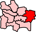
| Location |
| ||||
| Different from | |||||
 | |||||
Subcategories
This category has the following 13 subcategories, out of 13 total.
Media in category "Baillieston, Glasgow"
The following 44 files are in this category, out of 44 total.
-
 Apartment block on Brodie Drive (geograph 4946709).jpg 3,264 × 2,448; 4.79 MB
-
 Baillieston Road (A89) (geograph 5446613).jpg 640 × 480; 56 KB
-
 Baillieston Victoriana - geograph.org.uk - 1658010.jpg 572 × 388; 55 KB
-
 Baillieston, Buchanan Gardens - geograph.org.uk - 1657979.jpg 640 × 483; 35 KB
-
 Baillieston, Caledonia Road (geograph 2146302).jpg 600 × 453; 35 KB
-
 Baillieston, Dyke Street - geograph.org.uk - 1657989.jpg 640 × 483; 40 KB
-
 Baillieston, Main Street (geograph 2133687).jpg 800 × 540; 122 KB
-
 Baillieston, Main Street - geograph.org.uk - 1657999.jpg 640 × 483; 59 KB
-
 Baillieston, Nelson Street (geograph 2146225).jpg 600 × 453; 34 KB
-
 Baillieston, South Scott Street - geograph.org.uk - 2106800.jpg 1,024 × 719; 523 KB
-
 Bannerman High School, Baillieston (geograph 1664497).jpg 600 × 453; 34 KB
-
 Brodie Gardens - geograph.org.uk - 1261890.jpg 640 × 480; 107 KB
-
 Buchanan Street - geograph.org.uk - 1463379.jpg 640 × 483; 56 KB
-
 Buchanan Street, Baillieston - geograph.org.uk - 1626219.jpg 640 × 483; 44 KB
-
 Bus Lane Edinburgh Road (geograph 1832074).jpg 2,272 × 1,704; 836 KB
-
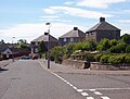
 Crossroads at Baillieston - geograph.org.uk - 1707227.jpg 640 × 480; 93 KB
-
 Easterhouse Road (geograph 5447409).jpg 640 × 480; 70 KB
-
 Ellismuir Farm - geograph.org.uk - 1775594.jpg 640 × 480; 77 KB
-
 Former Glasgow, Bothwell, Hamilton & Coatbridge Railway line (geograph 5279935).jpg 1,600 × 1,200; 548 KB
-
 Four Bridges - geograph.org.uk - 1482898.jpg 640 × 480; 108 KB
-
 Garrowhill, Edinburgh Road (geograph 2106983).jpg 1,024 × 731; 181 KB
-
 Glasgow Baillieston ScottishParliamentConstituency.PNG 162 × 136; 3 KB
-
 Glasgow Baillieston ScottishParliamentConstituency.svg 162 × 143; 19 KB
-
 Glasgow Business Park - geograph.org.uk - 1261903.jpg 640 × 480; 122 KB
-
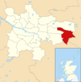 Glasgow wards 2017 no20 Baillieston.png 2,000 × 2,040; 504 KB
-
 Glenburn Avenue, Swinton - geograph.org.uk - 1654831.jpg 640 × 483; 60 KB
-
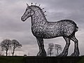 Heavy Horse - geograph.org.uk - 87389.jpg 640 × 480; 120 KB
-
 Map of Glasgow and its Environs OS Map name 007-14, Ordnance Survey, 1857-1893.png 11,330 × 7,559; 19.61 MB
-
 Map of Lanarkshire Sheet 007, Ordnance Survey, 1863-1865.tiff 10,677 × 7,165; 218.87 MB
-
 Mount Vernon from the air (geograph 5716452).jpg 640 × 480; 235 KB
-
 North Calder Water at Calderpark Haugh - geograph.org.uk - 1589222.jpg 640 × 483; 162 KB
-
 Old Road to Burntbroom - geograph.org.uk - 1473168.jpg 600 × 453; 71 KB
-
 OS old series Scotland 1 63360 31 (cropped).jpg 1,944 × 1,522; 743 KB
-
 Post box on Muirhead Road - geograph.org.uk - 1281539.jpg 640 × 480; 150 KB
-
 Swinton Avenue - geograph.org.uk - 1654901.jpg 640 × 483; 57 KB
-
 Swinton Crescent - geograph.org.uk - 1654839.jpg 640 × 483; 61 KB
-
 Swinton Crescent - geograph.org.uk - 1654895.jpg 640 × 483; 58 KB
-
 The Bridge Inn - geograph.org.uk - 1261897.jpg 640 × 480; 122 KB
-
 The Bridge Inn, Easterhouse (geograph 5447407).jpg 640 × 480; 54 KB
-
 The Heavy Horse (geograph 5764532).jpg 640 × 508; 122 KB
-
 The Post-Office annual Glasgow directory (1880) (14742876166).jpg 1,856 × 2,988; 1.41 MB
-

-
 Viaduct No.15 - geograph.org.uk - 1472063.jpg 640 × 480; 99 KB
-
 Weirwood Park - geograph.org.uk - 1462732.jpg 640 × 483; 63 KB
.jpg)
_(geograph_5446613).jpg)


.jpg)

.jpg)

.jpg)

.jpg)


.jpg)

.jpg)

.jpg)

.jpg)


.jpg)


.jpg)


.jpg)
.jpg)
_(14742876166).jpg)


