Category:Ballylesson
village in United Kingdom _-_geograph.org.uk_-_756917.jpg) | |||||
| Upload media | |||||
| Instance of | |||||
|---|---|---|---|---|---|
| Location | Northern Ireland | ||||
 | |||||
English: Ballylesson is a small village in County Down, Northern Ireland. In the 2001 Census it had a population of 108 people. The village lies within the Lagan Valley Regional Park and the Lisburn City Council area.
Subcategories
This category has only the following subcategory.
T
- Holy Trinity Church, Drumbo (7 F)
Media in category "Ballylesson"
The following 39 files are in this category, out of 39 total.
-
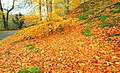
 Autumn at Minnowburn 2008 (2) - geograph.org.uk - 1023332.jpg 625 × 417; 112 KB
-
 Autumn at Minnowburn 2008 (3) - geograph.org.uk - 1023335.jpg 610 × 375; 104 KB
-
 Autumn at Minnowburn 2008 (8) - geograph.org.uk - 1039135.jpg 613 × 371; 107 KB
-
 Autumn at Minnowburn 2008 (9) - geograph.org.uk - 1039152.jpg 618 × 375; 114 KB
-
 Autumn at Minnowburn near Belfast (2) - geograph.org.uk - 599595.jpg 640 × 406; 124 KB
-
 Autumn at Minnowburn near Belfast (3) - geograph.org.uk - 599607.jpg 640 × 425; 134 KB
-
 Autumn at Minnowburn, 2008 (5) - geograph.org.uk - 1028332.jpg 609 × 388; 124 KB
-
 Autumn at Minnowburn, 2008 (6) - geograph.org.uk - 1028354.jpg 567 × 363; 110 KB
-
-
 Ballylesson near Dunmurry - geograph.org.uk - 1907446.jpg 700 × 411; 112 KB
-
 Ballylesson Road - geograph.org.uk - 3763325.jpg 4,000 × 3,000; 3.44 MB
-
 Fort Road - geograph.org.uk - 3763332.jpg 4,000 × 3,000; 2.97 MB
-
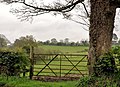 Gate and tree near Belfast - geograph.org.uk - 2906263.jpg 640 × 463; 117 KB
-
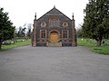
 Holy Trinity Parish Church, Ballylesson - geograph.org.uk - 2189008.jpg 640 × 484; 103 KB
-
 Purdysburn Hill Road, Ballylesson - geograph.org.uk - 756930.jpg 640 × 433; 110 KB
-

-

-
 Red Telephone Box, Ballylesson - geograph.org.uk - 756946.jpg 640 × 640; 174 KB
-

-
 Sign, Ballylesson - geograph.org.uk - 756932.jpg 640 × 480; 92 KB
-
 Signs, Ballylesson - geograph.org.uk - 756940.jpg 640 × 498; 153 KB
-
 Telephone box, Ballylesson, Belfast - geograph.org.uk - 2950078.jpg 640 × 366; 102 KB
-

-

-
 Two roads at Ballylesson, Belfast - geograph.org.uk - 2950175.jpg 640 × 357; 85 KB
-
 Unknown box, Ballylesson - geograph.org.uk - 756952.jpg 492 × 640; 198 KB
-
 Victorian Postbox, Ballylesson - geograph.org.uk - 756941.jpg 640 × 636; 140 KB
-

-

-
 Ballylesson Road, Ballylesson - geograph.org.uk - 756934.jpg 640 × 480; 125 KB
-
 Cooke-Instonians Rugby Club - geograph.org.uk - 1143775.jpg 640 × 480; 140 KB
-
 Fields near Ballylesson - geograph.org.uk - 748702.jpg 640 × 480; 120 KB
-
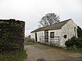
 Fort Road, Ballylesson (1) - geograph.org.uk - 748697.jpg 590 × 340; 99 KB
-
 Fort Road, Ballylesson (2) - geograph.org.uk - 748700.jpg 640 × 489; 145 KB
-
 Gate, Minnowburn Path - geograph.org.uk - 1407363.jpg 640 × 431; 529 KB
-

-
 Holy Trinity Drumbo, Ballylesson (2) - geograph.org.uk - 756921.jpg 480 × 640; 101 KB
-
 Purdysburn village. - geograph.org.uk - 373621.jpg 640 × 480; 113 KB
-
 The Ballylesson Road near Belfast - geograph.org.uk - 615687.jpg 640 × 428; 114 KB
_-_geograph.org.uk_-_1023332.jpg)
_-_geograph.org.uk_-_1023335.jpg)
_-_geograph.org.uk_-_1039135.jpg)
_-_geograph.org.uk_-_1039152.jpg)
_-_geograph.org.uk_-_599595.jpg)
_-_geograph.org.uk_-_599607.jpg)
_-_geograph.org.uk_-_1028332.jpg)
_-_geograph.org.uk_-_1028354.jpg)


_-_geograph.org.uk_-_5094092.jpg)


_-_geograph.org.uk_-_2560813.jpg)


_-_geograph.org.uk_-_2950093.jpg)
_-_geograph.org.uk_-_2950101.jpg)


_-_geograph.org.uk_-_748697.jpg)
_-_geograph.org.uk_-_748700.jpg)


_-_geograph.org.uk_-_756921.jpg)

