Category:Barfiliya
village in Ramle, Mandatory Palestine   | |||||
| Upload media | |||||
| Instance of | |||||
|---|---|---|---|---|---|
| Location | Ramle Subdistrict | ||||
| Area |
| ||||
 | |||||
Media in category "Barfiliya"
The following 17 files are in this category, out of 17 total.
-
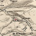 Historical map series for the area of Barfiliya (1870s).jpg 739 × 743; 211 KB
-
-
 Historical map series for the area of Barfiliya (1940s).jpg 739 × 743; 276 KB
-
 Innaba 1942.jpg 5,336 × 2,891; 4.78 MB
-
 Kharruba 1942.jpg 438 × 335; 100 KB
-
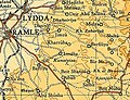
 Lydda and Ramla area - 9 July 1948.PNG 823 × 1,263; 92 KB
-
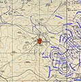
 Modi'in-Maccabim-Re'ut - Depopulated Palestinian Villages.png 1,114 × 910; 1.04 MB
-
 Barfilia bor2.jpg 1,024 × 767; 294 KB
-
 Barfilia gader.JPG 1,024 × 767; 215 KB
-
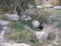
 בור מים בברפיליה 2.jpg 3,687 × 2,765; 4.27 MB
-
 בור מים בברפיליה.jpg 3,687 × 2,765; 3.7 MB
-
 ברפיליה נק' טריג 2.jpg 3,687 × 2,765; 3.5 MB
-
 ברפיליה נק' טריג.jpg 4,608 × 3,456; 7.16 MB
-
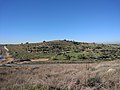 גבעת ברפיליה 2.jpg 3,687 × 2,765; 3.79 MB
-
 גבעת ברפיליה.jpg 3,687 × 2,765; 3.61 MB
-
 מודיעין מגבעת ברפיליה.jpg 3,687 × 2,765; 2.97 MB
-
 Historical map series for the area of Barfiliya (modern).jpg 739 × 743; 173 KB
.jpg)
.jpg)
.jpg)


.jpg)