Category:Barnby in the Willows
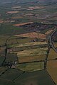
English: Barnby in the Willows is a village and civil parish in the Newark and Sherwood district of Nottinghamshire, England, just east of Newark-on-Trent. According to the 2001 census it had a population of 244. Just to the south of the village is the River Witham, which also forms the border with Lincolnshire here.
village in United Kingdom | |||||
| Upload media | |||||
| Instance of | |||||
|---|---|---|---|---|---|
| Location | Newark and Sherwood, Nottinghamshire, East Midlands, England | ||||
 | |||||
Subcategories
This category has only the following subcategory.
A
Media in category "Barnby in the Willows"
The following 133 files are in this category, out of 133 total.
-
 A17 Sleaford Road near Flawford Farm - geograph.org.uk - 5672326.jpg 640 × 480; 66 KB
-
 A17, Sleaford Road - geograph.org.uk - 4933550.jpg 640 × 427; 393 KB
-
 Accident at Barnby in the Willows - geograph.org.uk - 3633916.jpg 1,024 × 768; 356 KB
-
 Ah ^ Where's the path ^ - geograph.org.uk - 2442738.jpg 1,024 × 768; 244 KB
-

-
 Alongside Long Lane - geograph.org.uk - 4883029.jpg 1,024 × 768; 242 KB
-
 Another new gate on the footpath to Balderton - geograph.org.uk - 3084072.jpg 1,024 × 768; 261 KB
-
 Approaching the Church Bridge - geograph.org.uk - 4752472.jpg 1,024 × 768; 282 KB
-
-
 Barn at the Gables - geograph.org.uk - 2442708.jpg 1,024 × 768; 163 KB
-
 Barnby Dovecote - geograph.org.uk - 2442690.jpg 1,024 × 768; 233 KB
-
 Barnby Grange - geograph.org.uk - 1999377.jpg 1,024 × 768; 181 KB
-
 Barnby Hall - geograph.org.uk - 5246875.jpg 1,024 × 768; 165 KB
-
 Barnby Hall seen across the River Witham - geograph.org.uk - 6033779.jpg 1,024 × 768; 226 KB
-
 Barnby House - geograph.org.uk - 2442702.jpg 1,024 × 768; 143 KB
-
 Barnby in the Willows at sunset - geograph.org.uk - 6222235.jpg 1,024 × 768; 90 KB
-

-

-

-
 Barnby Village Hall - geograph.org.uk - 1999405.jpg 1,024 × 768; 137 KB
-
 Bend in Long Lane - geograph.org.uk - 3295861.jpg 2,256 × 1,504; 1.34 MB
-
 Bleak House Farm from Newark Road, Barnby - geograph.org.uk - 2009934.jpg 1,024 × 768; 111 KB
-
 Bridge over Shire Dyke - geograph.org.uk - 3084100.jpg 1,024 × 768; 192 KB
-
 Bridge over the River Witham - geograph.org.uk - 3084087.jpg 1,024 × 768; 211 KB
-
 By the A17 - geograph.org.uk - 4883009.jpg 1,024 × 768; 227 KB
-
 Corporation Plantation - geograph.org.uk - 2443967.jpg 1,024 × 768; 203 KB
-
 Cottages on Back Street, Barnby - geograph.org.uk - 1999412.jpg 1,024 × 768; 166 KB
-
 Damaged ash - geograph.org.uk - 4883017.jpg 1,024 × 768; 192 KB
-
 Dovecote Farm - geograph.org.uk - 2446011.jpg 1,024 × 768; 175 KB
-
 Dovecote, Barnby in the Willows - geograph.org.uk - 2910086.jpg 640 × 500; 106 KB
-
 Eastbound A17 near to Beckingham - geograph.org.uk - 4934496.jpg 640 × 427; 354 KB
-
 Entering Barnby in the Willows - geograph.org.uk - 2910071.jpg 640 × 480; 83 KB
-
 Entering Barnby in the Willows - geograph.org.uk - 3293117.jpg 2,256 × 1,504; 892 KB
-
 Entering Nottinghamshire on the A17 - geograph.org.uk - 2910050.jpg 640 × 480; 91 KB
-
 Entrance to Barnby in the Willows - geograph.org.uk - 4081817.jpg 3,776 × 2,520; 4.06 MB
-
 Entrance to Fen Farm - geograph.org.uk - 389664.jpg 640 × 427; 91 KB
-

-
 Farm buildings, Barnby Hall - geograph.org.uk - 1910677.jpg 1,600 × 1,200; 562 KB
-
 Farm road on Claypole Fen - geograph.org.uk - 389648.jpg 640 × 427; 79 KB
-
 Farmland and pylons, Bleak House Farm - geograph.org.uk - 2910098.jpg 2,686 × 2,048; 841 KB
-
 Farmland at the end of Broad Fen Lane - geograph.org.uk - 389497.jpg 640 × 427; 97 KB
-
 Farmland near Manor Farm - geograph.org.uk - 2910060.jpg 640 × 480; 40 KB
-
 Farmland off Long Lane - geograph.org.uk - 2910062.jpg 640 × 480; 82 KB
-
 Farmland, Barnby in the Willows - geograph.org.uk - 2910079.jpg 640 × 480; 37 KB
-
 Fen Farm - geograph.org.uk - 2009959.jpg 1,024 × 768; 155 KB
-
 Fen Lane - geograph.org.uk - 3671933.jpg 1,024 × 768; 167 KB
-
 Field alongside the A17 - geograph.org.uk - 1978392.jpg 1,024 × 768; 178 KB
-
 Field off Long Lane - geograph.org.uk - 1978411.jpg 1,024 × 768; 128 KB
-
 Flawford lane - geograph.org.uk - 5355246.jpg 1,024 × 768; 261 KB
-
 Footpath off Long Lane - geograph.org.uk - 2910069.jpg 640 × 480; 90 KB
-
 Fox Covert and Manor Farm - geograph.org.uk - 1911675.jpg 1,600 × 1,200; 561 KB
-
 Front Street, Barnby in the Willows - geograph.org.uk - 2446025.jpg 1,024 × 768; 169 KB
-
 Grange Farm - geograph.org.uk - 2009948.jpg 1,024 × 768; 182 KB
-
 Grange Farm - geograph.org.uk - 2910092.jpg 640 × 480; 44 KB
-
 Harvested field and Fen Farm - geograph.org.uk - 6224793.jpg 1,024 × 768; 200 KB
-
 Harvested field and Grange Farm - geograph.org.uk - 6224794.jpg 1,024 × 768; 154 KB
-
 Hen and Chicken Yard - geograph.org.uk - 2446058.jpg 1,024 × 768; 142 KB
-
 Hidden river - geograph.org.uk - 5564432.jpg 1,024 × 768; 201 KB
-
 I'm watching you - geograph.org.uk - 6033805.jpg 1,024 × 768; 224 KB
-
 Laundry Cottage, Barnby - geograph.org.uk - 1999386.jpg 1,024 × 768; 177 KB
-
 Lead theft - geograph.org.uk - 4226319.jpg 1,024 × 768; 292 KB
-
 Long Lane - geograph.org.uk - 4081825.jpg 3,776 × 2,520; 4.08 MB
-
 Long Lane joining the A17 (Sleaford Road) - geograph.org.uk - 4081832.jpg 3,776 × 2,520; 4.06 MB
-
 Long Lane junction ahead from A17 - geograph.org.uk - 3519620.jpg 640 × 491; 108 KB
-

-
 Manor Farm - geograph.org.uk - 1910682.jpg 1,600 × 1,200; 359 KB
-
 Muddy Fields near the A17 - geograph.org.uk - 3295865.jpg 2,256 × 1,504; 1.25 MB
-
 New gate on the path to Balderton - geograph.org.uk - 3084063.jpg 1,024 × 768; 236 KB
-
 Newark Road - geograph.org.uk - 2009943.jpg 1,024 × 768; 283 KB
-
 Newark Road heading west - geograph.org.uk - 2910095.jpg 640 × 480; 106 KB
-
 Newark Road heading west - geograph.org.uk - 2910099.jpg 640 × 480; 122 KB
-
 Newark Road near Willow Farm - geograph.org.uk - 3293107.jpg 2,256 × 1,504; 1.23 MB
-
 Not very encouraging - geograph.org.uk - 1978404.jpg 1,024 × 768; 312 KB
-
 Oilseed rape at Flawford - geograph.org.uk - 5355241.jpg 1,024 × 768; 213 KB
-
 Oilseed rape crop off Newark Road - geograph.org.uk - 2910093.jpg 640 × 480; 103 KB
-
 Repairing the damage - geograph.org.uk - 4752469.jpg 1,024 × 768; 148 KB
-

-
 River Witham - geograph.org.uk - 1910346.jpg 1,600 × 1,200; 435 KB
-
 River Witham in flood - geograph.org.uk - 1830781.jpg 1,600 × 1,200; 290 KB
-

-
 River Witham in flood at Barnby in the Willows - geograph.org.uk - 3084080.jpg 1,024 × 768; 213 KB
-
 Road to Flawford Farm - geograph.org.uk - 5355231.jpg 1,024 × 768; 150 KB
-
 Shire Dyke in flood - geograph.org.uk - 3084110.jpg 1,024 × 768; 169 KB
-
 Slaney Lodge Farm - geograph.org.uk - 3293114.jpg 2,256 × 1,504; 792 KB
-
 Sleaford Road (A17) near to Beckingham - geograph.org.uk - 4934493.jpg 640 × 480; 419 KB
-
 Sleaford Road (A17) towards Newark - geograph.org.uk - 2910055.jpg 640 × 480; 87 KB
-

-
 Stubble field and Barnby in the Willows - geograph.org.uk - 6070067.jpg 1,024 × 768; 129 KB
-
 Swans on the Witham - geograph.org.uk - 1837362.jpg 1,600 × 1,200; 437 KB
-
 The beginning of the footpath to Coddington - geograph.org.uk - 2442714.jpg 1,024 × 768; 236 KB
-
 The churchyard, Barnby in the Willows - geograph.org.uk - 5598807.jpg 1,024 × 768; 343 KB
-
 The churchyard, Barnby in the Willows - geograph.org.uk - 5598811.jpg 1,024 × 768; 287 KB
-

-

-
 The end of Fen Lane - geograph.org.uk - 3671943.jpg 1,024 × 768; 137 KB
-

-
-
 The River Witham at Barnby in the Willows - geograph.org.uk - 4067304.jpg 3,776 × 2,520; 3.98 MB
-
 The Skerries and farm bridge over the River Witham - geograph.org.uk - 1910360.jpg 1,600 × 1,200; 411 KB
-
 The Skerries and River Witham - geograph.org.uk - 1910372.jpg 1,600 × 1,200; 442 KB
-
 The Warren and Brickyard Holms - geograph.org.uk - 1911678.jpg 640 × 480; 95 KB
-
 Tower near Barnby Manor - geograph.org.uk - 1999124.jpg 1,024 × 768; 131 KB
-
 Track to Barnby Hall - geograph.org.uk - 2910083.jpg 640 × 480; 51 KB
-
 Track to Black Sykes - geograph.org.uk - 2910046.jpg 640 × 480; 102 KB
-
 Trees by a drain - geograph.org.uk - 4883021.jpg 1,024 × 768; 201 KB
-

-

-
 View towards Barnby Hall - geograph.org.uk - 2446068.jpg 1,024 × 768; 242 KB
-
 View towards Barnby in the Willows - geograph.org.uk - 3084123.jpg 1,024 × 768; 242 KB
-
 View towards Fenton - geograph.org.uk - 2192806.jpg 1,024 × 768; 114 KB
-
 View towards Grove Farm - geograph.org.uk - 2442750.jpg 1,024 × 768; 204 KB
-
 View towards Plots Farm - geograph.org.uk - 2442723.jpg 1,024 × 768; 161 KB
-
 View towards the Middle Buildings - geograph.org.uk - 2192798.jpg 1,024 × 768; 86 KB
-
 Walker defeated - geograph.org.uk - 3084135.jpg 1,024 × 768; 302 KB
-
 Walker triumphant - geograph.org.uk - 3671937.jpg 1,024 × 768; 132 KB
-
 Willow Tree Inn - geograph.org.uk - 1391524.jpg 640 × 426; 61 KB
-

-
 Willow Tree sign - geograph.org.uk - 1391530.jpg 426 × 640; 133 KB
-
 Witham bridge looking towards Fenton - geograph.org.uk - 1910338.jpg 3,264 × 2,448; 3.28 MB
-
 Woodland beside the A17 - geograph.org.uk - 2910052.jpg 640 × 480; 147 KB
-
 A17 towards Newark - geograph.org.uk - 389972.jpg 640 × 478; 84 KB
-
 Across the square to Fen Farm - geograph.org.uk - 412549.jpg 640 × 480; 140 KB
-
 Coddington Plantation from Grove Farm. - geograph.org.uk - 394573.jpg 640 × 424; 134 KB
-
 Footbridge at Grove Farm. - geograph.org.uk - 394585.jpg 424 × 640; 141 KB
-
 Grange Farm - geograph.org.uk - 214060.jpg 640 × 480; 70 KB
-
 Grove Farm. - geograph.org.uk - 394566.jpg 640 × 424; 125 KB
-
 Harvest Time - geograph.org.uk - 214062.jpg 640 × 480; 54 KB
-
 Long Lane - geograph.org.uk - 214081.jpg 640 × 480; 72 KB
-
 Private farm track - geograph.org.uk - 389671.jpg 640 × 427; 96 KB
-
 Public Footpath alongside a field. - geograph.org.uk - 394572.jpg 424 × 640; 129 KB
-
 The Way Out. - geograph.org.uk - 394559.jpg 424 × 640; 164 KB
-
 View through a hedge - geograph.org.uk - 214079.jpg 640 × 480; 89 KB
-
 Withamside Footpath - geograph.org.uk - 77658.jpg 480 × 640; 195 KB


_-_geograph.org.uk_-_5840043.jpg)
_-_geograph.org.uk_-_5840056.jpg)


_-_geograph.org.uk_-_4081832.jpg)


_-_geograph.org.uk_-_3084094.jpg)


_near_to_Beckingham_-_geograph.org.uk_-_4934493.jpg)
_towards_Newark_-_geograph.org.uk_-_2910055.jpg)


_-_geograph.org.uk_-_3084142.jpg)


