Category:Barney, Norfolk
English: Barney is a village within the civil parish of Fulmodeston in the English county of Norfolk.. The village lies to the south of the A148 King's Lynn to Cromer road near Thursford.The village is 7.2 miles east north east of the town of Fakenham, 17.1 miles west south west of Cromer and 121 miles north north east of London. The nearest railway station is at Sheringham for the Bittern Line which runs between Sheringham, Cromer and Norwich. The nearest airport is Norwich International Airport.
village in Norfolk, United Kingdom  | |||||
| Upload media | |||||
| Instance of | |||||
|---|---|---|---|---|---|
| Location | Fulmodeston, North Norfolk, Norfolk, East of England, England | ||||
 | |||||
Subcategories
This category has only the following subcategory.
M
Media in category "Barney, Norfolk"
The following 7 files are in this category, out of 7 total.
-
 Pavilion, Barney playing field - geograph.org.uk - 462831.jpg 640 × 480; 86 KB
-
 Steam gives way to the car - geograph.org.uk - 510115.jpg 640 × 480; 91 KB
-
 View SE across sheep pasture - geograph.org.uk - 570293.jpg 640 × 480; 61 KB
-
 A neatly trimmed hedge - geograph.org.uk - 570299.jpg 640 × 480; 112 KB
-
 Corn Barn, Barney - geograph.org.uk - 462793.jpg 640 × 480; 110 KB
-
 Corn Barn, Barney - geograph.org.uk - 462796.jpg 640 × 480; 126 KB
-
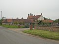 Old Hall Farm, Barney - geograph.org.uk - 462725.jpg 640 × 480; 68 KB


