Category:Barns in the City of Bradford
Media in category "Barns in the City of Bradford"
The following 26 files are in this category, out of 26 total.
-
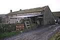
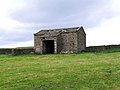
 A draughty barn. - geograph.org.uk - 742476.jpg 640 × 459; 128 KB
-
 Barn (2312430655).jpg 1,888 × 1,794; 2.61 MB
-
 Barn at High Royds Hall, Menston - geograph.org.uk - 1592647.jpg 640 × 425; 68 KB
-
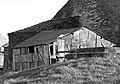
 Barn below Hunter Hill - geograph.org.uk - 38285.jpg 640 × 480; 152 KB
-
 Barn Conversion - Spen View Lane - geograph.org.uk - 1459731.jpg 640 × 480; 233 KB
-
 Barn, Bottom Farm.jpg 1,024 × 684; 166 KB
-
 Barn, Egypt, Thornton (17292108172).jpg 3,641 × 2,588; 7.85 MB
-
 Barn, Elam Grange.jpg 1,024 × 683; 154 KB
-
 Barn, Enfield Side - geograph.org.uk - 5407011.jpg 640 × 427; 102 KB
-
 Barn, Harp Lane, Queensbury (5596139274).jpg 3,862 × 2,688; 5.26 MB
-
 Barn, Town End, Clayton (4691643304).jpg 2,428 × 1,868; 6.1 MB
-
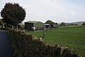 Barns off Cockin Lane - geograph.org.uk - 5181922.jpg 1,600 × 1,065; 453 KB
-
 Bottom Farm Barn-2-1200.jpg 1,200 × 900; 230 KB
-
 Cocklick Laithe - geograph.org.uk - 473255.jpg 640 × 480; 87 KB
-

-
 Disused Barn - Halifax Road - geograph.org.uk - 600228.jpg 640 × 480; 37 KB
-
 East Riddlesden Hall Barn.jpg 2,288 × 1,712; 1.32 MB
-
 Eastfield Lane, Burley-in-Wharfedale - geograph.org.uk - 752472.jpg 640 × 424; 94 KB
-
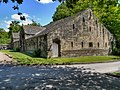 Great Barn, East Riddlesden Hall.jpg 640 × 481; 563 KB
-
 Hainworth - Hill Top Road - geograph.org.uk - 1272800.jpg 640 × 480; 98 KB
-
 Marchup Barn, Addingham - geograph.org.uk - 1551626.jpg 640 × 369; 55 KB
-
 Out Laith - geograph.org.uk - 293384.jpg 640 × 480; 112 KB
-
 Refurbished barn at Church Farm, Tong - geograph.org.uk - 5132498.jpg 1,024 × 768; 106 KB
-
 Roof detail, interior, Cocklick Laithe - geograph.org.uk - 473267.jpg 640 × 480; 146 KB
-
 Stanbury Barn.JPG 1,944 × 2,592; 1.85 MB
-


.jpg)


.jpg)


.jpg)
.jpg)


