Category:Barns in the Metropolitan Borough of Kirklees
Media in category "Barns in the Metropolitan Borough of Kirklees"
The following 22 files are in this category, out of 22 total.
-
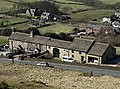 Ashes Lane, Almondbury.jpg 5,051 × 3,738; 5.22 MB
-
 Barn and White Cross Farm - geograph.org.uk - 109169.jpg 640 × 480; 107 KB
-
-

-
 Barn attached to Nathan's Cottages - geograph.org.uk - 3602264.jpg 2,000 × 1,485; 1.44 MB
-
 Barn by Booth's Bridge - geograph.org.uk - 5540032.jpg 4,032 × 3,024; 3.33 MB
-
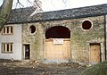
 Barn conversion at Mount Pleasant - geograph.org.uk - 3355731.jpg 2,000 × 1,500; 972 KB
-
 Barn near Hardenby Farm - geograph.org.uk - 5966093.jpg 640 × 487; 77 KB
-
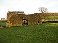
 Barn O'Cot - geograph.org.uk - 5965646.jpg 640 × 426; 80 KB
-
 Barn On Worts Hill Lane - geograph.org.uk - 5056543.jpg 1,200 × 799; 414 KB
-
-
 Barn, Upper Cote, Fixby - geograph.org.uk - 225367.jpg 640 × 475; 97 KB
-
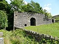
 Bradley Hall railway crossing - geograph.org.uk - 2488056.jpg 2,848 × 2,136; 1.5 MB
-
-
 Disused Barn on the Kirklees Way - geograph.org.uk - 960976.jpg 600 × 400; 71 KB
-
 Eroded barn wall - geograph.org.uk - 980255.jpg 480 × 640; 136 KB
-
 Field Barn, Holme - geograph.org.uk - 1412949.jpg 640 × 476; 152 KB
-
 Former barn, Gawthorpe Green Lane, Lepton - geograph.org.uk - 558882.jpg 640 × 476; 152 KB
-
 Grazing, Holt Head - geograph.org.uk - 5978812.jpg 640 × 480; 81 KB
-
 Nether Hall Barn.jpg 1,024 × 768; 223 KB
-
 Small barn, Almondbury - geograph.org.uk - 564859.jpg 640 × 480; 73 KB
-
 Springfield Barn, Scholes, Cleckheaton - geograph.org.uk - 217697.jpg 640 × 477; 149 KB


