Category:Barton Seagrave
English: Barton Seagrave is a village and civil parish in the Kettering borough of Northamptonshire, England. The village is a suburb of Kettering town, to the south-east of the town centre. It had a population of 4,185 according to the 2001 census.
village and civil parish in Northamptonshire, England, UK  | |||||
| Upload media | |||||
| Instance of |
| ||||
|---|---|---|---|---|---|
| Location | North Northamptonshire, Northamptonshire, East Midlands, England | ||||
| Population |
| ||||
 | |||||
Subcategories
This category has the following 2 subcategories, out of 2 total.
B
H
- Barton Seagrave Hall (4 F)
Media in category "Barton Seagrave"
The following 29 files are in this category, out of 29 total.
-

-
 A14 crossing the Midland Main Line - geograph.org.uk - 3580302.jpg 640 × 480; 49 KB
-

-
 A14 nears Polwell Lane overbridge - geograph.org.uk - 5082595.jpg 640 × 481; 67 KB
-
 Barton Road, Barton Seagrave - geograph.org.uk - 6603496.jpg 1,844 × 1,156; 1.07 MB
-
 Barton Road, Barton Seagrave - geograph.org.uk - 6603497.jpg 1,906 × 1,260; 947 KB
-

-
 Castle Way, Barton Seagrave - geograph.org.uk - 472426.jpg 640 × 428; 111 KB
-
 Cranford Road, Barton Seagrave - geograph.org.uk - 6603488.jpg 1,920 × 1,280; 841 KB
-
 Cranford Road, Barton Seagrave - geograph.org.uk - 6603491.jpg 1,850 × 1,164; 1.12 MB
-
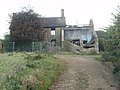 Dale's Lodge has seen better days - geograph.org.uk - 2657503.jpg 2,560 × 1,920; 1.12 MB
-
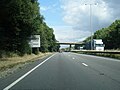
 Eastbound A14 approaching Junction 10 - geograph.org.uk - 3817707.jpg 640 × 480; 254 KB
-
 Eastbound A14 near Barton Seagrave - geograph.org.uk - 3817705.jpg 640 × 480; 288 KB
-
 Eastbound A14, Bridges at Junction 10 - geograph.org.uk - 3817708.jpg 640 × 480; 271 KB
-
 Grendon Drive - geograph.org.uk - 3820189.jpg 640 × 439; 52 KB
-
 Grendon Drive - geograph.org.uk - 3820192.jpg 640 × 480; 54 KB
-
 Grosvenor Road - geograph.org.uk - 5945510.jpg 640 × 360; 37 KB
-
 Kettering Town Centre, aerial 2014 - geograph.org.uk - 4057270.jpg 640 × 427; 101 KB
-
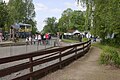 Miniature Railway Line, Wicksteed Park - geograph.org.uk - 4972607.jpg 1,024 × 682; 252 KB
-
 Near Southfield Farm - geograph.org.uk - 4782765.jpg 640 × 426; 46 KB
-
 Poseidon - geograph.org.uk - 1384438.jpg 640 × 480; 107 KB
-
 Powell Lane Bridge over the A14 - geograph.org.uk - 3817706.jpg 640 × 480; 273 KB
-
 Shell station in Barton Seagrave - geograph.org.uk - 6603494.jpg 1,920 × 1,280; 1.25 MB
-
 St Botolphs Road, Barton Seagrave - geograph.org.uk - 473427.jpg 640 × 428; 84 KB
-

-

-
 William Humphrey tomb in Swepston died 1591.jpg 1,456 × 1,147; 367 KB
-
 Barton Seagrave - geograph.org.uk - 376754.jpg 640 × 442; 87 KB
-
 Recycling Bins, Barton Seagrave - geograph.org.uk - 472396.jpg 640 × 428; 87 KB


