Category:Bas fourneaux de la forêt des Bellaires
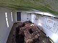
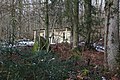
Bas fourneaux de la forêt des Bellaires
| Object location | | View all coordinates using: OpenStreetMap |
|---|
archaeological site in Romainmôtier-Envy in the canton of Vaud, Switzerland  | |||||
| Upload media | |||||
| Instance of | |||||
|---|---|---|---|---|---|
| Part of | |||||
| Location | |||||
| Heritage designation | |||||
 | |||||
Media in category "Bas fourneaux de la forêt des Bellaires"
The following 5 files are in this category, out of 5 total.
-
 Carriere Jaune-8.JPG 5,472 × 3,648; 12.83 MB
-
 Fourneaux-1.JPG 2,720 × 2,040; 1.73 MB
-
 Fourneaux-2.JPG 5,472 × 3,648; 12.97 MB
-
 Fourneaux-3.JPG 5,472 × 3,648; 12.53 MB
-
 Fourneaux-4.JPG 5,472 × 3,648; 13.31 MB


