Category:Basins and Islands Between Bueno and Puelo Rivers
 | |||||
| Upload media | |||||
| Instance of | |||||
|---|---|---|---|---|---|
| Location | |||||
| |||||
Subcategories
This category has the following 9 subcategories, out of 9 total.
C
- Chapo Lake (15 F)
L
- Llanquihue Lake (146 F)
M
P
- Petrohué River (141 F)
R
- Rio Peulla (7 F)
- River Cochamó (3 F)
T
Media in category "Basins and Islands Between Bueno and Puelo Rivers"
The following 9 files are in this category, out of 9 total.
-
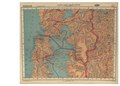
 104-atlasagro.png 626 × 491; 311 KB
-
 12-valdivia-osorno.jpg 5,502 × 3,336; 3.41 MB
-
 13-puerto-montt-ancud.jpg 5,551 × 3,359; 3.06 MB
-
 41-pto-montt-ancud-castro-MP0001339.pdf 3,737 × 3,125; 2.57 MB
-
 41.618S-73.6W-maullin-climate-chart.svg 686 × 462; 34 KB
-
 Cuenca-104-B.svg 1,174 × 851; 5.23 MB
-
 Maicolpue.jpg 4,032 × 3,024; 2.43 MB
-
 Maullin-climate-chart.svg 713 × 457; 36 KB
-
 Unifilar-Bueno-Puelo.svg 898 × 756; 87 KB


