Category:Bassenthwaite
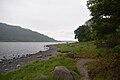
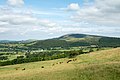
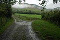
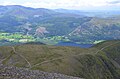
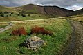
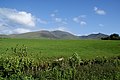
English: Bassenthwaite is a village and civil parish in the Allerdale district of Cumbria, England. According to the 2001 census it had a population of 412. The village is about nine miles east from Cockermouth, and is approximately one mile from Bassenthwaite Lake. Containing just a single pub and no shop, it is largely an agricultural community, with two farms within the village itself, with a number of holiday homes. Boasting a Church of England Church on its outskirts, together with a tiny methodist chapel, it contains many elements of the archetypal English village including a green, primary school and a stream running through it. The village also has a Caravan Site named Trafford Caravan Park. It is positioned on Carlisle Road 6 miles from the roundabout just outside Keswick. Bassenthwaite Village is at the foot of the wonderful Skiddaw (6th highest mountain in England at 3051ft) which is a fantastic view. Views seen from the village are of Robin Hood (hill), Skiddaw, Ullock Pike, Longside Egde, Dodd Wood, Barf ( in the distance ) and many more views.
village and civil parish in Cumbria, England, UK  | |||||
| Upload media | |||||
| Instance of | |||||
|---|---|---|---|---|---|
| Location | Allerdale, Cumbria, North West England, England | ||||
| Said to be the same as | Bassenthwaite (Wikimedia duplicated page, civil parish) | ||||
 | |||||
Subcategories
This category has the following 9 subcategories, out of 9 total.
A
- Armathwaite Hall (9 F)
B
- Bassenfell Manor (2 F)
- Bassenthwaite War Memorial (2 F)
J
M
- Mirehouse, Allerdale (7 F)
S
T
- Trotters World of Animals (6 F)
Media in category "Bassenthwaite"
The following 200 files are in this category, out of 612 total.
(previous page) (next page)-
 "Impulses from a vernal wood" - geograph.org.uk - 5770073.jpg 1,600 × 1,069; 1.73 MB
-
 A busy little corner - geograph.org.uk - 452865.jpg 640 × 480; 127 KB
-
 A choice of routes below Cockup - geograph.org.uk - 2327745.jpg 3,872 × 2,592; 4.39 MB
-
 A clear day on Skiddaw - geograph.org.uk - 3351464.jpg 640 × 480; 56 KB
-
 A farm track goes off to the left below Little Knott - geograph.org.uk - 2326935.jpg 3,872 × 2,592; 5.3 MB
-
 A Frosty Sale Fell Track. - geograph.org.uk - 95439.jpg 640 × 439; 46 KB
-
 A New Year's Day walk, along the Cumbria Way - geograph.org.uk - 4781634.jpg 1,024 × 768; 107 KB
-
 A Stone built sheep pen. - geograph.org.uk - 105996.jpg 640 × 480; 80 KB
-
-
 A view towards Skiddaw - geograph.org.uk - 5770118.jpg 1,600 × 1,071; 1.07 MB
-
 A whole family of black sheep - geograph.org.uk - 607844.jpg 640 × 480; 67 KB
-
 A591 at St. John's, Bassenthwaite - geograph.org.uk - 6264561.jpg 1,600 × 900; 574 KB
-
 A591, Bassenthwaite - geograph.org.uk - 6264568.jpg 1,600 × 900; 491 KB
-
 Above Barkbethdale - geograph.org.uk - 3090030.jpg 2,560 × 1,920; 2.07 MB
-
 Above Dash Beck - geograph.org.uk - 2976018.jpg 2,560 × 1,920; 974 KB
-
 Above Dead Crags - geograph.org.uk - 1712434.jpg 2,272 × 1,712; 878 KB
-
 Above Southerndale - geograph.org.uk - 3852042.jpg 2,560 × 1,920; 2.04 MB
-
 Access road from Skiddaw House and Dash Farm - geograph.org.uk - 2327803.jpg 3,872 × 2,592; 4.24 MB
-
 Across Southerndale - geograph.org.uk - 2220319.jpg 1,154 × 759; 384 KB
-
 Across the Dash valley - geograph.org.uk - 2327826.jpg 3,872 × 2,592; 4.69 MB
-
 Allerdale Ramble field path - geograph.org.uk - 5352036.jpg 5,202 × 3,465; 3.6 MB
-
 Allerdale Ramble gate from the Scarness Road - geograph.org.uk - 5352122.jpg 4,852 × 3,252; 4.34 MB
-
 Allerdale Ramble path at Bowness Bay - geograph.org.uk - 5352885.jpg 5,202 × 3,465; 3.43 MB
-
 Allerdale ramble path through wood - geograph.org.uk - 5352021.jpg 5,202 × 3,465; 5.19 MB
-
 Allerdale ramble. Stile into wood - geograph.org.uk - 5352018.jpg 5,202 × 3,465; 6.69 MB
-
 And then there was plastic.. - geograph.org.uk - 5770113.jpg 1,600 × 1,067; 1.51 MB
-
 Another gate on the access road to Dash Farm - geograph.org.uk - 2327864.jpg 3,872 × 2,592; 4.96 MB
-
 Approaching Bowness Bay - geograph.org.uk - 5352141.jpg 5,202 × 3,465; 4.07 MB
-
 Approaching Castle Inn on the B5291 - geograph.org.uk - 3382108.jpg 2,592 × 1,944; 1.72 MB
-
 Approaching the crossroads at Chapel Bridge - geograph.org.uk - 5807217.jpg 6,000 × 4,000; 6.26 MB
-
 Ascending Bakestall - geograph.org.uk - 3904352.jpg 2,560 × 1,920; 1.96 MB
-
 Ascending Skiddaw - geograph.org.uk - 3852040.jpg 2,560 × 1,920; 2.09 MB
-
 Ascending The Edge to Ullock Pike - geograph.org.uk - 958071.jpg 640 × 426; 78 KB
-
 Avoiding Cockup - geograph.org.uk - 1087138.jpg 640 × 480; 68 KB
-
 B5291 at Kilnhill - geograph.org.uk - 6217823.jpg 6,000 × 4,000; 4.65 MB
-
 B5291 near Armathwaite Hall - geograph.org.uk - 3933576.jpg 640 × 480; 406 KB
-
 Bakestall - geograph.org.uk - 4623376.jpg 1,500 × 1,000; 1.11 MB
-
 Bakestall and Dead Crags - geograph.org.uk - 945449.jpg 640 × 426; 84 KB
-
 Bank of the River Caldew - geograph.org.uk - 98830.jpg 640 × 482; 96 KB
-
 Barkbeth Gill - geograph.org.uk - 1087195.jpg 480 × 640; 69 KB
-
 Barkbethdale - geograph.org.uk - 1087177.jpg 640 × 480; 74 KB
-
 Bass Beck Bridge. - geograph.org.uk - 86666.jpg 640 × 480; 126 KB
-
 Bassenthwaite - geograph.org.uk - 577414.jpg 640 × 480; 167 KB
-
 Bassenthwaite - Sun Inn.jpg 640 × 480; 147 KB
-
 Bassenthwaite 1.jpg 640 × 372; 37 KB
-
 Bassenthwaite footbridge - geograph.org.uk - 5770086.jpg 1,600 × 1,069; 1.82 MB
-
 Bassenthwaite Ford - geograph.org.uk - 4387462.jpg 3,872 × 2,592; 4.52 MB
-
 Bassenthwaite from Barf - geograph.org.uk - 2477204.jpg 1,024 × 768; 201 KB
-
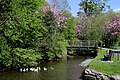
 Bassenthwaite Lake - geograph.org.uk - 1900448.jpg 640 × 480; 60 KB
-
 Bassenthwaite Lake - geograph.org.uk - 3933571.jpg 640 × 483; 295 KB
-
 Bassenthwaite Lake - geograph.org.uk - 5934440.jpg 2,048 × 1,536; 915 KB
-
 Bassenthwaite Lake behind Ullock Pike - geograph.org.uk - 3339975.jpg 3,264 × 2,448; 2.26 MB
-
 Bassenthwaite Lake looking South - geograph.org.uk - 5352893.jpg 5,202 × 3,465; 3.25 MB
-
 Bassenthwaite Lake looking West - geograph.org.uk - 5352901.jpg 5,202 × 3,465; 3.87 MB
-
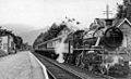 Bassenthwaite Lake Station geograph-2169541-by-Ben-Brooksbank.jpg 1,024 × 623; 329 KB
-
 Bassenthwaite Lakeside Lodges - geograph.org.uk - 1247760.jpg 640 × 426; 98 KB
-
 Bassenthwaite Lakeside Lodges - geograph.org.uk - 943090.jpg 640 × 426; 121 KB
-
 Bassenthwaite Primary School - geograph.org.uk - 1514556.jpg 640 × 480; 74 KB
-
 Bassenthwaite Village - geograph.org.uk - 1544211.jpg 640 × 480; 86 KB
-
 Bassenthwaite village and Skiddaw - geograph.org.uk - 3382126.jpg 2,592 × 1,944; 1.15 MB
-
 Bassenthwaite, UK - panoramio (1).jpg 3,264 × 2,448; 3.18 MB
-
 Bassenthwaite, UK - panoramio (10).jpg 3,264 × 2,448; 2.54 MB
-
 Bassenthwaite, UK - panoramio (2).jpg 3,264 × 2,448; 2.27 MB
-
 Bassenthwaite, UK - panoramio (4).jpg 2,448 × 3,264; 2.71 MB
-
 Bassenthwaite, UK - panoramio (5).jpg 2,448 × 3,264; 2.32 MB
-
 Bassenthwaite, UK - panoramio (6).jpg 2,448 × 3,264; 2.58 MB
-
 Bassenthwaite, UK - panoramio (7).jpg 3,264 × 2,448; 3.48 MB
-
 Bassenthwaite, UK - panoramio (8).jpg 3,264 × 2,448; 3.05 MB
-
 Bassenthwaite, UK - panoramio (9).jpg 2,448 × 3,264; 1.6 MB
-
 Bassenthwaite, UK - panoramio.jpg 2,448 × 3,264; 3.73 MB
-
 Bee Hives - geograph.org.uk - 1772626.jpg 640 × 480; 134 KB
-
 Beside Bassenthwaite Lake - geograph.org.uk - 5803527.jpg 1,600 × 1,067; 337 KB
-
 Betony - Stachys officinalis - geograph.org.uk - 1166944.jpg 640 × 480; 83 KB
-
 Beware low flying aircraft - geograph.org.uk - 3012269.jpg 3,008 × 2,000; 304 KB
-
 Billy Goat Gruff - geograph.org.uk - 1087687.jpg 480 × 640; 124 KB
-
 Birkett Edge - geograph.org.uk - 4348258.jpg 4,608 × 3,456; 3.6 MB
-
 Black Moss - geograph.org.uk - 1086147.jpg 640 × 480; 59 KB
-
 Black Nettle Hause - geograph.org.uk - 2327666.jpg 3,872 × 2,592; 4.37 MB
-
 Boat on Bassenthwaite - geograph.org.uk - 3012253.jpg 3,008 × 2,000; 1.09 MB
-
 Boundary between Old Plantation and the fellside Dodd Wood - geograph.org.uk - 3295758.jpg 3,264 × 2,448; 2.93 MB
-
 Bowness Bay - geograph.org.uk - 5934450.jpg 2,048 × 1,536; 1,007 KB
-
 Bowness Bay from field path near Bowness farm - geograph.org.uk - 5352042.jpg 5,202 × 3,465; 3.04 MB
-
 Bowness Bay, Bassenthwaite - geograph.org.uk - 5803515.jpg 1,600 × 1,067; 260 KB
-
 Bowness Bay, Bassenthwaite Lake - geograph.org.uk - 5352882.jpg 5,202 × 3,465; 2.89 MB
-
 Bowness Farm - geograph.org.uk - 5352025.jpg 5,202 × 3,465; 3.37 MB
-
 Bridleway across the fields - geograph.org.uk - 2326145.jpg 3,872 × 2,592; 4.09 MB
-
 Bridleway alongside a newly-planted hedge - geograph.org.uk - 3950996.jpg 1,024 × 768; 150 KB
-
 Bridleway and track to Park Wood - geograph.org.uk - 950412.jpg 426 × 640; 64 KB
-
 Bridleway heading to Ullock Pike - geograph.org.uk - 1274439.jpg 640 × 480; 113 KB
-
 Bridleway heading up into Park Wood - geograph.org.uk - 3950801.jpg 1,024 × 768; 156 KB
-

-
 Bridleway near Robin Hood Wood, Bassenthwaite - geograph.org.uk - 2322412.jpg 3,648 × 2,736; 4.63 MB
-
 Bridleway rising towards north ridge of Ullock Pike - geograph.org.uk - 4620661.jpg 1,500 × 1,000; 1.31 MB
-
 Bridleway to Bassenthwaite, above Park Wood - geograph.org.uk - 3950840.jpg 1,024 × 768; 138 KB
-
 Bridleway to Cockup - geograph.org.uk - 958160.jpg 640 × 426; 76 KB
-
 Bridleway traversing Robin Hood Wood - geograph.org.uk - 3950822.jpg 1,024 × 768; 197 KB
-
 Bridleway, Park Wood - geograph.org.uk - 3950828.jpg 1,024 × 768; 181 KB
-
 Broad End - geograph.org.uk - 3905753.jpg 2,560 × 1,920; 2.06 MB
-
 Broad End - geograph.org.uk - 958093.jpg 640 × 426; 92 KB
-
 Burthwaite Cottage - geograph.org.uk - 93356.jpg 640 × 427; 132 KB
-
 Burthwaite, near Bassenthwaite - geograph.org.uk - 4781667.jpg 1,024 × 768; 126 KB
-
 Buzzard Knott - geograph.org.uk - 1087074.jpg 640 × 480; 28 KB
-
 By Dead Beck - geograph.org.uk - 3905744.jpg 2,560 × 1,920; 1.24 MB
-
 Byway to Bassenthwaite - geograph.org.uk - 3382410.jpg 2,592 × 1,944; 1.7 MB
-
 Cairn on Cockup - geograph.org.uk - 4623658.jpg 1,500 × 1,000; 1.46 MB
-
 Cairn on Watches - geograph.org.uk - 1087548.jpg 640 × 480; 58 KB
-
 Cairn south of Skiddaw summit - geograph.org.uk - 4132699.jpg 640 × 480; 312 KB
-
 Car park at Rabbit Warren - geograph.org.uk - 2683523.jpg 640 × 480; 132 KB
-
 Car Park, Over Water - geograph.org.uk - 654408.jpg 640 × 480; 120 KB
-
 Caravans at Broadness Farm - geograph.org.uk - 5352131.jpg 5,202 × 3,465; 4.15 MB
-
 Carl Side Col - geograph.org.uk - 3852045.jpg 2,560 × 1,920; 485 KB
-
 Carl Side from Skiddaw - geograph.org.uk - 6190231.jpg 1,600 × 1,060; 384 KB
-
 Carlside Col - geograph.org.uk - 1086416.jpg 640 × 480; 58 KB
-
 Cass Beck Bridge - geograph.org.uk - 4781577.jpg 1,024 × 768; 182 KB
-
 Cass or Halls Beck - geograph.org.uk - 4781054.jpg 1,024 × 768; 212 KB
-
 Cass or Halls Beck, still high but falling - geograph.org.uk - 4781044.jpg 1,024 × 768; 217 KB
-
 Cassbeck Bridge - geograph.org.uk - 1541468.jpg 640 × 418; 112 KB
-
 Castle Inn Hotel - geograph.org.uk - 950237.jpg 640 × 426; 80 KB
-
 Cattle in Dash valley - geograph.org.uk - 945473.jpg 640 × 426; 92 KB
-
 Chapel Beck, downstream of Walk Mill Bridge - geograph.org.uk - 4781659.jpg 1,024 × 768; 229 KB
-
 Chapel Beck, looking upstream - geograph.org.uk - 4781663.jpg 768 × 1,024; 584 KB
-
 Chapel House, Bassenthwaite - geograph.org.uk - 946513.jpg 640 × 426; 72 KB
-
 Chapel in Bassenthwaite - geograph.org.uk - 946548.jpg 640 × 426; 73 KB
-
 Chapel Wood. - geograph.org.uk - 95451.jpg 640 × 480; 122 KB
-
 Closed Lonning A591 Near the Castle Inn - geograph.org.uk - 3279141.jpg 3,872 × 2,592; 4.62 MB
-
 Clouds over Bassenthwaite Lake - geograph.org.uk - 5352903.jpg 5,202 × 3,465; 2.73 MB
-
 Cockup viewed from the north - geograph.org.uk - 945454.jpg 640 × 426; 96 KB
-
 Coral Fungus - geograph.org.uk - 3168759.jpg 2,560 × 1,920; 617 KB
-
 Cows at Tenter Hill Farm - geograph.org.uk - 2327909.jpg 3,872 × 2,592; 6.29 MB
-
 Croquet lawn at Armathwaite Hall - geograph.org.uk - 2949129.jpg 640 × 480; 68 KB
-

-
 Cut-out cow, Bassenthwaite - geograph.org.uk - 945613.jpg 640 × 426; 70 KB
-
 Dash - geograph.org.uk - 38856.jpg 640 × 415; 58 KB
-
 Dash Beck - geograph.org.uk - 1519847.jpg 640 × 423; 71 KB
-
 Dash Beck - geograph.org.uk - 2327692.jpg 3,872 × 2,592; 4.54 MB
-
 Dash Beck - geograph.org.uk - 4387512.jpg 640 × 480; 111 KB
-
 Dash Farm - geograph.org.uk - 3642310.jpg 1,600 × 1,064; 470 KB
-
 Dash Valley - geograph.org.uk - 1517741.jpg 640 × 480; 70 KB
-
 Dash Valley - geograph.org.uk - 2137119.jpg 2,560 × 1,920; 953 KB
-
 Dash Valley - geograph.org.uk - 2137121.jpg 2,560 × 1,920; 1.39 MB
-
 Dash valley - geograph.org.uk - 945442.jpg 640 × 426; 94 KB
-
 Dash valley from Bakestall - geograph.org.uk - 945435.jpg 640 × 426; 87 KB
-
 Dash valley looking towards Dash Farm - geograph.org.uk - 367932.jpg 640 × 480; 89 KB
-
 Dead Beck (1) - geograph.org.uk - 4781598.jpg 768 × 1,024; 534 KB
-
 Dead Beck (2) - geograph.org.uk - 4781603.jpg 1,024 × 768; 162 KB
-
 Dead Beck - geograph.org.uk - 1519950.jpg 640 × 480; 93 KB
-
 Dead Beck - geograph.org.uk - 2137133.jpg 1,920 × 2,560; 1.27 MB
-
 Dead Beck - geograph.org.uk - 2137139.jpg 2,560 × 1,920; 1.1 MB
-
 Dead Beck - geograph.org.uk - 2137143.jpg 1,920 × 2,560; 1.4 MB
-
 Dead Beck - geograph.org.uk - 2137156.jpg 1,679 × 2,028; 1.09 MB
-
 Dead Beck - geograph.org.uk - 3905740.jpg 1,920 × 2,560; 1.14 MB
-
 Dead Beck, between Cockup and Dead Crags - geograph.org.uk - 4781592.jpg 1,024 × 768; 181 KB
-
 Descending Bakestall - geograph.org.uk - 2976015.jpg 2,560 × 1,920; 1.29 MB
-
 Descending Cockup - geograph.org.uk - 2137150.jpg 2,560 × 1,920; 1.23 MB
-
 Descending Skiddaw - geograph.org.uk - 3090034.jpg 1,920 × 2,560; 2.15 MB
-
 Descending to Ravenstone Hotel - geograph.org.uk - 817980.jpg 640 × 480; 85 KB
-
 Descending Ullock Pike - geograph.org.uk - 3047315.jpg 2,560 × 1,920; 2.12 MB
-
 Distant view of Binsey from the A591 near the Castle Inn - geograph.org.uk - 3279131.jpg 3,872 × 2,592; 4.74 MB
-
 Double Rainbow over Brockle Crag - geograph.org.uk - 2137161.jpg 2,560 × 1,920; 916 KB
-
 Dower House Scarness. - geograph.org.uk - 86642.jpg 640 × 480; 117 KB
-
 Drive, Mirehouse - geograph.org.uk - 5973237.jpg 640 × 360; 103 KB
-
 Edge of Bowness Bay - geograph.org.uk - 5352906.jpg 5,202 × 3,465; 4.31 MB
-
 Entrance to Peter House Farm - geograph.org.uk - 3642291.jpg 3,008 × 2,000; 1.52 MB
-
 Erratic boulder near Bassenthwaite - geograph.org.uk - 945477.jpg 640 × 426; 94 KB
-
 Farmland at Greenclose - geograph.org.uk - 950245.jpg 640 × 426; 67 KB
-
 Farmland at Scarness - geograph.org.uk - 957184.jpg 640 × 426; 67 KB
-
 Farmland in the valley of Dash Beck - geograph.org.uk - 4781586.jpg 1,024 × 768; 135 KB
-
 Farmland in the valley of Dash Beck - geograph.org.uk - 4781596.jpg 1,024 × 768; 109 KB
-
 Farmland near Bassenthwaite - geograph.org.uk - 6217858.jpg 6,000 × 4,000; 3.62 MB
-
 Fence at the waterside, Bassenthwaite Lake - geograph.org.uk - 5352886.jpg 5,202 × 3,465; 4.66 MB
-
 Fence, Skiddaw - geograph.org.uk - 4348254.jpg 4,608 × 3,456; 3.77 MB
-
 Field beside minor road - geograph.org.uk - 4620646.jpg 1,500 × 1,000; 1.37 MB
-
 Field in valley of Dash Beck - geograph.org.uk - 4623690.jpg 1,500 × 1,000; 1.57 MB
-
 Field north of Tenter Hill - geograph.org.uk - 4617056.jpg 1,500 × 843; 1.11 MB
-
 Field with a view of Skiddaw - geograph.org.uk - 2452085.jpg 3,872 × 2,592; 4.43 MB
-
 Fields and woods above Melbecks - geograph.org.uk - 2595533.jpg 2,592 × 1,944; 1.63 MB
-
 Fields and woods east of the A591 - geograph.org.uk - 3382420.jpg 2,592 × 1,944; 1.9 MB
-
 Fields near Mirkholme - geograph.org.uk - 2595551.jpg 2,592 × 1,944; 1.81 MB
-
 Fields near Peter House Farm - geograph.org.uk - 2327894.jpg 3,872 × 2,592; 3.94 MB
-
 Five holiday cottages at Melbecks - geograph.org.uk - 4781657.jpg 1,024 × 768; 135 KB
-
 Flanks of Skiddaw - geograph.org.uk - 5486618.jpg 1,600 × 1,200; 412 KB
-
 Fly Agaric - geograph.org.uk - 3168762.jpg 1,920 × 2,560; 2.09 MB
-
 Footbridge over the B5291 - geograph.org.uk - 6216829.jpg 6,000 × 4,000; 6.14 MB
-
 Footpath at Ling How - geograph.org.uk - 5087671.jpg 2,000 × 1,500; 375 KB
-
 Footpath in Park Wood - geograph.org.uk - 3950751.jpg 1,024 × 768; 206 KB
-
 Footpath in Rabbit Warren plantation - geograph.org.uk - 5089496.jpg 2,000 × 1,500; 701 KB
-
 Footpath on The Edge - geograph.org.uk - 5087657.jpg 2,000 × 1,500; 270 KB
-
 Footpath through Old Plantation - geograph.org.uk - 5089497.jpg 2,000 × 1,500; 448 KB
-
 Footpath to Bassenthwaite - geograph.org.uk - 2327900.jpg 3,872 × 2,592; 4.8 MB
-
 Footpath towards the Ravenstone Hotel - geograph.org.uk - 5087675.jpg 2,000 × 1,500; 501 KB
-
 Ford and village, Bassenthwaite - geograph.org.uk - 58641.jpg 480 × 360; 32 KB
-
 Forestry trail through Dodd Wood - geograph.org.uk - 3295749.jpg 3,872 × 2,592; 2.51 MB
-
 From the Plantation - geograph.org.uk - 1772623.jpg 640 × 480; 72 KB
-
 Gate and bridge crossing Dead Beck - geograph.org.uk - 2327725.jpg 3,872 × 2,592; 5.64 MB
-
 Gate and track to St Bega's - geograph.org.uk - 950731.jpg 640 × 426; 80 KB
-
 Gate into Church Plantation - geograph.org.uk - 5352029.jpg 5,202 × 3,465; 6.04 MB
-
 Gated entrance - geograph.org.uk - 6216818.jpg 6,000 × 4,000; 5.3 MB
-
 Gateway on the road up Dash valley - geograph.org.uk - 945472.jpg 640 × 426; 84 KB
-
 Gateway to Mirehouse gardens - geograph.org.uk - 5351980.jpg 5,202 × 3,465; 5.51 MB
-
 Getting a harvest from Park Wood (1) - geograph.org.uk - 3950778.jpg 1,024 × 768; 171 KB


.jpg)
.jpg)
.jpg)
.jpg)
.jpg)
.jpg)
.jpg)
.jpg)
.jpg)


_-_geograph.org.uk_-_4781598.jpg)
_-_geograph.org.uk_-_4781603.jpg)


_-_geograph.org.uk_-_3950778.jpg)