Category:Bassingbourn cum Kneesworth
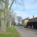
English: Bassingbourn cum Kneesworth is a civil parish in the South Cambridgeshire district of Cambridgeshire, England. Since the 1960s the parish contains the village of Bassingbourn and hamlet of Kneesworth and is situated just north of Royston in Hertfordshire. The parish is astride the A1198 (formerly the A14 and Ermine Street), and the Icknield Way (cum Ashwell Street).
Nederlands: Bassingbourn cum Kneesworth is een civil parish in het Engelse graafschap Cambridgeshire. De parish ligt in het district South Cambridgeshire en telt 4006 inwoners.
civil parish in the South Cambridgeshire district of Cambridgeshire, England | |||||
| Upload media | |||||
| Instance of | |||||
|---|---|---|---|---|---|
| Location | South Cambridgeshire, Cambridgeshire, East of England, England | ||||
 | |||||
Subcategories
This category has the following 3 subcategories, out of 3 total.
Media in category "Bassingbourn cum Kneesworth"
The following 187 files are in this category, out of 187 total.
-
A1198 from Royston - geograph.org.uk - 4484559.jpg 1,600 × 1,200; 812 KB
-
A1198 to Royston - geograph.org.uk - 4484553.jpg 1,600 × 1,200; 781 KB
-
A1198 towards Royston - geograph.org.uk - 5425002.jpg 640 × 480; 80 KB
-
A1198, Old North Road, heading north - geograph.org.uk - 5678324.jpg 640 × 428; 90 KB
-
A1198, Old North Road, heading north - geograph.org.uk - 5678417.jpg 640 × 428; 96 KB
-
A1198, Old North Road, heading north - geograph.org.uk - 5678421.jpg 640 × 428; 102 KB
-
A1198, Old North Road, heading north - geograph.org.uk - 5678441.jpg 640 × 428; 108 KB
-
A1198, Old North Road, heading north - geograph.org.uk - 5678454.jpg 640 × 428; 99 KB
-
A1198, Old North Road, heading north - geograph.org.uk - 5680996.jpg 640 × 474; 97 KB
-
A505 roundabout - geograph.org.uk - 5179648.jpg 1,600 × 1,213; 560 KB
-
Along Ashwell Street - geograph.org.uk - 5701857.jpg 1,024 × 768; 877 KB
-
Ashwell Street (track) looking west - geograph.org.uk - 3023693.jpg 2,560 × 1,920; 1,016 KB
-
Ashwell Street - geograph.org.uk - 5171303.jpg 1,600 × 1,200; 978 KB
-
Ashwell Street - geograph.org.uk - 5171313.jpg 1,600 × 1,200; 1,008 KB
-
Ashwell Street - geograph.org.uk - 5178386.jpg 1,600 × 1,200; 945 KB
-
Ashwell Street - geograph.org.uk - 5178450.jpg 1,600 × 1,200; 1.1 MB
-
Ashwell Street - geograph.org.uk - 5178470.jpg 1,600 × 1,200; 1.08 MB
-
Ashwell Street - geograph.org.uk - 5366220.jpg 1,600 × 1,200; 275 KB
-
Ashwell Street from Old North Road - geograph.org.uk - 5178478.jpg 1,600 × 1,200; 1,011 KB
-
Ashwell Street looking East - geograph.org.uk - 3023692.jpg 2,560 × 1,920; 990 KB
-
Ashwell Street near Keith Wood - geograph.org.uk - 5701868.jpg 1,024 × 768; 921 KB
-
At Bury Farm - geograph.org.uk - 5701750.jpg 1,024 × 768; 1.04 MB
-
At the south end of South End - geograph.org.uk - 5701912.jpg 1,024 × 768; 851 KB
-
Autumn in Keith Wood - geograph.org.uk - 5171322.jpg 1,600 × 1,200; 1.05 MB
-
Barriers across Ashwell Street - geograph.org.uk - 5178464.jpg 1,600 × 1,200; 1.1 MB
-
Bassingbourn Barracks - geograph.org.uk - 5783744.jpg 1,974 × 1,432; 1.66 MB
-
Bassingbourn Church - geograph.org.uk - 5541406.jpg 640 × 640; 110 KB
-
Bassingbourn countryside in snow - geograph.org.uk - 1967341.jpg 518 × 798; 62 KB
-
Bassingbourn from the air - geograph.org.uk - 3367456.jpg 480 × 640; 94 KB
-
Bassingbourn High Street - geograph.org.uk - 5703031.jpg 1,024 × 683; 771 KB
-
Bassingbourn Pharmacy - geograph.org.uk - 5782424.jpg 2,048 × 1,536; 1.5 MB
-
Bassingbourn Primary School - geograph.org.uk - 5783739.jpg 1,934 × 1,372; 1.39 MB
-
Bassingbourn United Reformed Church - geograph.org.uk - 5702135.jpg 1,024 × 732; 965 KB
-
Bassingbourn, historic houses in the High Street - geograph.org.uk - 5703037.jpg 1,024 × 1,024; 1.1 MB
-
Bassingbourn, historic houses on South End - geograph.org.uk - 5701934.jpg 1,024 × 1,024; 1.24 MB
-
Bassingbourn, houses on South End - geograph.org.uk - 5701923.jpg 1,024 × 731; 767 KB
-
Bassingbourn, North End - geograph.org.uk - 5702274.jpg 819 × 1,024; 1.35 MB
-
Bassingbourn, on South End - geograph.org.uk - 5701914.jpg 1,024 × 732; 1.03 MB
-
Bassingbourn, St Peter and St Paul - geograph.org.uk - 5702251.jpg 1,024 × 1,024; 1.44 MB
-
Bassingbourn, St Peter and St Paul - interior - geograph.org.uk - 5790586.jpg 819 × 1,024; 1,018 KB
-
Bassingbourn, St Peter and St Paul from the west - geograph.org.uk - 5702262.jpg 819 × 1,024; 1.11 MB
-
Bassingbourn, the north end of South End - geograph.org.uk - 5702217.jpg 1,024 × 731; 788 KB
-
Bassingbourn, Willmott's Recreation Ground - geograph.org.uk - 5702209.jpg 1,024 × 732; 855 KB
-
Bassingbourn-cum-Kneesworth, Cherry Tree House - geograph.org.uk - 5703062.jpg 1,024 × 768; 836 KB
-
Bassingbourne village - geograph.org.uk - 3771926.jpg 2,503 × 1,889; 1.33 MB
-
Big Cambridgeshire fields in early March - geograph.org.uk - 5701880.jpg 1,024 × 768; 884 KB
-
Borage by A1198 - geograph.org.uk - 4484563.jpg 1,600 × 1,200; 861 KB
-
Borage by A1198 - geograph.org.uk - 4484707.jpg 1,600 × 1,200; 708 KB
-
Borage by Marden Nursery - geograph.org.uk - 4484581.jpg 1,600 × 1,200; 855 KB
-
Borage by the A1198 - geograph.org.uk - 4484566.jpg 1,600 × 1,200; 933 KB
-
Bridleway to Ashwell Street - geograph.org.uk - 5171306.jpg 1,600 × 1,090; 882 KB
-
Bridleway to Ashwell Street - geograph.org.uk - 5178362.jpg 1,600 × 1,195; 960 KB
-
Bridleway to Ashwell Street - geograph.org.uk - 5178372.jpg 1,600 × 1,200; 937 KB
-
Bridleway to Ashwell Street - geograph.org.uk - 5178378.jpg 1,600 × 1,200; 926 KB
-
Bridleway towards A505 - geograph.org.uk - 5171307.jpg 1,600 × 1,200; 1,001 KB
-
Brook Road, Bassingbourn - geograph.org.uk - 2559675.jpg 1,600 × 1,200; 550 KB
-
Brook Road, Bassingbourn - geograph.org.uk - 5783730.jpg 1,960 × 1,412; 1.58 MB
-
Brook Road, Bassingbourne - geograph.org.uk - 3771949.jpg 2,592 × 1,944; 1.62 MB
-
Bungalows on Old North Road (A1198) - geograph.org.uk - 5425337.jpg 640 × 480; 77 KB
-
Byway from A1198 - geograph.org.uk - 4484569.jpg 1,600 × 1,200; 569 KB
-
Cereal crop north of Royston - geograph.org.uk - 5425353.jpg 640 × 480; 70 KB
-
Chestnut Lane - Kneesworth - geograph.org.uk - 5541397.jpg 640 × 640; 118 KB
-
Chestnut Lane towards Kneesworth - geograph.org.uk - 5425322.jpg 640 × 480; 65 KB
-
Chimney, Bassingbourn - geograph.org.uk - 4277059.jpg 3,240 × 4,320; 4.17 MB
-
Cottage in Kneesworth - geograph.org.uk - 5425325.jpg 640 × 480; 69 KB
-
Cottages on Old North Road, Kneesworth - geograph.org.uk - 5566580.jpg 2,014 × 1,490; 1,020 KB
-
Crop boundary - geograph.org.uk - 5171298.jpg 1,600 × 1,200; 1.01 MB
-
Crop field near Kneesworth - geograph.org.uk - 5425317.jpg 640 × 480; 99 KB
-
Crop field towards woodland - geograph.org.uk - 5425334.jpg 640 × 480; 91 KB
-
Crop field, Highfield Farm - geograph.org.uk - 5425345.jpg 640 × 480; 62 KB
-
Ditch and bridleway - geograph.org.uk - 3777666.jpg 640 × 377; 28 KB
-
Down the hill to Kneesworth - geograph.org.uk - 5703349.jpg 1,024 × 768; 702 KB
-
Equipment by the solar farm - geograph.org.uk - 5178432.jpg 1,600 × 1,200; 675 KB
-
Ermine Street southbound - geograph.org.uk - 5146831.jpg 3,648 × 2,432; 4.39 MB
-
Fen Road - geograph.org.uk - 5356794.jpg 1,600 × 1,231; 461 KB
-
Fen Road - geograph.org.uk - 5356839.jpg 1,600 × 1,200; 453 KB
-
Fen Road Footpath - geograph.org.uk - 5541409.jpg 640 × 640; 103 KB
-
Fen Road, Bassingbourn - geograph.org.uk - 5356840.jpg 1,600 × 1,136; 220 KB
-
Field and Keith Wood - geograph.org.uk - 5178430.jpg 1,600 × 1,200; 1,013 KB
-
Field by Ashwell Street - geograph.org.uk - 5171304.jpg 1,600 × 1,200; 904 KB
-
Field by Ashwell Street - geograph.org.uk - 5178461.jpg 1,600 × 1,200; 887 KB
-
Field by Bassingbourn - geograph.org.uk - 5356847.jpg 1,600 × 1,200; 243 KB
-
Field by Old North Road - geograph.org.uk - 5179637.jpg 1,600 × 1,200; 993 KB
-
Field by Old North Road, Whaddon - geograph.org.uk - 5566578.jpg 2,048 × 1,536; 1.49 MB
-
Field off Fen Road - geograph.org.uk - 5356798.jpg 1,600 × 1,200; 406 KB
-
Footpath - geograph.org.uk - 5541407.jpg 640 × 640; 160 KB
-
Footpath from Guise Lane - geograph.org.uk - 5366412.jpg 1,600 × 1,200; 532 KB
-
Former Red Lion pub, Kneesworth - geograph.org.uk - 4277081.jpg 4,320 × 3,240; 3.79 MB
-
Free range hens by Harcamlow Way - geograph.org.uk - 4484715.jpg 1,600 × 1,200; 683 KB
-
Glasshouses on the Old North Road - geograph.org.uk - 1349338.jpg 640 × 480; 96 KB
-
Greenhouses at Turnpike Nursery - geograph.org.uk - 344213.jpg 640 × 480; 59 KB
-
Harcamlow Way (byway) - geograph.org.uk - 5425343.jpg 640 × 480; 104 KB
-
Harpers Hair, Bassingbourn - geograph.org.uk - 5782426.jpg 2,048 × 1,536; 1.51 MB
-
Highfields Business Park - geograph.org.uk - 4484555.jpg 1,600 × 1,200; 559 KB
-
Highfields Business Park - geograph.org.uk - 4484695.jpg 1,600 × 1,200; 531 KB
-
Highfields Farm entrance - geograph.org.uk - 5178440.jpg 1,600 × 1,200; 629 KB
-
Horses by Ashwell Street - geograph.org.uk - 5178474.jpg 1,600 × 1,200; 834 KB
-
House on Old North Road, Kneesworth - geograph.org.uk - 5572189.jpg 1,946 × 1,388; 866 KB
-
Houses on Old North Road, Kneesworth - geograph.org.uk - 5678435.jpg 640 × 428; 109 KB
-
Houses on The Causeway, Bassingbourn - geograph.org.uk - 5783741.jpg 2,048 × 1,536; 1.5 MB
-
Kneesworth village - geograph.org.uk - 3771915.jpg 2,592 × 1,944; 1.26 MB
-
Kneesworth, a terrace on The Causeway - geograph.org.uk - 5703326.jpg 1,024 × 768; 787 KB
-
Kneesworth, on Old North Road - geograph.org.uk - 5703341.jpg 1,024 × 683; 851 KB
-
Kneesworth, plaster, weatherboarding and mossy thatch - geograph.org.uk - 5703328.jpg 1,024 × 1,024; 1.45 MB
-
Kneesworth, The Grange - geograph.org.uk - 5703336.jpg 819 × 1,024; 1,020 KB
-
Looking down North End in snow - geograph.org.uk - 1967333.jpg 784 × 490; 35 KB
-
Looking N on A1198 - geograph.org.uk - 5146829.jpg 3,648 × 2,432; 3.88 MB
-
Looking towards a solar farm - geograph.org.uk - 5178368.jpg 1,600 × 1,237; 888 KB
-
Marden Cottage Nursery Shop - geograph.org.uk - 4484579.jpg 1,600 × 1,200; 632 KB
-
Marden Cottage Nursery shop closed - geograph.org.uk - 5178482.jpg 1,600 × 1,200; 671 KB
-
Nearing the Meldreth-Kneesworth road - geograph.org.uk - 3885562.jpg 1,200 × 900; 1.25 MB
-
North end of the solar farm - geograph.org.uk - 5171321.jpg 1,600 × 1,248; 923 KB
-
North End, Bassingbourn - geograph.org.uk - 5356846.jpg 1,600 × 1,106; 301 KB
-
Old Milestone - geograph.org.uk - 2728642.jpg 367 × 640; 98 KB
-
Old North Road (A1198) - geograph.org.uk - 5425333.jpg 640 × 480; 75 KB
-
Old North Road (A1198) - geograph.org.uk - 5425338.jpg 640 × 480; 64 KB
-
Old North Road (A1198) - geograph.org.uk - 5425346.jpg 640 × 480; 80 KB
-
Old North Road at the junction of Bridge Street - geograph.org.uk - 5783745.jpg 1,990 × 1,454; 1.21 MB
-
Old North Road at the junction of The Causeway - geograph.org.uk - 6203292.jpg 1,920 × 1,280; 1.03 MB
-
Old North Road entering Cambridgeshire - geograph.org.uk - 5179642.jpg 1,600 × 1,200; 822 KB
-
Old North Road roundabout - Royston - geograph.org.uk - 5722868.jpg 640 × 480; 131 KB
-
Old North Road, Bassingbourn - geograph.org.uk - 5572188.jpg 2,048 × 1,536; 1.5 MB
-
Old North Road, Kneesworth - geograph.org.uk - 5572190.jpg 2,048 × 1,536; 909 KB
-
Old North Road, Kneesworth - geograph.org.uk - 6192747.jpg 1,920 × 1,280; 1.02 MB
-
Old North Road, Kneesworth - geograph.org.uk - 6203306.jpg 1,824 × 1,114; 1.21 MB
-
Old North Road, Whaddon - geograph.org.uk - 5566579.jpg 2,048 × 1,536; 1.5 MB
-
Old style telegraph pole on Old North Road, Kneesworth - geograph.org.uk - 6192748.jpg 1,280 × 1,920; 1.58 MB
-
On Ashwell Street - geograph.org.uk - 5701753.jpg 1,024 × 1,024; 1.22 MB
-
On Bassingbourn High Street - geograph.org.uk - 5703041.jpg 1,024 × 683; 726 KB
-
On Parade - geograph.org.uk - 87877.jpg 640 × 423; 66 KB
-
Paintball sign by A1198 - geograph.org.uk - 4484575.jpg 1,600 × 1,200; 677 KB
-
Park View, Bassingbourn - geograph.org.uk - 5356855.jpg 1,600 × 1,200; 267 KB
-
Path by A1198 - geograph.org.uk - 4484690.jpg 1,600 × 1,200; 826 KB
-
Path by A1198 - geograph.org.uk - 5178445.jpg 1,600 × 1,200; 825 KB
-
Path to Royston - geograph.org.uk - 5701772.jpg 1,024 × 731; 858 KB
-
Pea field by Harcamlow Way - geograph.org.uk - 4484724.jpg 1,600 × 1,200; 793 KB
-
Permissive path from Ashwell Street - geograph.org.uk - 5171311.jpg 1,600 × 1,200; 838 KB
-
Power lines across Ashwell Street - geograph.org.uk - 5178467.jpg 1,600 × 1,200; 1.17 MB
-
Power lines along Ashwell Street - geograph.org.uk - 5171305.jpg 1,600 × 1,200; 915 KB
-
Public footpath towards A505 - geograph.org.uk - 5178344.jpg 1,600 × 1,200; 895 KB
-
Reservoir behind Grange Farm - geograph.org.uk - 1436074.jpg 640 × 361; 174 KB
-
Road to Highfields Business Park - geograph.org.uk - 5425351.jpg 640 × 480; 58 KB
-
Royston from the air - geograph.org.uk - 2468585.jpg 640 × 480; 137 KB
-
Sewage works by Bassingbourn Barracks - geograph.org.uk - 5366408.jpg 1,600 × 1,200; 382 KB
-
Shop in Kneesworth - geograph.org.uk - 5425327.jpg 640 × 480; 68 KB
-
Sign on Old North Road - geograph.org.uk - 5179633.jpg 1,600 × 1,208; 807 KB
-
Solar Farm south of Ashwell Street - geograph.org.uk - 5366228.jpg 1,600 × 1,205; 350 KB
-
South Cambridgeshire farmland - geograph.org.uk - 3023687.jpg 2,560 × 1,920; 1.02 MB
-
South End, Bassingbourn - geograph.org.uk - 5783740.jpg 2,014 × 1,490; 1.29 MB
-
Spring Lane - geograph.org.uk - 5171323.jpg 1,600 × 1,200; 896 KB
-
Spring Lane - geograph.org.uk - 5701778.jpg 1,024 × 731; 948 KB
-
St Peter ^ St Paul, Bassingbourn - Gravestone - geograph.org.uk - 2294892.jpg 1,000 × 666; 186 KB
-
Strip woodland off Kneesworth Road - geograph.org.uk - 5425321.jpg 640 × 480; 83 KB
-
Stump of a concrete lamppost - geograph.org.uk - 5541412.jpg 640 × 640; 147 KB
-
Sugar beet - geograph.org.uk - 5171300.jpg 1,600 × 1,200; 1.3 MB
-
The Belle, Bassingbourn - geograph.org.uk - 5356852.jpg 1,600 × 1,154; 237 KB
-
The Brook - geograph.org.uk - 1349369.jpg 640 × 480; 105 KB
-
The Causeway at the junction of Old North Road - geograph.org.uk - 5783743.jpg 2,048 × 1,536; 1.51 MB
-
The Dry Ski Run at Bassingbourn Barracks - geograph.org.uk - 1354182.jpg 640 × 480; 106 KB
-
The Hoops pub, Bassingbourn - geograph.org.uk - 4277066.jpg 4,320 × 3,240; 3.44 MB
-
To Meldreth in the mist - geograph.org.uk - 3885553.jpg 1,200 × 900; 1.14 MB
-
Towards Fountain Farm - geograph.org.uk - 5541399.jpg 640 × 640; 141 KB
-
Towards Kneesworth - geograph.org.uk - 5541404.jpg 640 × 640; 163 KB
-
Towards Kneesworth - geograph.org.uk - 5541405.jpg 640 × 640; 117 KB
-
Tudor Cottage.jpg 4,032 × 3,024; 4.27 MB
-
Turnpike Nursery - geograph.org.uk - 4484721.jpg 1,600 × 1,200; 751 KB
-
War memorial, Bassingbourn - geograph.org.uk - 2559658.jpg 1,200 × 1,600; 1.03 MB
-
War memorial, Bassingbourn - geograph.org.uk - 2559665.jpg 1,200 × 1,600; 791 KB
-
War memorial, Bassingbourn - geograph.org.uk - 2559669.jpg 1,200 × 1,600; 705 KB
-
War memorial, Bassingbourn - geograph.org.uk - 4276990.jpg 4,320 × 3,240; 5.26 MB
-
Water for the sheep - geograph.org.uk - 5178436.jpg 1,600 × 1,200; 939 KB
-
Wellhead Springs - geograph.org.uk - 1349344.jpg 480 × 640; 106 KB
-
White House and Church Cottage, Bassingbourn - geograph.org.uk - 4277038.jpg 4,320 × 3,240; 5.64 MB
-
Wireless Station Park - geograph.org.uk - 1443079.jpg 640 × 361; 141 KB
-
Bassingbourn Road (A1198) - geograph.org.uk - 344209.jpg 640 × 480; 94 KB
-
Green lane - geograph.org.uk - 438797.jpg 426 × 640; 225 KB
-
MOD training area at Bassingbourn - geograph.org.uk - 438804.jpg 640 × 426; 119 KB
-
Shedbury Lane - geograph.org.uk - 223296.jpg 640 × 408; 147 KB
-
View from Fen Road near Haygate Farm - geograph.org.uk - 409070.jpg 640 × 480; 93 KB


