Category:Bathymetric maps of the North Atlantic
Media in category "Bathymetric maps of the North Atlantic"
The following 27 files are in this category, out of 27 total.
-
 2023 Titan submersible incident map.svg 512 × 512; 667 KB
-

-
 Batimetriezh ar Mor Keltiek ha Pleg-mor Gwaskogn.svg 3,478 × 3,804; 4.92 MB
-
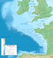
 Celtic Sea and Bay of Biscay bathymetric map-en.svg 3,479 × 3,805; 4.93 MB
-
 Celtic Sea and Bay of Biscay bathymetric map-fr.svg 3,478 × 3,804; 4.93 MB
-
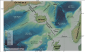
 Galicia & Galicia Bank-en.svg 1,491 × 663; 4.46 MB
-
 Gorringe Bank bathymetric map.png 1,921 × 1,200; 2.34 MB
-
 Greenland scotland-ridge-de.svg 962 × 593; 1.08 MB
-
 Itsaso Zeltikoko eta Bizkaiko Golkoko mapa batimetrikoa.svg 3,479 × 3,805; 4.93 MB
-
 Maritime boundaries between UK and France in Antilles-fr.svg 1,502 × 1,332; 403 KB
-
 N-Atlantic-topo (de).png 502 × 354; 288 KB
-
 N-Atlantic-topo.png 504 × 352; 288 KB
-
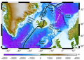
 North Atlantic Brightened.png 10,151 × 4,210; 65.5 MB
-
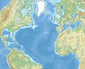 North Atlantic Ocean laea relief location map.jpg 1,181 × 958; 1.13 MB
-
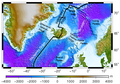
 Northeast Atlantic bathymetry.png 413 × 323; 347 KB
-
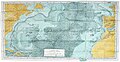 Physiographic map of the North Atlantic, 1957.jpg 3,000 × 1,545; 1.32 MB
-
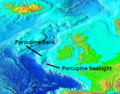 Porcupine Bank and Seabight, NE Atlantic.png 413 × 323; 292 KB
-
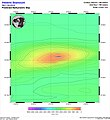
 RainbowVentFieldLocationOnMap.png 807 × 453; 677 KB
-
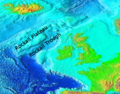 Rockall Plateau and Trough, NE Atlantic.png 413 × 323; 295 KB
-
 Saint-Pierre and Miquelon EEZ map-en.svg 750 × 800; 315 KB
-
 Sénégal drainage basin map-fr.svg 1,296 × 830; 3.53 MB
-
 SMNT-735N-0091W-Vesteris Seamount.jpg 901 × 981; 259 KB
-
 StLawrence Gulf bathymetry.jpg 820 × 505; 90 KB
-
 The Bell System technical journal (1922) (14569527447).jpg 3,462 × 1,928; 1.43 MB
-
 The Bell System technical journal (1922) (14755984285).jpg 3,436 × 2,663; 3.12 MB
-
 The Bell System technical journal (1922) (14775874393).jpg 3,480 × 2,738; 3.59 MB
-
 Vlaamse Banken.png 1,087 × 746; 1.15 MB


.png)


_(14569527447).jpg)
_(14755984285).jpg)
_(14775874393).jpg)
