Category:Batsford
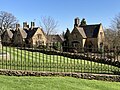
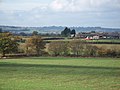
English: Batsford is a village and civil parish in the Cotswold district of Gloucestershire, England. According to the 2001 census it had a population of 99. The village is about 1½ miles north-west of Moreton-in-Marsh. There is a falconry centre close to the village and Batsford Arboretum is nearby, situated on the Cotswold scarp.
village in United Kingdom | |||||
| Upload media | |||||
| Instance of | |||||
|---|---|---|---|---|---|
| Location | Cotswold, Gloucestershire, South West England, England | ||||
| Population |
| ||||
 | |||||
Subcategories
This category has the following 5 subcategories, out of 5 total.
Media in category "Batsford"
The following 178 files are in this category, out of 178 total.
-
 A traditional Cotswold barn - geograph.org.uk - 4649331.jpg 1,024 × 680; 278 KB
-
 A traditional cum Dutch barn - geograph.org.uk - 4649333.jpg 1,024 × 680; 239 KB
-
 A twisty A429 heading north - geograph.org.uk - 3399080.jpg 640 × 480; 75 KB
-
 A429 leaving Moreton-in-Marsh - geograph.org.uk - 3849100.jpg 2,000 × 1,333; 679 KB
-
 A429 realignment at Aston Hale - geograph.org.uk - 3580857.jpg 1,024 × 768; 93 KB
-
 Access to Crossing Cottage - geograph.org.uk - 5490571.jpg 1,024 × 768; 328 KB
-
 Apse Roof - geograph.org.uk - 2481244.jpg 2,304 × 1,704; 1.57 MB
-
 Aston Hale from the footpath - geograph.org.uk - 1561854.jpg 640 × 480; 77 KB
-
 Autumn Fields - geograph.org.uk - 4714518.jpg 2,000 × 1,500; 1.48 MB
-
 Autumn Fields - geograph.org.uk - 4714523.jpg 2,000 × 1,333; 1.33 MB
-
 Autumn Fields - geograph.org.uk - 4714749.jpg 2,000 × 1,451; 1.25 MB
-
 Autumn Fields - geograph.org.uk - 4715202.jpg 2,000 × 1,333; 1.32 MB
-
 Autumn in Batsford Arboretum - geograph.org.uk - 3736554.jpg 680 × 1,024; 394 KB
-
 Autumn Limes at Batsford - geograph.org.uk - 4219566.jpg 2,000 × 1,434; 1.12 MB
-
 Autumn Limes at Batsford - geograph.org.uk - 4232148.jpg 2,000 × 1,874; 908 KB
-
 Avenue of trees, Batsford, Glos - geograph.org.uk - 3728197.jpg 768 × 1,024; 301 KB
-
 Back to nature - geograph.org.uk - 2016255.jpg 4,000 × 3,000; 3.2 MB
-
 Bamboo at Batsford Arboretum - geograph.org.uk - 4232168.jpg 2,000 × 2,000; 963 KB
-
 Batsford Arboretum - autumnal - geograph.org.uk - 4719506.jpg 640 × 480; 120 KB
-
 Batsford Arboretum - geograph.org.uk - 3736553.jpg 1,024 × 680; 409 KB
-
 Batsford Arboretum - geograph.org.uk - 3736556.jpg 1,024 × 680; 391 KB
-
 Batsford Arboretum - geograph.org.uk - 4719501.jpg 640 × 480; 163 KB
-
 Batsford church - geograph.org.uk - 3736594.jpg 680 × 1,024; 225 KB
-
 Batsford church - geograph.org.uk - 3736596.jpg 680 × 1,024; 173 KB
-
 Batsford Church - geograph.org.uk - 5552801.jpg 1,600 × 1,200; 563 KB
-
 Batsford Church from the Arboretum - geograph.org.uk - 4718060.jpg 640 × 480; 92 KB
-
 Batsford House - geograph.org.uk - 3736579.jpg 1,024 × 680; 245 KB
-
 Batsford House - geograph.org.uk - 3736581.jpg 1,024 × 680; 177 KB
-
 Batsford House - geograph.org.uk - 3736586.jpg 1,024 × 680; 268 KB
-
 Batsford House - geograph.org.uk - 3736597.jpg 1,024 × 680; 288 KB
-
 Batsford House - geograph.org.uk - 4219876.jpg 2,000 × 1,437; 1,001 KB
-
 Batsford House - geograph.org.uk - 4229592.jpg 2,000 × 1,209; 1.04 MB
-
 Batsford House - geograph.org.uk - 4229610.jpg 2,000 × 1,340; 990 KB
-
 Batsford House - geograph.org.uk - 6150086.jpg 3,348 × 2,344; 568 KB
-
 Batsford House from the Arboretum - geograph.org.uk - 5617697.jpg 640 × 484; 169 KB
-
 Batsford House from the footpath - geograph.org.uk - 4221503.jpg 2,000 × 1,360; 898 KB
-
 Batsford Junction - geograph.org.uk - 5151023.jpg 800 × 600; 209 KB
-

-
 Batsford Park, Gloucestershire - geograph.org.uk - 4480377.jpg 640 × 476; 203 KB
-
 Batsford Road Junction - geograph.org.uk - 6095109.jpg 1,600 × 1,200; 570 KB
-
 Batsford Stud - geograph.org.uk - 4232136.jpg 2,000 × 1,281; 907 KB
-
 Batsford Stud - geograph.org.uk - 5552792.jpg 1,600 × 1,200; 493 KB
-
 Batsford to Moreton-in-Marsh road - geograph.org.uk - 3776443.jpg 1,024 × 680; 268 KB
-
 Batsford view - geograph.org.uk - 5151016.jpg 640 × 480; 124 KB
-
 Batsford Village Houses - geograph.org.uk - 6095097.jpg 1,600 × 1,200; 434 KB
-
 Batsford, aerial 2019 - geograph.org.uk - 6238922.jpg 800 × 533; 110 KB
-
 Batsford, Gloucestershire-geograph-3729160-by-P-L-Chadwick.jpg 1,024 × 643; 250 KB
-
 Benchmark on St Mary's - geograph.org.uk - 2478985.jpg 1,704 × 2,304; 2.66 MB
-
 Bluebells and wild garlic at Batsford - geograph.org.uk - 4480370.jpg 427 × 640; 202 KB
-
-
 Boram Home Farm - geograph.org.uk - 5691499.jpg 1,600 × 1,066; 402 KB
-
 Chancel, Batsford church - geograph.org.uk - 3736603.jpg 680 × 1,024; 144 KB
-
 Coins not accepted here - geograph.org.uk - 5552780.jpg 1,600 × 1,200; 717 KB
-
 Concrete Trackways - geograph.org.uk - 2608438.jpg 640 × 442; 46 KB
-
 Cottage near arboretum - geograph.org.uk - 1590397.jpg 640 × 480; 117 KB
-
 Cottage on the Fosse Way - geograph.org.uk - 3399076.jpg 640 × 480; 95 KB
-
 Cottage on the hill - geograph.org.uk - 1592185.jpg 640 × 480; 98 KB
-
 Cottage undergoing restoration - geograph.org.uk - 4649322.jpg 800 × 531; 123 KB
-
 Country road near Batsford - geograph.org.uk - 3739354.jpg 1,024 × 680; 310 KB
-
 Countryside near Dorn - geograph.org.uk - 2608398.jpg 640 × 480; 114 KB
-
 Crossroads in Batsford - geograph.org.uk - 6238437.jpg 1,920 × 1,280; 1.36 MB
-
 Crossroads near Batsford - geograph.org.uk - 4219517.jpg 1,400 × 2,100; 764 KB
-
 Crossroads near Batsford village - geograph.org.uk - 1431061.jpg 640 × 427; 97 KB
-
 Daphne at Batsford - geograph.org.uk - 3467728.jpg 480 × 640; 381 KB
-
 Diamond Way - geograph.org.uk - 5691505.jpg 1,600 × 1,066; 312 KB
-
 Diamond Way - geograph.org.uk - 6417841.jpg 800 × 450; 75 KB
-
 Diamond Way - geograph.org.uk - 6417846.jpg 800 × 450; 111 KB
-
 Dorn Cottages - geograph.org.uk - 6101176.jpg 1,600 × 1,200; 358 KB
-
 Edward VII wall-mounted postbox, Batsford, Glos - geograph.org.uk - 3728093.jpg 629 × 1,024; 275 KB
-
 Edwardian postbox at Lower Lemington - geograph.org.uk - 5291936.jpg 1,066 × 1,600; 407 KB
-
 Electricity Sub-Station - geograph.org.uk - 3852456.jpg 2,000 × 1,383; 784 KB
-
 Entrance and drive to Oldborough Farm - geograph.org.uk - 6174729.jpg 1,024 × 768; 251 KB
-

-
 Estate houses, Batsford - geograph.org.uk - 1142667.jpg 640 × 461; 90 KB
-
 Farm building by Boram Farm - geograph.org.uk - 5691497.jpg 1,600 × 1,066; 246 KB
-
 Farm Buildings, New Farm - geograph.org.uk - 3399072.jpg 640 × 480; 41 KB
-
 Farm information - geograph.org.uk - 1592228.jpg 640 × 480; 74 KB
-
 Farm track at Batsford, Glos - geograph.org.uk - 3728125.jpg 1,024 × 669; 327 KB
-
 Farmland east of the A429 - geograph.org.uk - 3399070.jpg 640 × 541; 77 KB
-
 Farmland, New Farm - geograph.org.uk - 3399073.jpg 640 × 480; 56 KB
-
 Farmland, Oldborough Farm - geograph.org.uk - 3399078.jpg 640 × 480; 63 KB
-
 Field in Batsford - geograph.org.uk - 6238441.jpg 1,920 × 1,280; 1.48 MB
-
 Field in Batsford - geograph.org.uk - 6238443.jpg 1,920 × 1,280; 1.2 MB
-
 Field south of Dorn - geograph.org.uk - 4649342.jpg 1,024 × 680; 255 KB
-
 Fields at Batsford, Glos - geograph.org.uk - 3728275.jpg 1,024 × 675; 238 KB
-
 Fields north of Moreton-in-Marsh - geograph.org.uk - 3853481.jpg 2,000 × 1,333; 713 KB
-
 Footpath to Batsford - geograph.org.uk - 4221451.jpg 2,000 × 1,333; 930 KB
-
 Footpath to Batsford - geograph.org.uk - 4221495.jpg 2,000 × 1,333; 1.1 MB
-
 Footpath to Bourton on the Hill - geograph.org.uk - 4221411.jpg 2,000 × 1,386; 1.18 MB
-
 Footpath to Bourton on the Hill - geograph.org.uk - 4221422.jpg 1,900 × 2,155; 994 KB
-
 Footpath to Bourton on the Hill - geograph.org.uk - 4221473.jpg 2,000 × 1,410; 914 KB
-
 Footpath to Dunsden Coppice - geograph.org.uk - 5291930.jpg 1,600 × 1,066; 350 KB
-
 Footpath to Lower Lemington - geograph.org.uk - 2608386.jpg 640 × 480; 86 KB
-
 Footpath to Lower Lemington - geograph.org.uk - 5291926.jpg 1,600 × 1,066; 516 KB
-
 Fork in the road, Batsford, Glos - geograph.org.uk - 3728175.jpg 657 × 1,024; 295 KB
-
 Fosse Lodge - geograph.org.uk - 3055779.jpg 640 × 480; 82 KB
-
 Fosse Way (A429) heading north - geograph.org.uk - 3399069.jpg 640 × 480; 82 KB
-
 Fosse Way (A429) heading north - geograph.org.uk - 3399075.jpg 640 × 480; 56 KB
-
 Fosse Way - geograph.org.uk - 2608372.jpg 640 × 480; 86 KB
-
 Gargoyles on St Mary's, Batsford - geograph.org.uk - 2479878.jpg 1,704 × 2,304; 1.42 MB
-
 Golden crop in Moreton-in-Marsh - geograph.org.uk - 4109371.jpg 800 × 450; 138 KB
-
 Grassy track - geograph.org.uk - 5556442.jpg 1,024 × 768; 304 KB
-
 Grazing, Fosse Manor Farm - geograph.org.uk - 3399068.jpg 640 × 480; 75 KB
-
 House in Batsford - geograph.org.uk - 6238444.jpg 1,920 × 1,280; 1.59 MB
-
 Houses in Batsford.jpg 4,032 × 3,024; 3.95 MB
-
 Junction at the bottom of the hill - geograph.org.uk - 1431100.jpg 640 × 427; 91 KB
-
 Junction east of Batsford - geograph.org.uk - 4219596.jpg 2,000 × 1,258; 1.06 MB
-
 Lane in Batsford - geograph.org.uk - 6238439.jpg 1,920 × 1,280; 1.48 MB
-
 Lane in Batsford - geograph.org.uk - 6303518.jpg 1,804 × 1,199; 1.54 MB
-
 Lemington Manor - geograph.org.uk - 2608414.jpg 640 × 480; 84 KB
-
 Lemington Road Junction - geograph.org.uk - 6101185.jpg 1,600 × 1,200; 641 KB
-
 Line to Worcester - geograph.org.uk - 1592218.jpg 640 × 480; 110 KB
-
 Lodge at Batsford - geograph.org.uk - 891904.jpg 640 × 426; 74 KB
-
 Manor Farm, Lower Lemington - geograph.org.uk - 2016274.jpg 4,000 × 3,000; 2.69 MB
-
 Memorial cross, Batsford churchyard - geograph.org.uk - 3737787.jpg 680 × 1,024; 324 KB
-
 Memorial in Batsford church - geograph.org.uk - 3737722.jpg 1,024 × 680; 94 KB
-
 Memorial in Batsford church - geograph.org.uk - 3737780.jpg 680 × 1,024; 85 KB
-
 Memorial to Baron Redesdale, Batsford church - geograph.org.uk - 3736602.jpg 1,024 × 680; 120 KB
-
 Memorial to Clement Freeman Mitford - geograph.org.uk - 3737757.jpg 680 × 1,024; 153 KB
-
 Memorial to James Gardner, Batsford church - geograph.org.uk - 3737741.jpg 1,024 × 680; 163 KB
-
 Minor road heading west - geograph.org.uk - 3399074.jpg 640 × 480; 75 KB
-
 Minor road junction - geograph.org.uk - 1592203.jpg 640 × 480; 108 KB
-
 New bridge - geograph.org.uk - 2016277.jpg 4,000 × 3,000; 3.85 MB
-
 New Farm, Dorn (1) - geograph.org.uk - 2016233.jpg 4,000 × 3,000; 3.35 MB
-
 New Farm, Dorn (2) - geograph.org.uk - 2016235.jpg 4,000 × 3,000; 2.65 MB
-
 New Farm, Dorn - geograph.org.uk - 2608407.jpg 640 × 480; 72 KB
-
 Oak tree west of the footpath - geograph.org.uk - 4221443.jpg 2,000 × 1,325; 979 KB
-
 Oldborough Cottages - geograph.org.uk - 1562417.jpg 640 × 480; 75 KB
-
 Oldborough Farm from Dunsden Coppice - geograph.org.uk - 1562623.jpg 640 × 480; 57 KB
-
 Once were trains - geograph.org.uk - 2016246.jpg 4,000 × 3,000; 4.22 MB
-
 Once were trains - geograph.org.uk - 2016250.jpg 4,000 × 3,000; 4.19 MB
-
 Parkland at Batsford - geograph.org.uk - 3774697.jpg 1,024 × 680; 198 KB
-
 Rear entrance to Batsford Arboretum - geograph.org.uk - 5617676.jpg 480 × 640; 108 KB
-

-
 Red in June - geograph.org.uk - 2481261.jpg 1,704 × 2,304; 2.77 MB
-
 Road at Batsford, Glos - geograph.org.uk - 3728227.jpg 1,024 × 669; 261 KB
-
 Road from Moreton-in-Marsh to Todenham - geograph.org.uk - 4109320.jpg 800 × 613; 167 KB
-
 Road junction - geograph.org.uk - 1592190.jpg 640 × 480; 96 KB
-
 Road junction near Batsford village - geograph.org.uk - 1431076.jpg 640 × 427; 97 KB
-
 Road to Dorn - geograph.org.uk - 1431090.jpg 640 × 427; 111 KB
-
 Road to Dorn - geograph.org.uk - 1592196.jpg 640 × 480; 133 KB
-
 Road to Lower Lemington - geograph.org.uk - 1582245.jpg 640 × 480; 95 KB
-
 Road to Lower Lemington - geograph.org.uk - 4649338.jpg 1,024 × 680; 248 KB
-
 Road to Moreton - geograph.org.uk - 1592194.jpg 640 × 480; 106 KB
-
 Rough grazing - geograph.org.uk - 243282.jpg 640 × 480; 113 KB
-
 Sheep by the footpath - geograph.org.uk - 4714763.jpg 2,000 × 2,000; 1.59 MB
-
 Sheep in a field near Moreton-in-Marsh - geograph.org.uk - 3774693.jpg 1,024 × 680; 180 KB
-
 Sheep in Batsford Estate parkland - geograph.org.uk - 6663835.jpg 1,024 × 768; 309 KB
-
 St Mary's Batsford - geograph.org.uk - 4487826.jpg 604 × 900; 611 KB
-
 St Mary's Church, Batsford - geograph.org.uk - 6297744.jpg 6,000 × 4,000; 4.38 MB
-
 St. Mary's Church, Batsford - geograph.org.uk - 4714508.jpg 1,451 × 2,000; 1.79 MB
-
 St. Mary's Church, Batsford - geograph.org.uk - 6663831.jpg 1,024 × 768; 177 KB
-
 Stalls in Batsford church - geograph.org.uk - 3737729.jpg 1,024 × 680; 145 KB
-
 Stile on footpath to Bourton on the Hill - geograph.org.uk - 4221484.jpg 2,000 × 1,333; 973 KB
-
 Sundial on a gravestone - geograph.org.uk - 4649329.jpg 1,024 × 680; 278 KB
-
 The A429 north of Moreton in Marsh - geograph.org.uk - 3249879.jpg 1,600 × 1,153; 397 KB
-
 The A429, Fosse Way - geograph.org.uk - 6174739.jpg 1,024 × 768; 239 KB
-
 The Cotswold Line at Dorn - geograph.org.uk - 4649339.jpg 1,024 × 680; 326 KB
-
 The edge of Park Plantation - geograph.org.uk - 243272.jpg 640 × 480; 93 KB
-
 The interior of Batsford church - geograph.org.uk - 3737686.jpg 680 × 1,024; 126 KB
-
 The junction for Dorn with two lay-bys - geograph.org.uk - 3580843.jpg 1,024 × 768; 155 KB
-
 The road to Dorn - geograph.org.uk - 2016239.jpg 4,000 × 3,000; 2.59 MB
-

-
 The road to Lower Lemington - geograph.org.uk - 2016242.jpg 4,000 × 3,000; 1.85 MB
-
 The Secret, Moreton-in-Marsh - geograph.org.uk - 4109285.jpg 800 × 538; 156 KB
-
 Track to Lemington - geograph.org.uk - 2016262.jpg 4,000 × 3,000; 3.38 MB
-
 Track to Oldborough Farm - geograph.org.uk - 3399079.jpg 640 × 480; 73 KB
-
 Track to Woodhills Farm - geograph.org.uk - 2608426.jpg 640 × 480; 136 KB
-
 Trafalgar Farm - geograph.org.uk - 5616377.jpg 3,264 × 2,448; 4.32 MB
-
 Train leaving Moreton-in-Marsh - geograph.org.uk - 3852440.jpg 2,000 × 2,000; 771 KB
-
 Trees at Batsford Arboretum - geograph.org.uk - 4480360.jpg 640 × 427; 198 KB
-
 Victorian letterbox - geograph.org.uk - 4649340.jpg 680 × 1,024; 284 KB
-
 View across Batsford - geograph.org.uk - 6303519.jpg 1,892 × 1,236; 1.51 MB
-
 View from Cadley Hill - geograph.org.uk - 47143.jpg 640 × 422; 182 KB
-
 Wheatfield by the Fosse Way - geograph.org.uk - 5490575.jpg 1,024 × 768; 220 KB
-
 Wheatfield near Lower Lemington - geograph.org.uk - 5556452.jpg 1,024 × 768; 212 KB
-
 Wide field margin - geograph.org.uk - 5556448.jpg 1,024 × 768; 271 KB
-


_heading_north_-_geograph.org.uk_-_3399069.jpg)
_heading_north_-_geograph.org.uk_-_3399075.jpg)


_-_geograph.org.uk_-_2016233.jpg)
_-_geograph.org.uk_-_2016235.jpg)


