Category:Beaumont Leys
human settlement in United Kingdom  | |||||
| Upload media | |||||
| Instance of |
| ||||
|---|---|---|---|---|---|
| Location | Leicester, City of Leicester, Leicestershire, East Midlands, England | ||||
| Different from | |||||
 | |||||
Media in category "Beaumont Leys"
The following 56 files are in this category, out of 56 total.
-
 Astill Lodge Road, Leicester - geograph.org.uk - 389536.jpg 640 × 509; 121 KB
-
 Autumn along the A46 - geograph.org.uk - 1012889.jpg 640 × 407; 43 KB
-
 Beaumont Leys Phase One sign - geograph.org.uk - 3498816.jpg 640 × 586; 67 KB
-
 Beaumont Leys Shopping Centre - geograph.org.uk - 75416.jpg 640 × 427; 127 KB
-
 Beaumont Lodge, Leicester - geograph.org.uk - 389526.jpg 640 × 589; 126 KB
-
 Beaumont Lodge, Leicester - geograph.org.uk - 75832.jpg 640 × 427; 173 KB
-
 Beaumont Park, aerial 2018 - geograph.org.uk - 5846028.jpg 800 × 632; 118 KB
-
 Beaumont Shopping Centre - geograph.org.uk - 5294758.jpg 800 × 526; 89 KB
-
 Beaumont Walk - geograph.org.uk - 4573896.jpg 2,000 × 1,500; 591 KB
-
 Belgrave Boulevard - geograph.org.uk - 3498822.jpg 640 × 420; 42 KB
-
 Belgrave Boulevard, Mowmacre Hill - geograph.org.uk - 5978189.jpg 1,024 × 768; 174 KB
-
 Benchmark on ^11 Burdett Way - geograph.org.uk - 5991724.jpg 1,024 × 665; 286 KB
-
 Benchmark on ^81 Woodstock Road - geograph.org.uk - 5991504.jpg 1,024 × 683; 309 KB
-
 Beware - elderly people^ - geograph.org.uk - 3589259.jpg 640 × 480; 59 KB
-

-
 Flooded building site - geograph.org.uk - 5273574.jpg 800 × 549; 128 KB
-
 Flume rides at Leys Leisure Centre, Beaumont Leys - geograph.org.uk - 4428600.jpg 1,920 × 1,080; 682 KB
-
 Fly tipping along Thurcaston Road - geograph.org.uk - 5273564.jpg 800 × 648; 171 KB
-
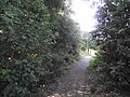
 Footpath through Wembury Gardens, Mowmacre Hill - geograph.org.uk - 5978211.jpg 1,024 × 768; 179 KB
-

-
 Goats at Gorse Hill City Farm - geograph.org.uk - 73264.jpg 640 × 480; 283 KB
-
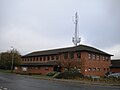
 Guess whose offices these are... - geograph.org.uk - 3472068.jpg 1,306 × 979; 355 KB
-
 Holderness Road - geograph.org.uk - 3498829.jpg 640 × 450; 34 KB
-
 Home Farm shopping centre - geograph.org.uk - 3498817.jpg 640 × 446; 46 KB
-
 Hoods Close in Leicester - geograph.org.uk - 5273572.jpg 800 × 509; 115 KB
-
 Houses of Burdett Way, ^11 nearest - geograph.org.uk - 5991736.jpg 1,024 × 683; 180 KB
-
 Keepers Lodge, Beaumont Centre - geograph.org.uk - 3288158.jpg 1,024 × 768; 121 KB
-
 LeicesterBeaumontLeysWard.svg 2,000 × 2,308; 288 KB
-
 Lismore Walk - geograph.org.uk - 4573872.jpg 2,000 × 1,500; 499 KB
-
 Lismore Walk, Leicester - geograph.org.uk - 4710800.jpg 1,920 × 1,080; 656 KB
-
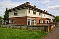
 Marwood Road in Stocking Farm, Leicester - geograph.org.uk - 5503270.jpg 800 × 450; 116 KB
-
 Marwood Road, Leicester - geograph.org.uk - 2482146.jpg 640 × 480; 83 KB
-
 Newbiggin Place - geograph.org.uk - 3498818.jpg 640 × 467; 38 KB
-
 Police station, Beaumont Leys - geograph.org.uk - 5978223.jpg 1,024 × 768; 95 KB
-
 Red Hill Way (A563) - geograph.org.uk - 3589258.jpg 640 × 480; 59 KB
-
 Red Hill Way (A563) - geograph.org.uk - 3589262.jpg 640 × 480; 55 KB
-

-
 Row of houses on Woodstock Road - geograph.org.uk - 5991508.jpg 1,024 × 683; 198 KB
-
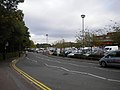 Rutherford Road and car parks, Beaumont Centre - geograph.org.uk - 3288154.jpg 1,024 × 768; 143 KB
-

-
 St Luke's Parish Church - geograph.org.uk - 5273514.jpg 800 × 521; 127 KB
-
 Steps towards Jersey Road, Mowmacre Hill - geograph.org.uk - 5978207.jpg 1,024 × 768; 286 KB
-
 Strasbourg Drive eastwards - geograph.org.uk - 3498819.jpg 640 × 464; 51 KB
-
 Strasbourg Drive westwards - geograph.org.uk - 3498820.jpg 640 × 475; 44 KB
-
 Strasbourg Drive, Leicester - geograph.org.uk - 4710818.jpg 1,920 × 1,080; 633 KB
-
 Tedworth Green, Mowmacre Hill - geograph.org.uk - 5978213.jpg 1,024 × 768; 107 KB
-
 The Church of Christ the King - geograph.org.uk - 4573998.jpg 2,000 × 1,401; 234 KB
-
 Thurcaston Road at Mowmacre Hill - geograph.org.uk - 5273558.jpg 800 × 514; 90 KB
-
 Towards Beaumont Leys Lane - geograph.org.uk - 3498832.jpg 640 × 478; 55 KB
-
 Towards Peppercorn Walk - geograph.org.uk - 3498821.jpg 640 × 503; 55 KB
-
 West car park, Beaumont Centre - geograph.org.uk - 3291059.jpg 1,024 × 768; 191 KB
-
 West side of Beaumont Centre - geograph.org.uk - 3291068.jpg 1,024 × 768; 166 KB
-
 Western part of Jersey Road, Mowmacre Hill - geograph.org.uk - 5978200.jpg 1,024 × 768; 203 KB
-

-
 Old Barn Walk, Beaumont Leys, Leicester - geograph.org.uk - 75822.jpg 640 × 427; 137 KB
-
 Tilling Road, Beaumont Leys, Leicester - geograph.org.uk - 75811.jpg 640 × 427; 153 KB


_-_geograph.org.uk_-_3589258.jpg)
_-_geograph.org.uk_-_3589262.jpg)


