Category:Beckermonds, North Yorkshire
village in United Kingdom  | |||||
| Upload media | |||||
| Instance of | |||||
|---|---|---|---|---|---|
| Location | Buckden, Craven, North Yorkshire, Yorkshire and the Humber, England | ||||
 | |||||
Media in category "Beckermonds, North Yorkshire"
The following 57 files are in this category, out of 57 total.
-
 A day out - geograph.org.uk - 1152884.jpg 640 × 482; 115 KB
-
 Approaching Beckermonds - geograph.org.uk - 2019321.jpg 640 × 480; 116 KB
-

-
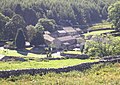
 Beckermonds - geograph.org.uk - 101839.jpg 640 × 480; 128 KB
-
 Beckermonds - geograph.org.uk - 2019489.jpg 640 × 480; 135 KB
-
 Beckermonds - geograph.org.uk - 2022826.jpg 640 × 480; 119 KB
-
 Beckermonds - geograph.org.uk - 551337.jpg 640 × 456; 161 KB
-
 Beckermonds from the west - geograph.org.uk - 4046786.jpg 1,600 × 1,200; 390 KB
-
 Beckermonds, Langstrothdale - geograph.org.uk - 3537768.jpg 1,024 × 768; 150 KB
-
 Beckermonds. - geograph.org.uk - 285523.jpg 640 × 480; 67 KB
-
 Beckermonds.jpg 640 × 480; 234 KB
-
 Benchmark on a barn at Beckermonds - geograph.org.uk - 2984027.jpg 683 × 1,024; 294 KB
-
 Benchmark on letter box at Beckermonds - geograph.org.uk - 2983948.jpg 683 × 1,024; 292 KB
-
 Descent to Beckermonds - geograph.org.uk - 3266361.jpg 4,320 × 3,240; 4.13 MB
-
 Detour from Dales Way near Beckermonds (8th October 2019).jpg 5,152 × 3,864; 7.33 MB
-
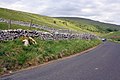
 Dry Stone Wall on Horse Head. - geograph.org.uk - 285502.jpg 640 × 480; 203 KB
-
 Drystone Wall and Forestry. - geograph.org.uk - 285515.jpg 640 × 480; 92 KB
-
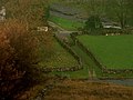
 Farm buildings at Beckermonds - geograph.org.uk - 2984077.jpg 1,024 × 683; 234 KB
-
 Fingerpost at Beckermonds - geograph.org.uk - 3266324.jpg 4,320 × 3,240; 4.14 MB
-
 Footbridge over Green Field Beck at Beckermonds - geograph.org.uk - 4046781.jpg 1,600 × 1,200; 727 KB
-
 Footpath descending to Beckermonds - geograph.org.uk - 3266343.jpg 4,320 × 3,240; 5.7 MB
-

-
 Langstrothdale - geograph.org.uk - 8054.jpg 640 × 427; 86 KB
-
 Langstrothdale east of Beckermonds - geograph.org.uk - 2984223.jpg 1,024 × 683; 213 KB
-
 Limestone outcrops west of Beckermonds - geograph.org.uk - 2981889.jpg 1,024 × 683; 255 KB
-
 Looking downhill towards Beckermonds - geograph.org.uk - 1366027.jpg 640 × 426; 75 KB
-
 Moorland near Beckermonds - geograph.org.uk - 1848134.jpg 2,592 × 1,944; 1.15 MB
-
 Moss Growing on Drystone Wall. - geograph.org.uk - 285518.jpg 640 × 480; 284 KB
-
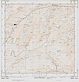 Ordnance Survey Sheet SD 88 Published 1952.jpg 7,189 × 7,522; 5.43 MB
-

-
 Source of River Wharfe geograph-1499556-by-Richard-Buck.jpg 640 × 425; 80 KB
-
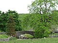 The bridge at Beckermonds (geograph 3537776).jpg 1,024 × 768; 182 KB
-
 The infant Wharfe - geograph.org.uk - 216441.jpg 640 × 480; 143 KB
-
 The Post Box at Beckermonds - geograph.org.uk - 3266321.jpg 3,240 × 4,320; 4.45 MB
-
 The Wharfe at Beckermonds - geograph.org.uk - 2022833.jpg 640 × 480; 153 KB
-
 Trailer near Beckermonds - geograph.org.uk - 2021251.jpg 640 × 480; 121 KB
-
 Trees. - geograph.org.uk - 285058.jpg 480 × 640; 240 KB
-
 Area of Shake Holes. - geograph.org.uk - 285522.jpg 640 × 480; 214 KB
-
 Beckermonds - geograph.org.uk - 556892.jpg 640 × 480; 116 KB
-
 Dry Stone Walls on Eller Carr Moss. - geograph.org.uk - 285514.jpg 640 × 480; 194 KB
-
 Farmhouse at Beckermonds. - geograph.org.uk - 285530.jpg 640 × 480; 285 KB
-
 Faws. - geograph.org.uk - 285526.jpg 640 × 480; 95 KB
-
 Ford at Beckermonds. - geograph.org.uk - 285528.jpg 640 × 480; 85 KB
-
 Forestry and Moorland above Beckermonds. - geograph.org.uk - 285521.jpg 640 × 480; 208 KB
-
 Forestry Track on West Moor. - geograph.org.uk - 284817.jpg 640 × 480; 79 KB
-
 Maze. - geograph.org.uk - 284828.jpg 640 × 480; 90 KB
-
 Moss above Oughtershaw. - geograph.org.uk - 283871.jpg 640 × 480; 206 KB
-
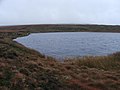 Oughtershaw Tarn. - geograph.org.uk - 283868.jpg 640 × 480; 216 KB
-
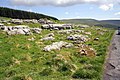
 Pile of Stones on Eller Carr Moss. - geograph.org.uk - 285504.jpg 640 × 480; 223 KB
-
 Pond on Eller Carr Moss. - geograph.org.uk - 285505.jpg 640 × 480; 215 KB
-
 Rocks beside Oughtershaw Tarn. - geograph.org.uk - 284113.jpg 640 × 480; 235 KB
-
 Shaft of Sunlight. - geograph.org.uk - 285525.jpg 640 × 480; 212 KB
-
 Small Unnamed Tarn. - geograph.org.uk - 284108.jpg 640 × 480; 214 KB
-
 Stile on Eller Carr. - geograph.org.uk - 285064.jpg 640 × 480; 78 KB
-
 Trackside Stream. - geograph.org.uk - 285067.jpg 480 × 640; 245 KB
-
 Trees at Faws. - geograph.org.uk - 285532.jpg 640 × 480; 266 KB
-
 Wall and Fence near Oughtershaw Tarn. - geograph.org.uk - 284311.jpg 640 × 480; 238 KB


.jpg)


.jpg)


