Category:Behren-Lübchin
municipality of Germany   | |||||
| Upload media | |||||
| Instance of |
| ||||
|---|---|---|---|---|---|
| Location | Rostock District, Mecklenburg-Western Pomerania, Germany | ||||
| Population |
| ||||
| Area |
| ||||
| Elevation above sea level |
| ||||
| official website | |||||
 | |||||
Subcategories
This category has the following 8 subcategories, out of 8 total.
A
- Gut Alt Quitzenow (2 F)
B
- Gut Bobbin (4 F)
- Burgwall Neu Nieköhr (3 F)
- Burgwall Behren-Lübchin (6 F)
C
D
- Duckwitzer See (1 F)
G
- Großsteingrab Viecheln (1 F)
W
Media in category "Behren-Lübchin"
The following 9 files are in this category, out of 9 total.
-
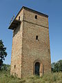 Alt Quitzenow Wasserturm 2009-08-20 104.jpg 1,536 × 2,048; 1.99 MB
-
 Alt Quitzenow Wasserturm Blick durchs Fenster 2009-08-20 103.jpg 1,536 × 2,048; 1.66 MB
-
 Behren-Luebchin Wasdow Alt Quitzenow Wasserturm.jpg 2,736 × 3,648; 2.56 MB
-
 Behren-Lübchin in GÜ.PNG 299 × 299; 6 KB
-
 Bobbin LK Guestrow Friedhofskapelle.JPG 2,617 × 1,947; 1.34 MB
-

-

-
 Tumuli in Neu Quitzenow.jpg 2,816 × 2,112; 2.22 MB
-
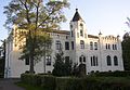 Viecheln manor.jpg 1,770 × 1,230; 370 KB


