Category:Beinn Dòrain

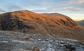
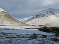
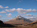
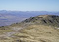
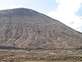
Beinn Dòrain (Gaelic: Beinn Dòbhrain 'hill of the streamlet' or 'hill of the otters'), is a mountain located in the Bridge of Orchy hills of Argyll and Bute, Scotland. It is one of the most recognisable mountains in Scotland, as it curves gracefully up from the West Highland Way.
1076m high mountain in Argyll and Bute, Scotland, UK  | |||||
| Upload media | |||||
| Instance of | |||||
|---|---|---|---|---|---|
| Location |
| ||||
| Mountain range | |||||
| Topographic prominence |
| ||||
| Elevation above sea level |
| ||||
| Parent peak | |||||
 | |||||
Subcategories
This category has the following 2 subcategories, out of 2 total.
A
B
- Beinn an Dòthaidh (35 F)
Media in category "Beinn Dòrain"
The following 150 files are in this category, out of 150 total.
-
 A bouldery burn, Glen Orchy - geograph.org.uk - 775202.jpg 640 × 480; 115 KB
-
 A fairly full Abhainn Shira - geograph.org.uk - 712591.jpg 1,000 × 668; 309 KB
-
 A small loch in the saddle between Beinn an Dothaidh and Beinn Dorain, Scotland 01.jpg 5,090 × 2,962; 7.16 MB
-
 A82 looking north to Beinn Dorain - geograph.org.uk - 72440.jpg 640 × 480; 73 KB
-
 Abhainn Shira - geograph.org.uk - 1003185.jpg 640 × 480; 113 KB
-
 Abhainn Shira - geograph.org.uk - 204611.jpg 478 × 640; 148 KB
-
 Abhainn Shira - geograph.org.uk - 919849.jpg 640 × 469; 65 KB
-
 Allt Coire a' Ghathalach - geograph.org.uk - 1421381.jpg 640 × 480; 71 KB
-
 Approaching Beinn Dòrain - geograph.org.uk - 956548.jpg 500 × 375; 80 KB
-
 Approaching Coire an Dòthaidh - geograph.org.uk - 918313.jpg 640 × 426; 51 KB
-

-
 Argyll and Bute, UK - panoramio (7).jpg 1,600 × 1,200; 652 KB
-
 Auch - geograph.org.uk - 27399.jpg 409 × 640; 102 KB
-
 Auch viaduct and Glen Coralan - geograph.org.uk - 1186220.jpg 640 × 480; 94 KB
-
 Auch viaduct below Beinn Dorain - geograph.org.uk - 720629.jpg 640 × 426; 67 KB
-
 Autumnal rainbow 1985 - geograph.org.uk - 290214.jpg 640 × 405; 43 KB
-
 Beinn an Dothaidh during sunrise, Scotland.jpg 5,457 × 3,331; 10.85 MB
-

-
 Beinn Bhreac-liath - geograph.org.uk - 86432.jpg 640 × 191; 57 KB
-
 Beinn Dorain (1076m) - geograph.org.uk - 3071974.jpg 800 × 600; 65 KB
-
 Beinn Dorain (6631373019).jpg 2,592 × 1,936; 1.4 MB
-
 Beinn Dorain (6631373919).jpg 2,592 × 1,936; 1.37 MB
-
 Beinn Dorain - geograph.org.uk - 10431.jpg 640 × 480; 181 KB
-
 Beinn Dorain - geograph.org.uk - 1577544.jpg 480 × 640; 70 KB
-
 Beinn Dorain - geograph.org.uk - 2341990.jpg 800 × 487; 293 KB
-
 Beinn Dorain - geograph.org.uk - 877195.jpg 640 × 480; 51 KB
-
-
 Beinn Dorain dominates the view ahead - geograph.org.uk - 4074404.jpg 4,608 × 3,456; 3.76 MB
-
 Beinn Dorain from A82 near Auch - panoramio - SteveMi.jpg 2,560 × 1,920; 2.27 MB
-
 Beinn Dorain from A82 near Auch - panoramio.jpg 2,560 × 1,920; 2.21 MB
-
 Beinn Dorain from Beinn Odhar.jpg 2,000 × 1,500; 259 KB
-
 Beinn Dorain from the A82 - geograph.org.uk - 1166157.jpg 640 × 480; 43 KB
-
 Beinn Dorain from the A82 - geograph.org.uk - 1166171.jpg 640 × 480; 41 KB
-

-
 Beinn Dorain Summit Cairn - geograph.org.uk - 2351120.jpg 640 × 480; 80 KB
-
 Beinn Dorain View - geograph.org.uk - 3122088.jpg 640 × 425; 78 KB
-
 Beinn Dorain View - geograph.org.uk - 3122097.jpg 640 × 383; 58 KB
-
 Beinn Dorain viewed from the south - geograph.org.uk - 919505.jpg 640 × 426; 64 KB
-
 Beinn Dorain's north ridge - geograph.org.uk - 1767979.jpg 800 × 600; 227 KB
-
 Beinn Dorain.jpg 3,504 × 2,336; 2.46 MB
-
 Beinn Dòrain north ridge - geograph.org.uk - 122166.jpg 640 × 453; 70 KB
-
 Beinn Dòrain south top - geograph.org.uk - 780812.jpg 640 × 480; 61 KB
-
 Beinn Dòrain, the south top - geograph.org.uk - 780823.jpg 640 × 480; 71 KB
-
 Beinn Dòrain, top of the south ridge - geograph.org.uk - 780848.jpg 640 × 480; 77 KB
-
 Beinn Odhar - geograph.org.uk - 267226.jpg 640 × 446; 67 KB
-
 Beinn Odhar - geograph.org.uk - 770448.jpg 640 × 480; 75 KB
-
 Ben Dorain - geograph.org.uk - 107747.jpg 640 × 480; 113 KB
-
 Ben Dorain - geograph.org.uk - 206276.jpg 640 × 480; 66 KB
-
 Ben Dorain from the old road - geograph.org.uk - 2265442.jpg 715 × 479; 75 KB
-
 Bridge of Orchy - geograph.org.uk - 1377885.jpg 1,000 × 669; 333 KB
-
 Cairn on top of Beinn Udlaidh - geograph.org.uk - 102713.jpg 640 × 480; 36 KB
-

-

-
 Coire a' Ghabhalach - geograph.org.uk - 778329.jpg 640 × 359; 73 KB
-
 Coire an Dòthaidh - geograph.org.uk - 782826.jpg 640 × 480; 100 KB
-
 Crianlarich - Flickr - Graham Grinner Lewis.jpg 3,648 × 2,736; 2.54 MB
-
 Duncan Ban MacIntyre memorial - geograph.org.uk - 952636.jpg 640 × 480; 80 KB
-
 Former A82 under Beinn Odhar - geograph.org.uk - 14373.jpg 400 × 263; 10 KB
-
 Icing on the North Ridge of Beinn Dòrain - geograph.org.uk - 1745617.jpg 1,024 × 683; 269 KB
-
 Inferior pasture on the Auch Estate - geograph.org.uk - 784514.jpg 640 × 426; 60 KB
-
 Loch Lyon from An Grianan - geograph.org.uk - 8301.jpg 640 × 480; 69 KB
-
 Loch Lyon looking west - geograph.org.uk - 1607857.jpg 640 × 480; 78 KB
-
 Lochan at the bealach - geograph.org.uk - 1421326.jpg 640 × 480; 66 KB
-
 Lochan below Beinn an Dòthaidh - geograph.org.uk - 782814.jpg 640 × 480; 78 KB
-
 Lochan on col above Coire Chailein - geograph.org.uk - 1301801.jpg 640 × 480; 88 KB
-
 Looking towards Beinn Dòrain - geograph.org.uk - 3451910.jpg 640 × 480; 138 KB
-
 Meall Garbh - geograph.org.uk - 771514.jpg 640 × 359; 63 KB
-
 Meall Garbh - geograph.org.uk - 778323.jpg 640 × 359; 72 KB
-
 Meall Garbh - geograph.org.uk - 779861.jpg 640 × 480; 84 KB
-
 Meall Tionail - geograph.org.uk - 770768.jpg 640 × 480; 96 KB
-
 Meall Tionail, Beinn Dòrain - geograph.org.uk - 778325.jpg 640 × 359; 59 KB
-
 Morning mist Beinn Dorain - geograph.org.uk - 952467.jpg 640 × 480; 28 KB
-
 North ridge below Beinn Dòrain - geograph.org.uk - 122158.jpg 640 × 531; 83 KB
-
 North ridge of Beinn Dòrain - geograph.org.uk - 771671.jpg 640 × 359; 55 KB
-
 North ridge of Beinn Dòrain - geograph.org.uk - 771915.jpg 640 × 480; 67 KB
-
 North ridge of Beinn Dòrain - geograph.org.uk - 780880.jpg 640 × 480; 63 KB
-
 On Beinn Dorain's north ridge - geograph.org.uk - 740784.jpg 1,000 × 666; 249 KB
-
 On the West Highland Way - geograph.org.uk - 176411.jpg 640 × 480; 99 KB
-
 Outflow from Loch Tulla - geograph.org.uk - 780840.jpg 637 × 391; 54 KB
-
 Parallel burns, Leacann Beinn Dòrain - geograph.org.uk - 775844.jpg 640 × 480; 128 KB
-
 Path erosion, Allt Coire an Dothaidh - geograph.org.uk - 782878.jpg 640 × 480; 90 KB
-
 Rannoch Moor - geograph.org.uk - 1533816.jpg 640 × 480; 92 KB
-
 Rock cairn at Cairn Sasunnaich, Scotland.jpg 5,471 × 2,855; 8.08 MB
-
 Rowan berries, Bridge of Orchy - geograph.org.uk - 1495872.jpg 640 × 480; 140 KB
-
 Scenic salt lick - geograph.org.uk - 1301757.jpg 640 × 480; 93 KB
-
 South ridge of Stob Ghabhar - geograph.org.uk - 107461.jpg 640 × 480; 67 KB
-
 South ridge, Beinn Dòrain - geograph.org.uk - 776698.jpg 640 × 480; 80 KB
-
 Southern reaches of Loch Lyon - geograph.org.uk - 1333060.jpg 640 × 480; 71 KB
-
 Summit cairn of Meall Garbh - geograph.org.uk - 779872.jpg 640 × 480; 58 KB
-
 The Auch Glen - geograph.org.uk - 776744.jpg 640 × 480; 69 KB
-
 The Auch Horseshoe - geograph.org.uk - 771532.jpg 640 × 300; 58 KB
-
 The Auch Viaduct - geograph.org.uk - 770454.jpg 480 × 640; 73 KB
-
 The bottom of Beinn Dorain's north ridge - geograph.org.uk - 1018724.jpg 800 × 525; 194 KB
-
 The north shoulder of Creag Mhor - geograph.org.uk - 1607985.jpg 640 × 480; 88 KB
-
 The northwest side of the Auch Glen - geograph.org.uk - 776885.jpg 640 × 359; 58 KB
-
 The old road to Lochaber. - geograph.org.uk - 27396.jpg 473 × 640; 60 KB
-
 The south summit, Beinn Dòrain - geograph.org.uk - 771608.jpg 640 × 480; 81 KB
-
 The West Highland Way at Auch Gleann - geograph.org.uk - 176416.jpg 640 × 480; 121 KB
-
 View north east from Beinn Dorain - geograph.org.uk - 740801.jpg 1,000 × 668; 277 KB
-
 View north west from Beinn Dorain - geograph.org.uk - 740793.jpg 1,000 × 665; 311 KB
-
 View of Beinn Dorain - geograph.org.uk - 693307.jpg 640 × 427; 50 KB
-
 View south from Meall a' Phuill - geograph.org.uk - 754602.jpg 640 × 426; 44 KB
-
 View southeast from the Màm Carraigh - geograph.org.uk - 1105014.jpg 1,000 × 644; 439 KB
-
 View towards Beinn Dorain - geograph.org.uk - 2439189.jpg 1,000 × 700; 209 KB
-
 View towards Beinn Dorain - geograph.org.uk - 2439196.jpg 1,000 × 723; 238 KB
-
-
 West Highland Railway - geograph.org.uk - 865938.jpg 480 × 640; 86 KB
-

-

-
 West Highland Way below Beinn Odhair - geograph.org.uk - 106739.jpg 640 × 469; 72 KB
-

-
 A rare forked burn on Beinn Dòrain - geograph.org.uk - 775897.jpg 480 × 640; 103 KB
-
 Ais-an t-Sìdhean - geograph.org.uk - 770712.jpg 640 × 480; 68 KB
-
 Allt Coire a' Ghathalach - geograph.org.uk - 770757.jpg 640 × 480; 111 KB
-
 Allt Coire a' Ghathalach - geograph.org.uk - 777367.jpg 640 × 480; 97 KB
-
 Allt Coire an Dòthaidh - geograph.org.uk - 782869.jpg 480 × 640; 91 KB
-
 Allt Coire Dubhchraig - geograph.org.uk - 219303.jpg 640 × 478; 111 KB
-
 Allt Kinglass, Upper Glen Orchy - geograph.org.uk - 771615.jpg 640 × 480; 69 KB
-
 Allt na h-Annait - geograph.org.uk - 770688.jpg 480 × 640; 91 KB
-

-
 Beinn Achaladair - geograph.org.uk - 779866.jpg 640 × 359; 64 KB
-
 Beinn an Dòthaidh - geograph.org.uk - 780871.jpg 640 × 359; 65 KB
-
 Beinn Dorain - geograph.org.uk - 641036.jpg 600 × 300; 99 KB
-
 Beinn Dòrain - geograph.org.uk - 776706.jpg 640 × 480; 67 KB
-
 Beinn Dòrain - geograph.org.uk - 782846.jpg 640 × 359; 60 KB
-
 Beinn Dòrain from the Auch Glen - geograph.org.uk - 776737.jpg 480 × 640; 76 KB
-
 Beinn Dòrain, north ridge - geograph.org.uk - 780860.jpg 640 × 480; 82 KB
-
 Beinn Dòrain, the north top - geograph.org.uk - 780834.jpg 640 × 480; 65 KB
-
 Below Coire Chruitein - geograph.org.uk - 770462.jpg 640 × 480; 73 KB
-
 Ben Dorain - geograph.org.uk - 822230.jpg 640 × 480; 55 KB
-

-
 Coire a' Ghabhalach - geograph.org.uk - 771034.jpg 640 × 359; 73 KB
-
 Coire a' Ghathalach - geograph.org.uk - 777443.jpg 640 × 480; 100 KB
-
 Coire a' Ghathalach - geograph.org.uk - 777446.jpg 640 × 359; 70 KB
-
 Coire an Dòthaidh - geograph.org.uk - 771946.jpg 640 × 359; 49 KB
-
 Crags and cornices, Beinn Dòrain - geograph.org.uk - 771549.jpg 640 × 480; 69 KB
-
 Doire Grotha - geograph.org.uk - 770435.jpg 480 × 640; 100 KB
-
 East end of Aonach Eagach - geograph.org.uk - 330455.jpg 640 × 415; 72 KB
-
 East ridge of Beinn Dòrain - geograph.org.uk - 777987.jpg 640 × 480; 72 KB
-
 Glen Coralan - geograph.org.uk - 27400.jpg 640 × 401; 48 KB
-
 Head of Coire Daingean - geograph.org.uk - 20175.jpg 640 × 416; 65 KB
-
 High on Stob Coire Odhair - geograph.org.uk - 12347.jpg 640 × 443; 95 KB
-
 Highland landscape - geograph.org.uk - 435886.jpg 640 × 480; 105 KB
-
 Leacann Beinn Dòrain - geograph.org.uk - 775839.jpg 640 × 480; 122 KB
-
 Lochan Coire Thoraidh - geograph.org.uk - 422350.jpg 640 × 480; 96 KB
-

-
 Summit of Beinn a' Chaisteil. - geograph.org.uk - 27462.jpg 452 × 296; 21 KB
-
 Summit of Beinn Dorain - geograph.org.uk - 664680.jpg 640 × 470; 43 KB
-
 The Duncan Ban MacIntyre Memorial - geograph.org.uk - 435883.jpg 640 × 480; 110 KB
-
 Typical peat bog - geograph.org.uk - 418640.jpg 640 × 480; 82 KB


.jpg)


_-_geograph.org.uk_-_3071974.jpg)
.jpg)
.jpg)


