Category:Beinn Tharsuinn, Garelochhead

Media in category "Beinn Tharsuinn, Garelochhead"
The following 14 files are in this category, out of 14 total.
-
 Allt Bhaile a' Mhuillin - geograph.org.uk - 721587.jpg 640 × 480; 68 KB
-
 Auchengaich Hill - geograph.org.uk - 721595.jpg 640 × 480; 67 KB
-
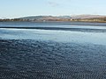 Exposed sand, near Ardmore - geograph.org.uk - 1076096.jpg 640 × 480; 77 KB
-
 Fence on the moor - geograph.org.uk - 1301508.jpg 640 × 480; 78 KB
-
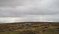
 Hilltop near Tom na h-Airidh - geograph.org.uk - 981435.jpg 640 × 480; 61 KB
-

-
 Woods alongside the Stuckiedow Burn - geograph.org.uk - 1301331.jpg 640 × 480; 67 KB
-
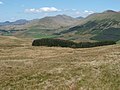
 Beinn Chaorach - geograph.org.uk - 481421.jpg 640 × 427; 114 KB
-
 Beinn Tharsuinn - Balcnock ridge - geograph.org.uk - 721583.jpg 640 × 480; 71 KB
-
 Beinn Tharsuinn - geograph.org.uk - 719382.jpg 640 × 375; 34 KB
-
 Climbing Beinn Tharsuinn, Luss Hills - geograph.org.uk - 125092.jpg 640 × 480; 147 KB
-
 Col below Beinn Tharsuinn - geograph.org.uk - 719371.jpg 639 × 449; 57 KB
-
 Col below Beinn Tharsuinn - geograph.org.uk - 719374.jpg 640 × 480; 57 KB
-
 Headwall, Coire Coinghil - geograph.org.uk - 719367.jpg 640 × 480; 57 KB


