Category:Belleeks
village in the United Kingdom  | |||||
| Upload media | |||||
| Instance of | |||||
|---|---|---|---|---|---|
| Location | Northern Ireland | ||||
 | |||||
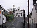
English: Belleeks or Belleek is a small village in south County Armagh, Northern Ireland. In the 2001 Census it had a population of 150 people. It lies within the Newry and Mourne District Council area and in the Barony of Upper Fews.
Media in category "Belleeks"
The following 124 files are in this category, out of 124 total.
-
 "Good Luck Belleek" sign - geograph.org.uk - 1542700.jpg 640 × 480; 118 KB
-
 "Hands off our School", Belleek - geograph.org.uk - 1542676.jpg 640 × 480; 125 KB
-

-

-

-
 Agricultural traffic on the Barr Road - geograph.org.uk - 4220196.jpg 1,600 × 1,197; 299 KB
-

-

-

-
 Ascending the Annacloghmullin mountain road - geograph.org.uk - 4221307.jpg 1,600 × 1,200; 693 KB
-
 Bad bend in the A25 East of Belleek - geograph.org.uk - 6194876.jpg 3,506 × 1,629; 3.22 MB
-

-

-
 Belleek, County Armagh - geograph.org.uk - 1542672.jpg 640 × 480; 84 KB
-
 Belleeks Post Office - geograph.org.uk - 1542693.jpg 640 × 480; 98 KB
-
 Blackrock Fuels on the A25 - geograph.org.uk - 6178112.jpg 3,838 × 2,770; 5.53 MB
-
 Blind summit on the Annacloghmullin mountain road - geograph.org.uk - 4221721.jpg 1,600 × 1,200; 333 KB
-
 Bungalow above the Newry Road outside Belleek - geograph.org.uk - 6193687.jpg 4,000 × 3,000; 2.77 MB
-

-

-
 Derelict farmhouse south of the Duburren Road - geograph.org.uk - 6244978.jpg 4,000 × 3,000; 5.37 MB
-
 Disused stone quarry west of Belleek - geograph.org.uk - 6237247.jpg 4,000 × 3,000; 2.36 MB
-

-
 Entering Belleek - geograph.org.uk - 1542675.jpg 640 × 480; 81 KB
-
 Entering the village of Belleek from the East along the A25 - geograph.org.uk - 6236481.jpg 2,510 × 1,775; 2.26 MB
-
 Entering the village of Belleek from the West along the A25 - geograph.org.uk - 6186434.jpg 2,551 × 2,242; 2.44 MB
-

-
 Farm access lane on the Annacloghmullin mountain road - geograph.org.uk - 4221305.jpg 1,600 × 1,200; 719 KB
-
 Farm buildings on the Shaughan Road - geograph.org.uk - 4166947.jpg 1,024 × 768; 229 KB
-
 Farm bungalow alongside the A25 west of Belleek - geograph.org.uk - 6178121.jpg 3,699 × 2,049; 4.99 MB
-

-
 Farm house on Shaughan Road - geograph.org.uk - 4212738.jpg 1,024 × 768; 236 KB
-

-
 Farmhouse and outbuildings on the Barr Road - geograph.org.uk - 6247878.jpg 2,669 × 1,998; 3.11 MB
-

-

-

-

-
 Francis Hughes Park, Belleek - geograph.org.uk - 1542685.jpg 640 × 480; 104 KB
-
 Frontier bus alongside the Newry Road - geograph.org.uk - 6193696.jpg 3,579 × 2,338; 4.58 MB
-
 Fuchsia hedges on Shaughan Road - geograph.org.uk - 4214097.jpg 1,024 × 768; 213 KB
-
 Fuchsia hedges on the Annacloghmullin mountain road - geograph.org.uk - 4221511.jpg 1,600 × 1,200; 659 KB
-

-
 Fáilte go Béal Leice^ - geograph.org.uk - 1542670.jpg 640 × 480; 146 KB
-

-

-

-

-
 Improved grassland between two areas of wildscape - geograph.org.uk - 4221802.jpg 1,600 × 1,200; 463 KB
-

-

-

-

-

-
 Main Street, Belleek - geograph.org.uk - 1542691.jpg 640 × 480; 94 KB
-
 Memorial to the Hunger Strikers, Belleek - geograph.org.uk - 1542689.jpg 640 × 480; 152 KB
-

-

-
 Newry Road about 1km East of Belleek - geograph.org.uk - 6193679.jpg 3,677 × 2,119; 6.42 MB
-
 Newtown Road near Belleek - geograph.org.uk - 1542652.jpg 640 × 480; 119 KB
-

-

-
 Private access lane off the Shaughan Road - geograph.org.uk - 4214086.jpg 1,024 × 768; 359 KB
-

-
 Private farm lane linking Tate Road and Shaughan Road - geograph.org.uk - 6167862.jpg 3,372 × 2,040; 4.74 MB
-

-
 Red farm shed on Shaughan Road - geograph.org.uk - 4213954.jpg 1,024 × 768; 181 KB
-
 Right-hand bend in the Shaughan Road - geograph.org.uk - 4213901.jpg 1,024 × 768; 174 KB
-
 Rolling country side in the upper Forkhill River valley - geograph.org.uk - 4221865.jpg 1,600 × 1,200; 394 KB
-
 Roofless cottage on the Barr Road - geograph.org.uk - 4224440.jpg 1,600 × 1,200; 683 KB
-

-
 Settlement along Shaughan Road - geograph.org.uk - 4213890.jpg 1,024 × 768; 164 KB
-

-
 Shaughan Road entering hilly country - geograph.org.uk - 4214090.jpg 1,024 × 768; 173 KB
-
 Shaughan Road outside the Laurence O'Toole GAAC - geograph.org.uk - 4210055.jpg 1,024 × 768; 126 KB
-
 Shaughan Road south of the Laurence O'Toole GAAC - geograph.org.uk - 4212687.jpg 1,024 × 768; 206 KB
-
 Southern end of the Annacloghmullins mountain road - geograph.org.uk - 4224480.jpg 1,600 × 1,200; 569 KB
-
-

-
 Start of the descent down to Shaughan Road - geograph.org.uk - 4221850.jpg 1,600 × 1,200; 533 KB
-
 Steep descent on the Barr Road - geograph.org.uk - 6245338.jpg 4,000 × 3,000; 2.57 MB
-

-

-
 Sugar Loaf Hill and Camlough Mountain from the Barr Road - geograph.org.uk - 6245221.jpg 2,617 × 1,931; 2.3 MB
-
 Sycamore tree on the Barr Road - geograph.org.uk - 6248114.jpg 2,669 × 1,998; 2.61 MB
-
 The A25 (Newtown Road) in the village of Belleek - geograph.org.uk - 6178096.jpg 4,000 × 3,000; 2.29 MB
-

-

-

-

-

-

-

-
 The Newry bus stop at Belleek - geograph.org.uk - 6178074.jpg 3,781 × 1,892; 3.48 MB
-
 The Newry Road at its approach towards Belleek - geograph.org.uk - 6193675.jpg 3,437 × 1,712; 3.41 MB
-
 The North-western end of Courtney Roads - geograph.org.uk - 6243867.jpg 4,000 × 3,000; 2.92 MB
-

-

-

-
 The southern end of Barr Road at Annacloghmullin - geograph.org.uk - 4220191.jpg 1,600 × 1,200; 457 KB
-
 The western end of Barr Road viewed from Shaughan Road - geograph.org.uk - 4219583.jpg 1,600 × 1,197; 278 KB
-
 The western end of Duburren Road - geograph.org.uk - 6244976.jpg 3,970 × 2,958; 7.51 MB
-

-
 Track leading on to Annacloghmullin Mountain - geograph.org.uk - 4221314.jpg 1,600 × 1,200; 558 KB
-
 Tractor piggy-back on Shaughan Road - geograph.org.uk - 4214121.jpg 1,024 × 768; 157 KB
-
 Traditional cottage on the Duburren Road - geograph.org.uk - 6243847.jpg 4,000 × 3,000; 2.91 MB
-
 Trimmed hedges alongside the A25 West of Belleek - geograph.org.uk - 6194880.jpg 3,610 × 2,000; 4.22 MB
-
 Undulating grazing land west of Shaughan Road - geograph.org.uk - 4213899.jpg 1,024 × 768; 180 KB
-

-

-

-

-
 View across farmland between Barr Road and Crooked Road - geograph.org.uk - 4224468.jpg 1,600 × 1,184; 280 KB
-
 View north along Barr Road - geograph.org.uk - 4224444.jpg 1,600 × 1,200; 490 KB
-
 View North along Barr Road - geograph.org.uk - 6244980.jpg 4,000 × 3,000; 2.35 MB
-

-

-

-

-
 View west towards the Shaughan Road corridor - geograph.org.uk - 4221874.jpg 1,600 × 1,200; 622 KB
-

-

-

-
 Wooded rock outcrops above the Forkhill valley - geograph.org.uk - 4213932.jpg 1,024 × 768; 219 KB


_in_the_village_of_Belleek_-_geograph.org.uk_-_6178096.jpg)


