Category:Ben Rhydding
village in West Yorkshire, United Kingdom  | |||||
| Upload media | |||||
| Instance of | |||||
|---|---|---|---|---|---|
| Location | Ilkley, Bradford, West Yorkshire, Yorkshire and the Humber, England | ||||
 | |||||
English: Ben Rhydding is a Wharfedale village in the Metropolitan Borough of Bradford, West Yorkshire, England. It is part of the Ilkley urban area and civil parish.
Subcategories
This category has the following 9 subcategories, out of 9 total.
B
- Ben Rhydding Hydro (10 F)
C
- Coutances Way, Ilkley (4 F)
D
- Denton Bridge (Yorkshire) (5 F)
H
J
R
- Rivock Edge (3 F)
Media in category "Ben Rhydding"
The following 75 files are in this category, out of 75 total.
-
 A Back Lane in Ben Rhydding - geograph.org.uk - 1329581.jpg 640 × 480; 125 KB
-
 Avenue by the Craiglands Hotel - geograph.org.uk - 1024511.jpg 480 × 640; 143 KB
-
 Beck Foot Farm - geograph.org.uk - 547586.jpg 640 × 480; 115 KB
-
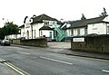
 Ben Rhydding - geograph.org.uk - 1329573.jpg 640 × 480; 105 KB
-

-
 Ben Rhydding Drive, Ben Rhydding - geograph.org.uk - 2905581.jpg 2,592 × 1,944; 941 KB
-
 Ben Rhydding from the moor edge - geograph.org.uk - 1020367.jpg 480 × 640; 95 KB
-
 Ben Rhydding Golf Course (2548720227).jpg 2,509 × 1,784; 3.39 MB
-
 Ben Rhydding Golf Course Hole 14 - geograph.org.uk - 2454865.jpg 4,320 × 3,240; 3.43 MB
-
 Ben Rhydding Gravel Pits - geograph.org.uk - 1550936.jpg 480 × 640; 139 KB
-

-
-

-
 Bolling Road, Ben Rhydding - geograph.org.uk - 1332362.jpg 640 × 480; 87 KB
-
 Bolling Road, Ben Rhydding - geograph.org.uk - 56006.jpg 640 × 480; 97 KB
-

-
 Bus Shelter - Bolling Road, Ben Rhydding - geograph.org.uk - 911330.jpg 640 × 502; 263 KB
-
 Coronation Hospital - Springs Lane - geograph.org.uk - 911329.jpg 640 × 442; 199 KB
-
 Cow and Calf Hotel - geograph.org.uk - 844062.jpg 640 × 480; 64 KB
-
 Disused Quarry - geograph.org.uk - 755517.jpg 640 × 426; 69 KB
-
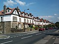
 East Parade - Dean Street - geograph.org.uk - 1197764.jpg 640 × 480; 237 KB
-
 East Parade - Little Lane - geograph.org.uk - 1197805.jpg 640 × 480; 267 KB
-
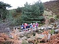
 Field and Footbridge - geograph.org.uk - 1132332.jpg 640 × 475; 89 KB
-
 Fieldway - Valley Drive - geograph.org.uk - 911364.jpg 640 × 463; 230 KB
-
 Foot Bridge over Backstone Beck - geograph.org.uk - 615606.jpg 640 × 480; 113 KB
-
 Footpath - Bolling Road, Ben Rhydding - geograph.org.uk - 911331.jpg 478 × 640; 285 KB
-
 Footpath - Cowpasture Road - geograph.org.uk - 911319.jpg 555 × 640; 367 KB
-
 Footpath to Ilkley Moor - geograph.org.uk - 620732.jpg 640 × 480; 129 KB
-
 Golden Butts Road - Little Lane - geograph.org.uk - 1197806.jpg 640 × 438; 175 KB
-
 Gordon Street - North Parade - geograph.org.uk - 1197774.jpg 640 × 480; 231 KB
-
 Hangingstone Road - geograph.org.uk - 755527.jpg 640 × 426; 86 KB
-
 High Lanshaw Dam - geograph.org.uk - 744114.jpg 640 × 426; 92 KB
-
 House near Ben Rhydding - geograph.org.uk - 1981700.jpg 3,072 × 2,048; 246 KB
-
 House on the southern edge of Ben Rhydding - geograph.org.uk - 1981728.jpg 2,048 × 3,072; 342 KB
-
 Houses at the southern edge of Ben Rhydding - geograph.org.uk - 1981706.jpg 3,072 × 2,048; 264 KB
-

-
 International Wool Secretariat building, Ben Rhydding, Ilkley.jpg 1,210 × 710; 242 KB
-
 Lower Wellington Road - Little Lane - geograph.org.uk - 1197807.jpg 640 × 430; 207 KB
-
 Mayfield Avenue - Valley Drive - geograph.org.uk - 911371.jpg 640 × 429; 176 KB
-
 Mayfield Road - Little Lane - geograph.org.uk - 1197784.jpg 640 × 410; 166 KB
-

-
 Mornington Road - Little Lane - geograph.org.uk - 1197801.jpg 640 × 472; 204 KB
-
 Mount Stead - geograph.org.uk - 755543.jpg 640 × 426; 85 KB
-
 North Parade - East Parade - geograph.org.uk - 1197770.jpg 640 × 480; 229 KB
-
 North Parade - Little Lane - geograph.org.uk - 1197796.jpg 640 × 480; 249 KB
-
 North side of Ilkley Moor - geograph.org.uk - 1020365.jpg 640 × 332; 43 KB
-
 On the edge of the moor - geograph.org.uk - 671229.jpg 640 × 399; 61 KB
-
 Optident Office Building - geograph.org.uk - 1139051.jpg 640 × 480; 108 KB
-
 Playground - Backstone Way, Valley Drive - geograph.org.uk - 911375.jpg 640 × 404; 210 KB
-
 Post Office - Wheatley Lane, Ben Rhydding - geograph.org.uk - 911301.jpg 640 × 473; 221 KB
-
 Reflections in the tarn. - geograph.org.uk - 755489.jpg 640 × 426; 83 KB
-
 Rombald's Lane, Ben Rhydding - geograph.org.uk - 2454883.jpg 4,320 × 3,240; 4.2 MB
-

-
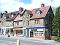
 Shopping parade, Ben Rhydding - geograph.org.uk - 56004.jpg 640 × 480; 130 KB
-

-
 Springs Medical Centre - Springs Lane - geograph.org.uk - 911326.jpg 640 × 437; 222 KB
-
-
 Storm Damage - geograph.org.uk - 755531.jpg 640 × 426; 109 KB
-
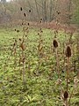
 Teasels at Ben Rhydding - geograph.org.uk - 1550952.jpg 480 × 640; 70 KB
-

-
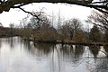
 The Tarn, Ilkley - geograph.org.uk - 1020345.jpg 640 × 480; 85 KB
-
 The Valley Dental Clinic - Valley Road - geograph.org.uk - 911369.jpg 640 × 437; 258 KB
-

-
 Victorian Steps - geograph.org.uk - 615610.jpg 640 × 480; 141 KB
-
 View over Ben Rhydding, Ilkley - geograph.org.uk - 3172254.jpg 1,600 × 1,140; 477 KB
-
 View over Ilkley - geograph.org.uk - 1652911.jpg 640 × 410; 136 KB
-
 View towards Ben Rhydding - geograph.org.uk - 1981724.jpg 3,072 × 2,048; 180 KB
-
 Waymarker, Rombalds Moor - geograph.org.uk - 18006.jpg 800 × 600; 163 KB
-
 Wellington Road - Little Lane - geograph.org.uk - 1197809.jpg 640 × 468; 175 KB
-
 West Parade - North Parade - geograph.org.uk - 1197778.jpg 640 × 444; 190 KB
-

-
 Woods Place - Little Lane - geograph.org.uk - 1197781.jpg 640 × 464; 199 KB
-
 Crag House and pasture - geograph.org.uk - 42650.jpg 640 × 480; 120 KB
-
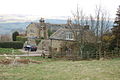
 Farmhouse at Stead - geograph.org.uk - 755538.jpg 640 × 426; 65 KB
-
 The Cow and Calf Hotel, Ilkley - geograph.org.uk - 18014.jpg 800 × 600; 143 KB


.jpg)


