Category:Benarty Hill
hill in Fife, and Perth and Kinross, Scotland, UK  | |||||
| Upload media | |||||
| Instance of | |||||
|---|---|---|---|---|---|
| Location |
| ||||
| Topographic prominence |
| ||||
| Elevation above sea level |
| ||||
 | |||||
Media in category "Benarty Hill"
The following 21 files are in this category, out of 21 total.
-
 2020-02-22 — Benarty Hill viewed from M90 direction Perth looking east 1.jpg 8,100 × 2,682; 5.91 MB
-
 2020-02-22 — Benarty Hill viewed from M90 direction Perth looking east 2.jpg 8,100 × 3,593; 7.91 MB
-
 Arable land, Fruix - geograph.org.uk - 1294388.jpg 640 × 388; 55 KB
-
 Benarty - geograph.org.uk - 1615338.jpg 640 × 427; 51 KB
-
 Benarty and North Berwick Law - geograph.org.uk - 370326.jpg 640 × 480; 72 KB
-
 Benarty from Brackley - geograph.org.uk - 1660175.jpg 427 × 640; 226 KB
-
 Benarty Hill - geograph.org.uk - 73136.jpg 480 × 640; 78 KB
-
 Benarty Hill - geograph.org.uk - 819357.jpg 640 × 480; 99 KB
-
 Benarty Hill near Ballingry Pan.jpg 6,197 × 1,881; 5.79 MB
-
 Benarty Hill near Ballingry.jpg 4,000 × 2,250; 5.8 MB
-
 BenartyHill.jpg 2,984 × 728; 239 KB
-
 Craigs to the west of Benarty Hill - geograph.org.uk - 164209.jpg 640 × 480; 37 KB
-
 House - geograph.org.uk - 143754.jpg 640 × 480; 87 KB
-
 Looking to the Fife Lomonds - geograph.org.uk - 700577.jpg 640 × 480; 53 KB
-
 M90 junction 5 - geograph.org.uk - 913020.jpg 640 × 480; 72 KB
-
 Path through the heather - geograph.org.uk - 819345.jpg 480 × 640; 96 KB
-
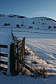
 Snow covered Benarty - geograph.org.uk - 1636700.jpg 640 × 427; 49 KB
-

-
 Track and Wall - geograph.org.uk - 1108060.jpg 480 × 640; 121 KB
-
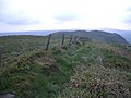
 Wall - geograph.org.uk - 167683.jpg 640 × 480; 112 KB
-
 Westfield Opencast Site restoration - geograph.org.uk - 929440.jpg 640 × 480; 77 KB


