Category:Benchmarks in Oxford
Media in category "Benchmarks in Oxford"
The following 200 files are in this category, out of 345 total.
(previous page) (next page)-

-

-

-
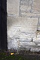
 Bench mark across the street - geograph.org.uk - 2123962.jpg 600 × 800; 119 KB
-
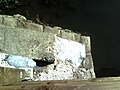
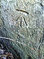
 Bench mark by the bin - geograph.org.uk - 2124008.jpg 600 × 800; 105 KB
-
 Bench mark on the Library - geograph.org.uk - 2124002.jpg 600 × 800; 200 KB
-

-
 Benchmark and pump at St Mary's Church - geograph.org.uk - 2045818.jpg 768 × 1,024; 198 KB
-
 Benchmark and snail at ^32 Sunningwell Road - geograph.org.uk - 2052685.jpg 768 × 1,024; 229 KB
-

-
 Benchmark and SV sign on ^73 Walton Street - geograph.org.uk - 3283279.jpg 683 × 1,024; 271 KB
-

-
 Benchmark at entrance to the Covered Market - geograph.org.uk - 2051935.jpg 1,024 × 768; 263 KB
-
 Benchmark at entrance to ^50 Copse Lane - geograph.org.uk - 3680698.jpg 649 × 1,024; 279 KB
-

-

-

-

-

-
 Benchmark at Osney Lock - geograph.org.uk - 4855075.jpg 683 × 1,024; 232 KB
-

-

-
 Benchmark below letter box on Charlbury Road - geograph.org.uk - 3269462.jpg 683 × 1,024; 257 KB
-
 Benchmark below the pebbledash on ^23 Ash Grove - geograph.org.uk - 3679869.jpg 683 × 1,024; 298 KB
-

-

-

-
 Benchmark by entrance to All Souls College - geograph.org.uk - 2033335.jpg 1,024 × 768; 250 KB
-
 Benchmark by the phonebox - geograph.org.uk - 4528240.jpg 600 × 800; 97 KB
-
 Benchmark inside extension of ^544 Banbury Road - geograph.org.uk - 3225111.jpg 683 × 1,024; 162 KB
-
 Benchmark on 'The Bungalow' - geograph.org.uk - 3247007.jpg 683 × 1,024; 244 KB
-
 Benchmark on 'The Chester' - geograph.org.uk - 4877534.jpg 650 × 1,024; 176 KB
-
 Benchmark on 'The Lodge' - geograph.org.uk - 3265539.jpg 683 × 1,024; 300 KB
-

-
 Benchmark on a building at Churchill Hospital - geograph.org.uk - 3751586.jpg 683 × 1,024; 270 KB
-
-
-

-
 Benchmark on back of milestone on Abingdon Road - geograph.org.uk - 2047185.jpg 768 × 1,024; 329 KB
-

-
 Benchmark on barn at Manor Farm, Binsey - geograph.org.uk - 3265809.jpg 683 × 1,024; 292 KB
-
 Benchmark on Binsey Lane Bridge abutment - geograph.org.uk - 5712326.jpg 1,024 × 683; 335 KB
-
 Benchmark on Botley Road railway bridge - geograph.org.uk - 2119209.jpg 600 × 800; 152 KB
-

-

-
 Benchmark on buttress of All Saints Church - geograph.org.uk - 3687231.jpg 1,024 × 683; 221 KB
-
 Benchmark on buttress of Christ Church College - geograph.org.uk - 2052017.jpg 768 × 1,024; 219 KB
-
 Benchmark on buttress of Salesian House - geograph.org.uk - 3329781.jpg 683 × 1,024; 194 KB
-
 Benchmark on buttress of St Giles Church - geograph.org.uk - 2176402.jpg 600 × 800; 257 KB
-
 Benchmark on buttress of St Margaret's Church - geograph.org.uk - 3282353.jpg 683 × 1,024; 253 KB
-
 Benchmark on buttress of St Matthew's Church - geograph.org.uk - 3871738.jpg 683 × 1,024; 206 KB
-

-
 Benchmark on canal bank at Bridge 238 - geograph.org.uk - 2594095.jpg 683 × 1,024; 185 KB
-

-
 Benchmark on Castle Tavern - geograph.org.uk - 2015990.jpg 768 × 1,024; 229 KB
-
 Benchmark on Church of St Michael and All Angels - geograph.org.uk - 2016923.jpg 768 × 1,024; 300 KB
-
 Benchmark on Church Way wall, near Tudor Cottage - geograph.org.uk - 3862652.jpg 683 × 1,024; 326 KB
-
-

-
 Benchmark on County Hall, New Road - geograph.org.uk - 2777341.jpg 683 × 1,024; 262 KB
-
 Benchmark on Cowley Church - geograph.org.uk - 2111609.jpg 600 × 800; 175 KB
-
 Benchmark on culvert at Fiddler's Island - geograph.org.uk - 4877186.jpg 1,024 × 683; 258 KB
-
 Benchmark on culvert beside Castle Mill Stream - geograph.org.uk - 3264376.jpg 1,024 × 683; 292 KB
-
 Benchmark on culvert beside Willow Walk - geograph.org.uk - 3281796.jpg 683 × 1,024; 222 KB
-

-
-

-

-
 Benchmark on Elsfield Hall - geograph.org.uk - 3223222.jpg 683 × 1,024; 221 KB
-

-
 Benchmark on entrance to Christ Church College - geograph.org.uk - 2051981.jpg 768 × 1,024; 247 KB
-
 Benchmark on Exeter College, Broad Street - geograph.org.uk - 2051920.jpg 768 × 1,024; 212 KB
-
 Benchmark on Exeter House, Magdalen Road - geograph.org.uk - 3864020.jpg 683 × 1,024; 322 KB
-
 Benchmark on First Turn railway bridge - geograph.org.uk - 3246165.jpg 683 × 1,024; 237 KB
-
 Benchmark on flats (^448) Banbury Road - geograph.org.uk - 2017253.jpg 768 × 1,024; 243 KB
-

-

-

-

-

-
 Benchmark on gatepost of ^1 Bradmore Road - geograph.org.uk - 2785061.jpg 683 × 1,024; 221 KB
-
 Benchmark on gatepost of ^115 Banbury Road - geograph.org.uk - 2016761.jpg 1,024 × 768; 252 KB
-
 Benchmark on gatepost of ^210 Woodstock Road - geograph.org.uk - 2762469.jpg 683 × 1,024; 266 KB
-
 Benchmark on Godstow Nunnery - geograph.org.uk - 3246113.jpg 688 × 1,024; 266 KB
-
 Benchmark on Godstow Road wall opposite carpark - geograph.org.uk - 3245675.jpg 683 × 1,024; 297 KB
-
 Benchmark on hospital building, Warneford Lane - geograph.org.uk - 3762659.jpg 683 × 1,024; 292 KB
-
 Benchmark on Isis Boathouse - geograph.org.uk - 3862358.jpg 736 × 1,024; 162 KB
-
 Benchmark on Kenilworth Avenue wall - geograph.org.uk - 3761837.jpg 683 × 1,024; 334 KB
-
 Benchmark on Lake Street Community Centre - geograph.org.uk - 2053230.jpg 768 × 1,024; 293 KB
-
 Benchmark on Leckford Road wall - geograph.org.uk - 3282535.jpg 683 × 1,024; 293 KB
-
 Benchmark on Lincoln College Library - geograph.org.uk - 2018069.jpg 768 × 1,024; 222 KB
-
 Benchmark on lodge, Warneford Lane - geograph.org.uk - 3762234.jpg 683 × 1,024; 268 KB
-
 Benchmark on low wall beside Headington Road - geograph.org.uk - 3948597.jpg 683 × 1,024; 288 KB
-
 Benchmark on Magdalen College - geograph.org.uk - 2033087.jpg 768 × 1,024; 223 KB
-
 Benchmark on Medley Manor Farm farmhouse - geograph.org.uk - 5713160.jpg 659 × 1,024; 286 KB
-
 Benchmark on Merton College wall - geograph.org.uk - 2045994.jpg 1,024 × 768; 274 KB
-

-
 Benchmark on North Street wall - geograph.org.uk - 4855136.jpg 683 × 1,024; 296 KB
-

-
 Benchmark on Osney Town bridge - geograph.org.uk - 2119255.jpg 600 × 800; 152 KB
-

-
 Benchmark on Oxford Canal bridge 236 - geograph.org.uk - 2594134.jpg 1,024 × 683; 285 KB
-

-
 Benchmark on Oxford Register Office - geograph.org.uk - 2068110.jpg 768 × 1,024; 335 KB
-
 Benchmark on Oxford University Press - geograph.org.uk - 4279751.jpg 683 × 1,024; 266 KB
-

-
 Benchmark on pier of bridge over River Thames - geograph.org.uk - 2740847.jpg 683 × 1,024; 287 KB
-
 Benchmark on Queens College, behind street sign - geograph.org.uk - 2032726.jpg 1,024 × 768; 225 KB
-
 Benchmark on Radcliffe Observatory tower - geograph.org.uk - 3266411.jpg 1,024 × 683; 179 KB
-
 Benchmark on railway bridge on Watlington Road - geograph.org.uk - 2446147.jpg 683 × 1,024; 249 KB
-

-

-
 Benchmark on side of Thames Path footbridge - geograph.org.uk - 3255703.jpg 1,024 × 683; 254 KB
-
 Benchmark on side of the Hobgoblin pub - geograph.org.uk - 2033319.jpg 768 × 1,024; 280 KB
-
 Benchmark on side of ^1 Leckford Place - geograph.org.uk - 2016387.jpg 768 × 1,024; 245 KB
-
 Benchmark on side of ^11 Alma Place - geograph.org.uk - 2033295.jpg 768 × 1,024; 270 KB
-
 Benchmark on side of ^12 Marston Ferry Road - geograph.org.uk - 2016843.jpg 768 × 1,024; 152 KB
-
 Benchmark on side of ^120 Banbury Road - geograph.org.uk - 2016800.jpg 768 × 1,024; 299 KB
-
 Benchmark on side of ^7 Bailey Road - geograph.org.uk - 2447224.jpg 1,024 × 683; 279 KB
-
 Benchmark on south angle of Milham Ford Building - geograph.org.uk - 2032037.jpg 1,024 × 768; 300 KB
-
 Benchmark on south end of wall of Merton Grove - geograph.org.uk - 2032734.jpg 1,024 × 768; 229 KB
-
 Benchmark on St Andrew's Church - geograph.org.uk - 3679960.jpg 683 × 1,024; 286 KB
-
 Benchmark on St Andrew's Road wall - geograph.org.uk - 3680118.jpg 683 × 1,024; 334 KB
-
 Benchmark on St Andrews CP School, London Road - geograph.org.uk - 3679773.jpg 1,024 × 683; 296 KB
-
 Benchmark on St Barnabas Church - geograph.org.uk - 4241964.jpg 683 × 1,024; 336 KB
-
 Benchmark on St Clements Church - geograph.org.uk - 3949044.jpg 683 × 1,024; 255 KB
-
 Benchmark on St Ebbes Church - geograph.org.uk - 2060476.jpg 768 × 1,024; 295 KB
-
 Benchmark on St John the Evangelist's Church - geograph.org.uk - 2053001.jpg 768 × 1,024; 270 KB
-
 Benchmark on St Luke's Chapel - geograph.org.uk - 3265853.jpg 685 × 1,024; 225 KB
-
 Benchmark on St Mary Magdalen's Church - geograph.org.uk - 5135090.jpg 1,024 × 683; 322 KB
-
 Benchmark on St Mary's Church - geograph.org.uk - 3862453.jpg 656 × 1,024; 286 KB
-
 Benchmark on St Mary's Church Iffley - geograph.org.uk - 2643579.jpg 1,024 × 683; 284 KB
-
 Benchmark on St Thomas the Martyr Church - geograph.org.uk - 2111506.jpg 600 × 800; 138 KB
-

-
 Benchmark on step of Devils Backbone Bridge - geograph.org.uk - 2054616.jpg 768 × 1,024; 311 KB
-
 Benchmark on step outside ^37 Headley Way - geograph.org.uk - 4657502.jpg 683 × 1,024; 303 KB
-

-
-
 Benchmark on SW angle of Balliol College - geograph.org.uk - 4246906.jpg 683 × 1,024; 206 KB
-
 Benchmark on Thames Path edge - geograph.org.uk - 4875266.jpg 683 × 1,024; 304 KB
-

-
 Benchmark on the closed The Friar public house - geograph.org.uk - 3950075.jpg 714 × 1,024; 282 KB
-

-

-
 Benchmark on the Cricketer's Arms - geograph.org.uk - 4843464.jpg 683 × 1,024; 291 KB
-
 Benchmark on the Fir Tree pub, Iffley Road - geograph.org.uk - 3864364.jpg 1,024 × 663; 188 KB
-
-
 Benchmark on the gatepost of ^215 Woodstock Road - geograph.org.uk - 2762368.jpg 683 × 1,024; 270 KB
-
 Benchmark on the join - geograph.org.uk - 2439156.jpg 600 × 800; 178 KB
-

-
 Benchmark on The Manor Farm house - geograph.org.uk - 3680284.jpg 683 × 1,024; 276 KB
-
 Benchmark on the north face of ^48 Rectory Road - geograph.org.uk - 3864570.jpg 692 × 1,024; 253 KB
-

-
 Benchmark on The Plough - geograph.org.uk - 3247083.jpg 683 × 1,024; 158 KB
-
 Benchmark on the Radcliffe Observatory - geograph.org.uk - 3266386.jpg 702 × 1,024; 180 KB
-
-
 Benchmark on the SE parapet of Godstow Bridge - geograph.org.uk - 3244904.jpg 683 × 1,024; 289 KB
-

-
 Benchmark on the side of ^35 Bainton Road - geograph.org.uk - 2765966.jpg 683 × 1,024; 262 KB
-
 Benchmark on the side wall of Godstow Lock - geograph.org.uk - 3255649.jpg 1,024 × 683; 301 KB
-

-

-
 Benchmark on the Top Pavilion, Cutteslowe Park - geograph.org.uk - 3223201.jpg 683 × 1,024; 250 KB
-
 Benchmark on the Trout Inn - geograph.org.uk - 3246045.jpg 683 × 1,024; 260 KB
-
 Benchmark on The White Hart public house - geograph.org.uk - 3244960.jpg 683 × 1,024; 232 KB
-

-

-
 Benchmark on Turnpike Cottage, ^566 Banbury Road - geograph.org.uk - 3225197.jpg 683 × 1,024; 248 KB
-
 Benchmark on wall angle at Great Leys - geograph.org.uk - 3265697.jpg 683 × 1,024; 267 KB
-

-
 Benchmark on wall at entrance to The Old Dairy - geograph.org.uk - 3289165.jpg 683 × 1,024; 303 KB
-
-

-

-
 Benchmark on wall at ^236 Woodstock Road - geograph.org.uk - 2769001.jpg 683 × 1,024; 295 KB
-

-
 Benchmark on wall between ^35 and ^37 Park Town - geograph.org.uk - 3954118.jpg 1,024 × 683; 227 KB
-

-
 Benchmark on wall of Barracks Lane - geograph.org.uk - 2114889.jpg 600 × 800; 189 KB
-
-

-

-

-
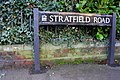 Benchmark on wall of Stratfield Road - geograph.org.uk - 3270283.jpg 1,024 × 683; 252 KB
-
 Benchmark on wall of Whitehouse Road - geograph.org.uk - 2068063.jpg 768 × 1,024; 387 KB
-
 Benchmark on wall of ^44 King's Cross Road - geograph.org.uk - 3289594.jpg 683 × 1,024; 230 KB
-
 Benchmark on wall of ^67 Old Road - geograph.org.uk - 3685829.jpg 683 × 1,024; 274 KB
-
 Benchmark on wall outside Folly Bridge Inn - geograph.org.uk - 2068009.jpg 768 × 1,024; 313 KB
-
 Benchmark on wall outside ^2 Abingdon Road - geograph.org.uk - 2068038.jpg 768 × 1,024; 299 KB
-

-
 Benchmark on wall outside ^99 Oliver Road - geograph.org.uk - 3330201.jpg 1,024 × 683; 270 KB
-

-
 Benchmark on wall pier at ^10 Chadlington Road - geograph.org.uk - 3269889.jpg 779 × 1,024; 256 KB
-
 Benchmark on wall pier of Bear Lane - geograph.org.uk - 2018053.jpg 1,024 × 768; 189 KB
-

-

-
 Benchmark on Weirs Lane bridge - geograph.org.uk - 2443543.jpg 1,024 × 683; 264 KB
-
 Benchmark on west face of Kings Mill House - geograph.org.uk - 3902862.jpg 683 × 1,024; 200 KB
-
 Benchmark on western parapet of Folly Bridge - geograph.org.uk - 2054730.jpg 768 × 1,024; 275 KB
-
 Benchmark on Wharf House, Thames Street - geograph.org.uk - 3713835.jpg 683 × 1,024; 232 KB


_Banbury_Road_-_geograph.org.uk_-_2017253.jpg)


