Category:Berg-en-Dal (camp)
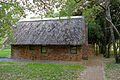
English: A tourist camp in the southern Kruger National Park, situated south of Matjulu hill, on the bank of Matjulu spruit. A weir creates a small dam adjacent to camp. The name, meaning "mountain and valley", was proposed for the former Dalmanutha by U. de V. Pienaar in 1983, cf. Floors vd Wateren In August 1900, during the Second Boer War, it was the site of a conflict between Louis Botha's and British forces.
rest camp in the Kruger Park .jpg) | |||||
| Upload media | |||||
| Instance of |
| ||||
|---|---|---|---|---|---|
| Located in protected area | |||||
| Location | Ehlanzeni District Municipality, Mpumalanga, Transvaal region | ||||
 | |||||
Subcategories
This category has the following 3 subcategories, out of 3 total.
Media in category "Berg-en-Dal (camp)"
The following 12 files are in this category, out of 12 total.
-
 Berg-en-Dal Gate (16442935715).jpg 5,472 × 3,648; 14.79 MB
-
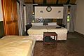
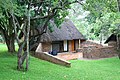
 Bungalow N°27 (15887762874).jpg 5,307 × 3,538; 18.08 MB
-
 Bungalow N°27 (16255353938).jpg 5,472 × 3,648; 6.06 MB
-
 Bungalow N°27 (16255637230).jpg 5,472 × 3,648; 15.46 MB
-
 Bungalow N°27 (16256735559).jpg 5,229 × 3,486; 10.25 MB
-
 Electric Fence (15843370603).jpg 5,472 × 3,648; 13.75 MB
-
 Kruger Park, Berg en Dal - panoramio.jpg 900 × 600; 273 KB
-
 Mapping on OpenStreetMap at the Berg-en-Dal rest camp 1.jpg 4,640 × 2,610; 3.25 MB
-
 Mapping on OpenStreetMap at the Berg-en-Dal rest camp 2.jpg 4,640 × 2,610; 3.04 MB
-
 Memorial Kruger Park.jpg 2,592 × 1,944; 2.03 MB
-
 Perimeter View from Bungalow N°27 (16441301431).jpg 5,472 × 3,648; 18.9 MB
-
 Sunset (16463908095).jpg 5,472 × 3,648; 9.13 MB
.jpg)
.jpg)
.jpg)
.jpg)
.jpg)


.jpg)
.jpg)