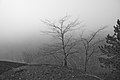
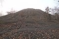
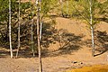
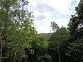
Category:Bergehalde Grühlingstraße
| Object location | | View all coordinates using: OpenStreetMap |
|---|
  | |||||
| Upload media | |||||
| Instance of | |||||
|---|---|---|---|---|---|
| Located in protected area | |||||
| Location | Dudweiler, Q20850647, Saarbrücken, Regionalverband Saarbrücken, Saarland, Germany | ||||
| Elevation above sea level |
| ||||
 | |||||
Subcategories
This category has the following 2 subcategories, out of 2 total.
V
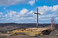
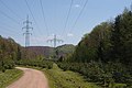
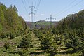
Media in category "Bergehalde Grühlingstraße"
The following 25 files are in this category, out of 25 total.
-
 20130310Kleiner Fudji10.jpg 2,000 × 1,500; 946 KB
-
 20150305Bergehalde Gruelingstrasse.jpg 3,000 × 2,250; 1.1 MB
-
 20190310Bergehalde Grühlingstraße 01.jpg 4,032 × 6,032; 6.64 MB
-
 20190310Bergehalde Grühlingstraße 02.jpg 6,016 × 4,016; 28.5 MB
-
 20190310Bergehalde Grühlingstraße 05.jpg 6,016 × 4,016; 14.51 MB
-
 20200215Bergehalde Grühlingstraße.jpg 4,189 × 2,801; 1.74 MB
-
 20200411Bergehalde Grühlingstraße 01.jpg 5,806 × 3,882; 6.61 MB
-
 20200411Bergehalde Grühlingstraße 02.jpg 6,032 × 4,032; 7.84 MB
-
 20200624 Bergehalde Grühlingstraße 01.jpg 6,032 × 4,032; 12.95 MB
-
 20200624 Bergehalde Grühlingstraße 06.jpg 6,032 × 4,032; 7.91 MB
-
 20200707 Bergehalde Grühlingstraße 09.jpg 6,016 × 4,016; 28.07 MB
-
 20201210 Bergehalde Grühlingstraße 01.jpg 6,031 × 4,031; 13.74 MB
-
 20201210 Bergehalde Grühlingstraße 03.jpg 5,967 × 3,989; 7.82 MB
-
 20201210 Bergehalde Grühlingstraße 04.jpg 3,787 × 2,426; 2.79 MB
-
 20201210 Bergehalde Grühlingstraße 06.jpg 5,869 × 3,923; 9.69 MB
-
 20201210Bergehalde Jägersfreude1.jpg 2,750 × 2,063; 1.88 MB
-
 20201210Bergehalde Jägersfreude2.jpg 2,750 × 2,063; 1.7 MB
-
 20201210Betula pendula1.jpg 2,500 × 1,875; 896 KB
-
 20201218 Bergehalde Grühlingstraße 01.jpg 6,031 × 4,031; 4.9 MB
-
 20201218 Bergehalde Grühlingstraße 02.jpg 6,031 × 4,031; 5.29 MB
-
 20201218 Bergehalde Grühlingstraße 04.jpg 6,031 × 4,031; 3.35 MB
-
 20201218 Bergehalde Grühlingstraße 05.jpg 6,031 × 4,031; 6.29 MB
-
 20210905 Bergehalde Grühlingstraße 03.jpg 6,016 × 4,016; 19.81 MB
-
 Bergehalde Grühlingstraße 03.jpg 6,032 × 4,032; 10.88 MB
-
 Urwaldtour.12jpg.jpg 5,152 × 3,864; 7.89 MB


