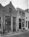
Category:Bergstraat 27, Deventer
| Object location | | View all coordinates using: OpenStreetMap |
|---|
 | |||||
| Upload media | |||||
| Instance of |
| ||||
|---|---|---|---|---|---|
| Location | Deventer, Overijssel, Netherlands | ||||
| Street address |
| ||||
| Located on street | |||||
| Heritage designation |
| ||||
 | |||||
|
This is a category about rijksmonument number 12450
|
| Address |
|
Media in category "Bergstraat 27, Deventer"
The following 7 files are in this category, out of 7 total.
-
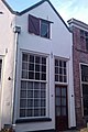 Bergstraat 27 Deventer.jpg 1,712 × 2,560; 1.01 MB
-
 Overzicht - Deventer - 20055429 - RCE.jpg 971 × 1,200; 253 KB
-
 Overzicht - Deventer - 20055431 - RCE.jpg 1,200 × 967; 216 KB
-
 Voorgevels - Deventer - 20055422 - RCE.jpg 965 × 1,200; 231 KB
-
 Voorgevels - Deventer - 20055424 - RCE.jpg 1,200 × 806; 195 KB
-
 Voorgevels - Deventer - 20055426 - RCE.jpg 955 × 1,200; 225 KB
-
 Voorgevels, overzicht - Deventer - 20055423 - RCE.jpg 816 × 1,200; 180 KB


