Category:Bettiscombe
English: Bettiscombe is a hamlet in west Dorset, England, situated in the Marshwood Vale four miles west of Beaminster. The village has a population of 63 according to the United Kingdom Census 2001.
village in the United Kingdom  | |||||
| Upload media | |||||
| Instance of | |||||
|---|---|---|---|---|---|
| Location | West Dorset, Dorset, South West England, England | ||||
 | |||||
Subcategories
This category has only the following subcategory.
S
- St Stephen's Church, Bettiscombe (16 F)
Media in category "Bettiscombe"
The following 42 files are in this category, out of 42 total.
-

-
 B 3165 entering Marshwood - geograph.org.uk - 745097.jpg 640 × 480; 78 KB
-
 B3165 at Marshalsea - geograph.org.uk - 4733105.jpg 2,816 × 2,112; 774 KB
-
 Bettiscombe Manor - geograph.org.uk - 5278317.jpg 3,456 × 2,304; 935 KB
-
 Bettiscombe Manor - geograph.org.uk - 5278320.jpg 3,456 × 2,304; 773 KB
-
 Bettiscombe village hall - geograph.org.uk - 886575.jpg 640 × 426; 78 KB
-
 Bettiscombe, September 2013 - geograph.org.uk - 3748230.jpg 640 × 480; 106 KB
-
 Bettiscombe, Village Hall - geograph.org.uk - 3000300.jpg 900 × 560; 439 KB
-
 Cottages and church, Bettiscombe - geograph.org.uk - 4714361.jpg 1,920 × 1,227; 504 KB
-
 Country below Bettiscombe Manor - geograph.org.uk - 561807.jpg 640 × 480; 104 KB
-
 Downland at Bettiscombe - geograph.org.uk - 3748228.jpg 640 × 480; 81 KB
-

-
 Farmland near Lower House Farm - geograph.org.uk - 5167292.jpg 640 × 427; 50 KB
-
 Field access, Pilsdon - geograph.org.uk - 5658229.jpg 1,024 × 683; 354 KB
-
 Field near Pilsdon - geograph.org.uk - 563385.jpg 640 × 480; 136 KB
-
 Fields near Attisham - geograph.org.uk - 4328234.jpg 640 × 428; 106 KB
-
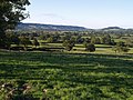
 Fields near Bettiscombe - geograph.org.uk - 1869940.jpg 640 × 480; 75 KB
-
 Gate and maize field below Pilsdon Pen - geograph.org.uk - 562087.jpg 640 × 480; 149 KB
-

-
 Horse Mill Cross - geograph.org.uk - 6250139.jpg 1,600 × 1,200; 687 KB
-
 Landscape west of Pilsdon - geograph.org.uk - 559520.jpg 640 × 480; 128 KB
-
 Lane at Horse Mill Cross - geograph.org.uk - 4697012.jpg 1,024 × 1,024; 281 KB
-
 Lane to Bettiscombe - geograph.org.uk - 4714307.jpg 1,785 × 1,317; 515 KB
-
 Little Ashes and Lower House Farm - geograph.org.uk - 561842.jpg 640 × 361; 87 KB
-
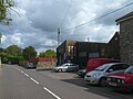 Marshwood Garage, B3165 in Marshalsea - geograph.org.uk - 6250128.jpg 1,600 × 1,200; 710 KB
-
 Northern edge of Marshwood Vale - geograph.org.uk - 561862.jpg 640 × 480; 123 KB
-
 Overgrown footpath to Bettiscombe House - geograph.org.uk - 1869932.jpg 640 × 480; 131 KB
-
 Part of Bettiscombe Manor House - geograph.org.uk - 5167286.jpg 640 × 427; 58 KB
-
 Ploughed field near Bettiscombe - geograph.org.uk - 5167295.jpg 640 × 427; 55 KB
-
 Postbox, Bettiscombe - geograph.org.uk - 4714654.jpg 1,920 × 1,440; 758 KB
-
 Postbox, Bettiscombe - geograph.org.uk - 4714662.jpg 1,920 × 2,560; 1.11 MB
-
 Revelshay Farm - geograph.org.uk - 5278326.jpg 3,456 × 2,304; 807 KB
-
 Rush hour in Bettiscombe - geograph.org.uk - 3648699.jpg 640 × 480; 69 KB
-
 Six Acre Plantation - geograph.org.uk - 561897.jpg 640 × 480; 129 KB
-

-
 The B3164 through Birdsmoorgate - geograph.org.uk - 2164392.jpg 640 × 480; 64 KB
-
 Track To Nash Farm - geograph.org.uk - 285964.jpg 640 × 470; 50 KB
-
 Traffic jam in Bettiscombe - geograph.org.uk - 3748238.jpg 640 × 480; 73 KB
-
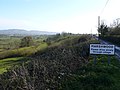
 View east from Marshwood - geograph.org.uk - 745085.jpg 640 × 480; 59 KB
-

-

-
 Water House Farm - geograph.org.uk - 4714380.jpg 1,920 × 1,295; 686 KB


